
Distance: 9km
The section between Abbeyshrule and Ballybrannigan Harbour just outside of Ballymahon is one of the quietest and most picturesque sections of the Royal Canal and well worth the visit to meander around the many bends of the canal here. Leaving Abbeyshrule we first cross over Webb Bridge to the southern bank of the canal which we will stay on for this entire stretch.

Descending down on the other side of Webb Bridge there is a playground and some picnic benches. As previously mentioned, Abbesyshrule has a very active and proud Tidy Towns group and this can be seen by all the effort gone into with planting, sculptures and public areas around the harbour both sides of the bridge. If you look to the left beyond the River Inny you can see the ruins of the Abbey and its bell tower in the distance by the graveyard.

Rounding the corner leaving Abbeyshrule it is 1.5km to the 39th Lock at Draper’s Bridge. The 39th Lock is the only lock we will encounter today and the 39th Level is the longest level on the western side of the Summit Level being a little over 11km long before reaching the 40th Lock.

Almost hidden behind the overgrowth beside the 39th Lock is the remains of the Lock Keeper’s Cottage. Behind a house on the main road the walls remain intact of this two room cottage, same in design as many of the previous ones we’ve seen but sadly the roof has come in and not much else remains except for the two fireplaces.

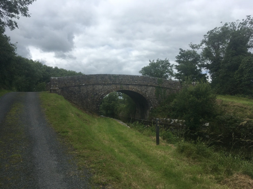
A little over 1.5km on from the 39th Lock with come to Allard’s Bridge which is an accommodation bridge allowing farmers access to both sides of the canal. It is possible to pass under the bridge and if you do you can see a cut into the stone on both sides that allows wooden boards to be places to stop the water. These slots can be found at several bridges and are useful when you need to stem the water when carrying out maintenance or fixing a breach.

As I was passing Allard’s Bridge on my most recent trip I came across Riversdale Holidays The Sub barge passing under the Bridge as it was heading west. The Sub is available for hire by holiday makers for those looking to take a leisurely break on the Royal Canal.

A little over 1km from Allard’s Bridge is Guy’s Bridge. This is another accommodation bridge though it is my understanding that from here it is now possible to cross down to the bank of the Inny and onto Newcastle Woods before crossing the restored White’s Bridge which will bring you into the new Longford Centre Parcs. I seem to have missed this new path completely so I will need to go back and confirm and will update this post accordingly when I have.
After passing Guy’s Bridge there is a sharp right hand bend to bring you up the straight towards Molly Ward’s Bridge which lies just 500m beyond. Molly Ward’s Bridge is also an accommodation bridge and seeing these three almost uniform bridges in a row shows the great skill of the workmen who built them. All built to the same design they stand proud in their surroundings over 200 years later, surviving the downturn of the canal, its closing and then its restoration.

1km further on we come to Fowlard’s or Cloonard Bridge which carries the N55 road from Edgeworthstown to Ballymahon. Unfortunately being such an important road, the original narrow humpback bridge is gone, only the limestone retaining walls remaining. When passing under the concrete structure you can see marks of where the modified bridge passed at a much lower level as clearance for boats was no longer necessary when then canal was closed. Thankfully Longford County Council altered, raised or rebuilt several bridges that they had only made culverts for when the Royal Canal closed to trade to once again allow for navigation.

1.5km from on from Fowlard’s Bridge we come to Toome Bridge. It was from here that passengers on the Royal Canal boats could catch a Bianconi Coach to Athlone up until the Midland Great Western Railway opened their station in Athlone around 1850.

A little over 1km from Toome Bridge we cross over one of the several spillways on the canal extension built between Coolnahay and Cloondara. This one is similar to the one previously mentioned near the Whitworth Aqueduct but retains its original arch without a plinth blocking it. Theses spillways had a raised shelf where excess water would spill over down under the arch and to a water source below.

It is slightly short of 1km to Chaigneau Bridge and Ballybrannigan Harbour from the overflow. The bridge still retains a turnstile type gate underneath it which used to be found at several of these bridges so it is easier to go up and over this bridge to enter the harbour area.

Over the bridge the canal opens up to one of its more substantial harbours with boats often found mooring here. Standing prominently over the harbour is also the remains of an old canal storehouse which is increasinly being consumed by ivy.

At the end of the harbour is the restored ticket house which to the best of my knowledge is used by the Royal Canal Amenity Group.

Not far from the ticket office at the wall of the harbour you can still make out the engraving marking the restoration of the harbour and this part of the canal by the Royal Canal Amenity Group and the Office for Public Works in 1995. The O.P.W. had responsibility for the canal before the establishment of Waterways Ireland.

It is about a 2km walk from the harbour into the small town of Ballymahon where there are several pubs and shops to eat or get supplies. However the town is best reached from Longford Bridge which I will cover in the next section.
Part 1: North Wall to Cross Guns Bridge
Part 2: Cross Guns Bridge to Castleknock
Part 3: Castleknock to Leixlip Confey
Part 4: Leixlip Confey to Maynooth
Part 7: Thomastown to Mullingar Harbour
Part 8: Mullingar to Coolnahay
Part 9: Coolnahay to Ballynacargy Bridge
Part 10: Ballynacargy to Abbeyshrule
Part 12: Ballybrannigan to the 41st Lock
Part 13: 41st Lock to Richmond Harbour

17 replies on “Royal Canal Greenway: Abbeyshrule to Ballybrannigan”
[…] Part 11: Abbeyshrule to Ballybrannigan […]
LikeLike
[…] Part 11: Abbeyshrule to Ballybrannigan […]
LikeLike
[…] Part 11: Abbeyshrule to Ballybrannigan […]
LikeLike
[…] Part 11: Abbeyshrule to Ballybrannigan […]
LikeLike
[…] Part 11: Abbeyshrule to Ballybrannigan […]
LikeLike
[…] Part 11: Abbeyshrule to Ballybrannigan […]
LikeLike
[…] Part 11: Abbeyshrule to Ballybrannigan […]
LikeLike
[…] Part 11: Abbeyshrule to Ballybrannigan […]
LikeLike
[…] Part 11: Abbeyshrule to Ballybrannigan […]
LikeLike
[…] Part 11: Abbeyshrule to Ballybrannigan […]
LikeLike
[…] Part 11: Abbeyshrule to Ballybrannigan […]
LikeLike
[…] Part 11: Abbeyshrule to Ballybrannigan […]
LikeLike
[…] Part 11: Abbeyshrule to Ballybrannigan […]
LikeLike
[…] as previously mentioned is a harbour just to the north of Ballymahon. Before taking to the Greenway to the 41st Lock, a […]
LikeLike
[…] Part 11: Abbeyshrule to Ballybrannigan […]
LikeLike
[…] Part 11: Abbeyshrule to Ballybrannigan […]
LikeLike
[…] as previously mentioned is a harbour just to the north of Ballymahon. Before taking to the Greenway to the 41st Lock, I […]
LikeLike