On Saturday I needed to get a long training run in preparation for my run along the Royal Canal. Niamh and I have been touring around a lot of parkrun venues in recent months trying not to repeat ourselves so with that in mind we decided to do parkrun in Athlone last week, with my plan to tire myself out as best I could at parkrun and then to run the full length of the Old Rail Trail from Athlone to Mullingar.

Given the Old Rail Trail now occupies the space that was the old Midlands Great Western Railway line from Mullingar (where it leaves the Royal Canal) to Athlone. I thought it was a good way of covering new ground that is still linked to the history of the Royal Canal, almost like another branch off the canal itself and another route to the Shannon. The Old Rail Trail itself will be part of the main Greenway that they hope to extend from Dublin via Mullingar on the Royal Canal Greenway to Athlone via the Old Rail Trail and onward to Galway. From its starting point at Whitegates about 1km east of the old Athlone Midlands Great Western Railway Station and the River Shannon the Old Rail Trail is exactly 42.2km or marathon distance to where it ends as it joins the Royal Canal Greenway Grange Bridge 1.5km west of Mullingar Train Station.

Niamh and I had previously hired bikes in Mullingar and cycled from there to Moate and back a few years ago so I had some idea of what I was in for. Unlike the compacted dust stone surface that makes up the majority of the Royal Canal Greenway, the entire length of the Old Rail Trail is a smooth tarmac surface with very long straight sections that stretch on towards the horizon. At one point along my run I mused to myself how this resembled descriptions of Death Valley by those who have ran the Bad Water Ultra, only thankfully I had none of the heat to deal with, nor the yellow lines of the hard shoulder to run on.

Leaving Maynooth just before 8am Niamh and I got to Athlone Institute of Technology just before 9am. The sports campus was a hive of activity as the Irish National Juvenile Indoor Championships were taking place. parkrun takes place around the back of the sports campus. It was quiet when we arrived but by half nine there were 70 runners and walker present to take on the event. The Athlone course is a little convoluted to follow for first time runners being two laps of football pitched before bringing you on two hilly loops around the back of the college campus and the outdoor running track. Following those in front of me I stuck to the route ok finishing in a time of 22:04 which given the hills I was happy with and was the 10th finisher home. The course was a little short but that’s fair given how easy it is to cut the corners going around the football fields it is understandable.
After a brief conversation with the volunteers Niamh and I left the parkrun and went up to the Spar at Garrycastle which is just off the Old Rail Trail. I picked up a breakfast roll a large bottle of Lucozade sport, grabbed my large running back pack, said goodbye to Niamh and walked to my starting point at Whitegates 2km closer into Athlone town while munching down on the breakfast roll. I know I will be needing to eat solid foods for the Royal Canal Run so I may as well get used to it. The walk seemed to take forever and I originally had planned on starting at 10:30 at Garrycastle, but by going back to the start of the route it meant it was 10:50 when I started running.

The breakfast roll was sitting well but almost immediately I regretted getting the large bottle of Lucozade sport. My large running bag is certainly useful for carrying gear but it can be a bit cumbersome. I had chosen not to use the hydration bladder for the day instead thinking I would get a 750ml bottle of Lucozade Sport for one side pouch and a 750ml bottle of water for the other side. With the weather being cooler than it had been for a few days I then decided I didn’t need the water. So starting out, the bag was off balance on my right shoulder and the bottle was so big that every time I swung my right harm I was rubbing off the bottle. Not much I could do about it now but lesson learned, in future with the red bag, max bottle size is 500ml and I need to balance both sides out. Better to have it and not need it than need it and not have it.
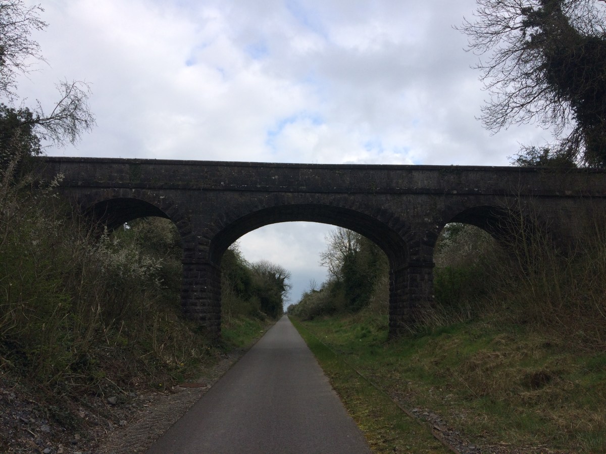
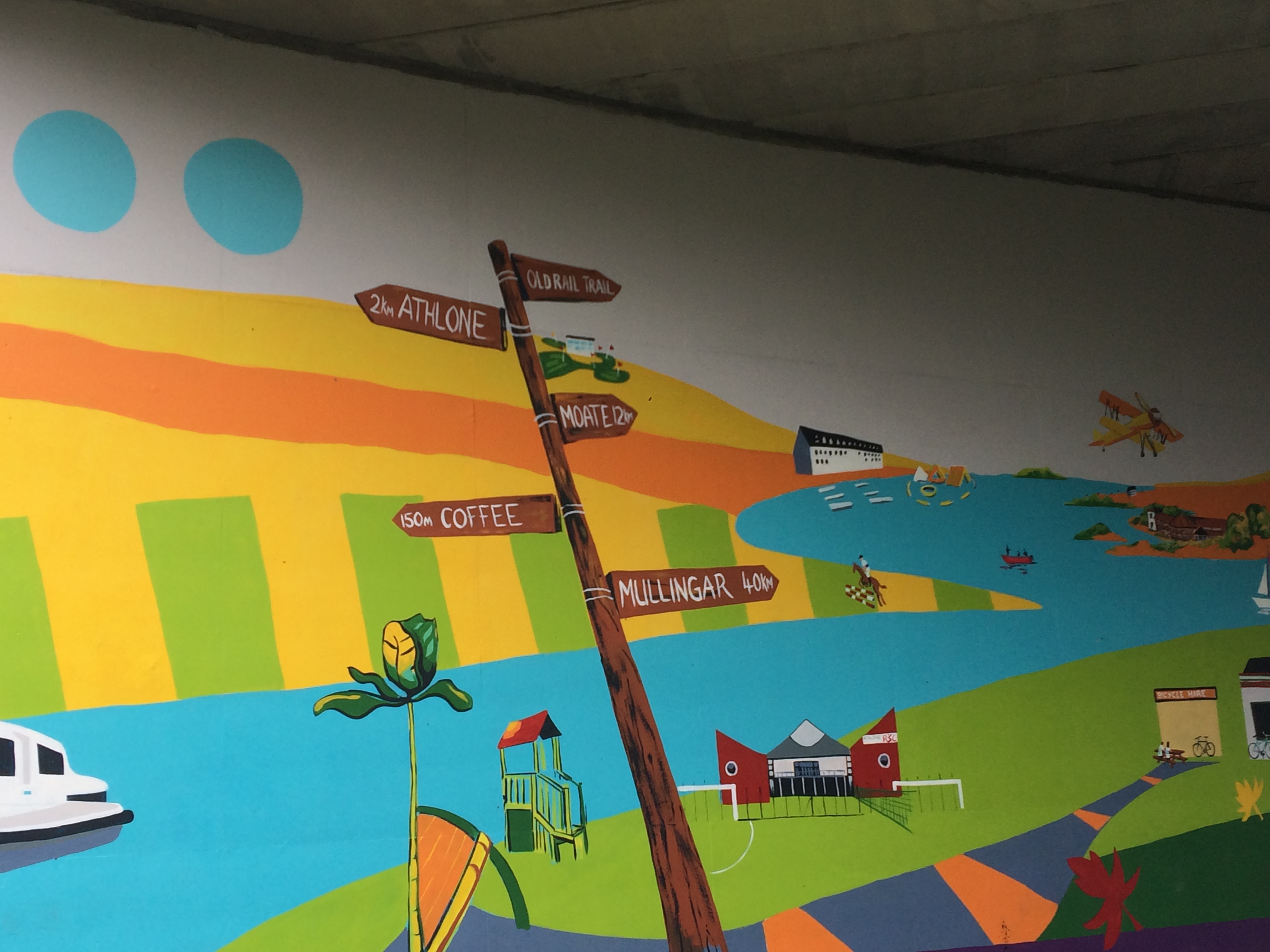
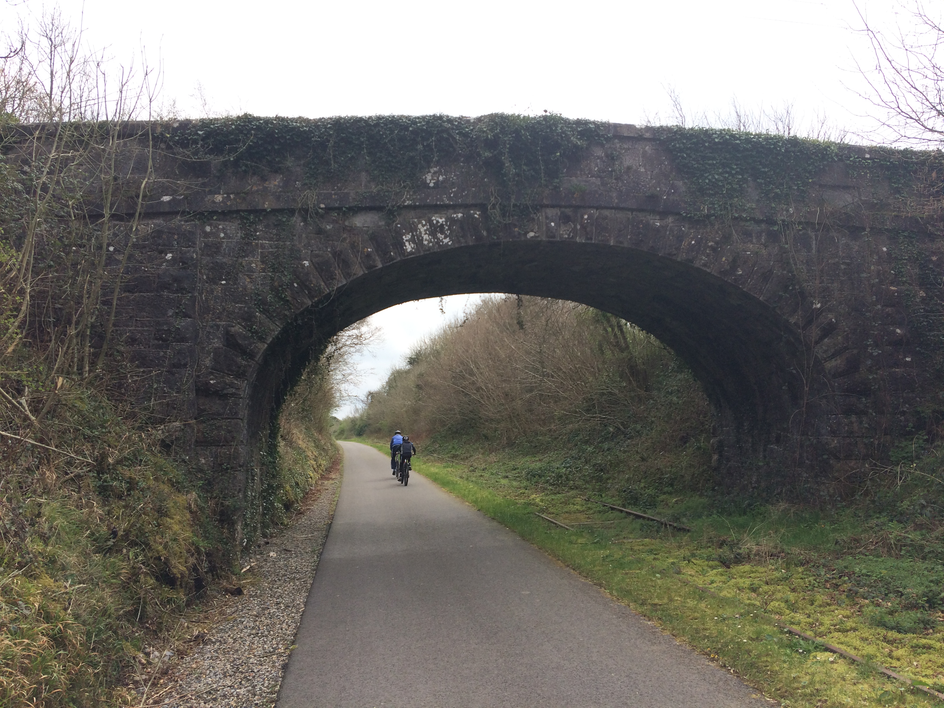
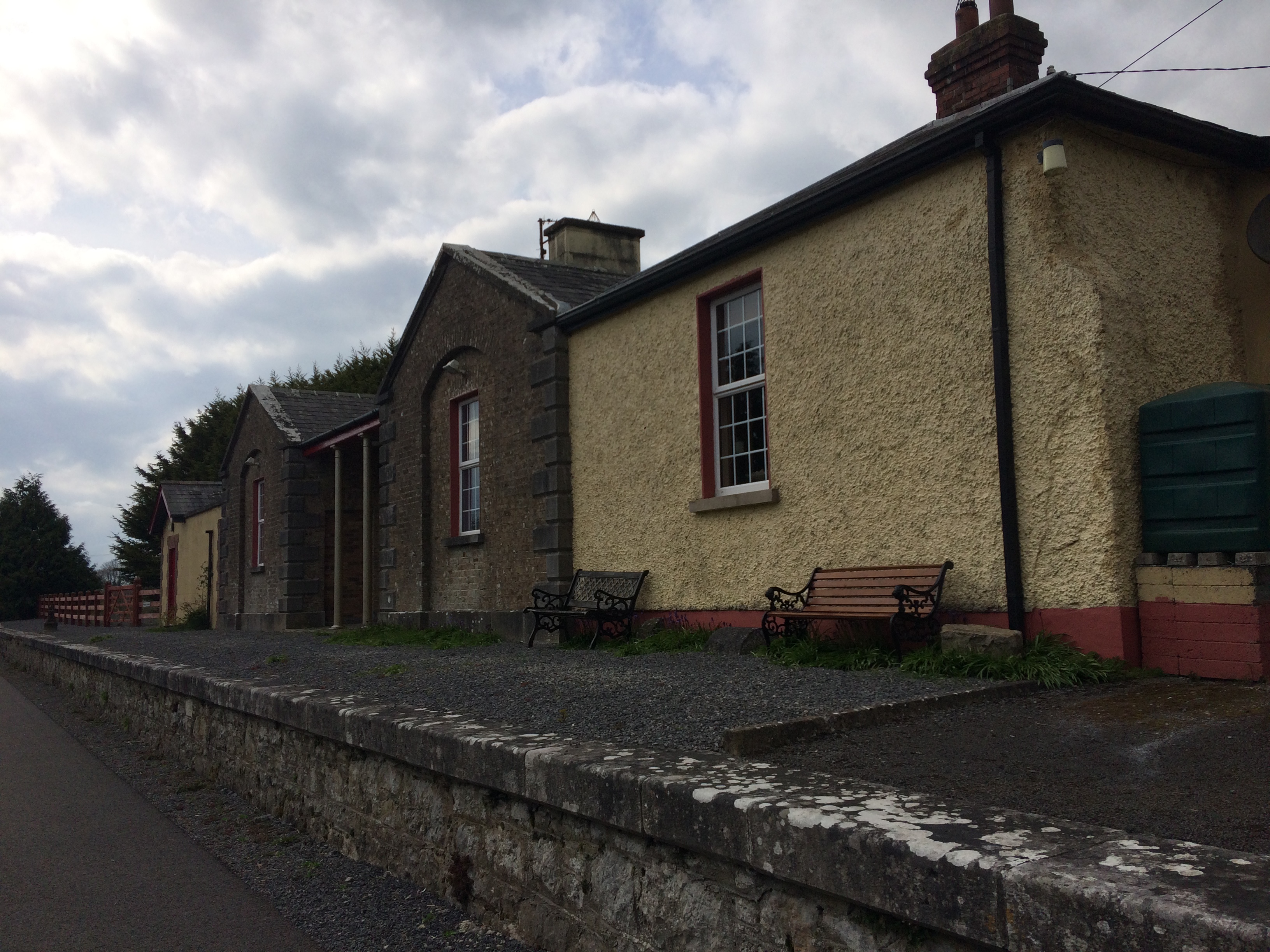
The 2km stretch back to Garrycastle went much quicker on the way back now that I was running. This whole section has street lighting along it and is a well-used amenity by walkers, runners and cyclists with plenty of entrances onto the Old Rail Trail from the surrounding housing estates. I also passed by Athlone Southern Gaels GAA club, the Athlone Regional Sports Centre and Athlone Town Stadium on my way back out towards Garrycastle. At Garrycastle there is the Spar which is a decent size for anyone who want a place to stop or start on the Old Rail Trail. It has a good deli, a place to sit down and toilets. The Athlone I.T Campus and parkrun is just to the south of the Old Rail Trail and the N6 and exit 9 are just to the north. There is an old bridge over the Old Rail Trail here. This bridge like most I encountered along the way was most likely built at the time the railway line was put down in the late 1840s and early 1850s. The Midlands Great Western Railway Station in Athlone opened in 1851, some eight years before the Great Western and Southern Railway station opened in 1859. The old bridge is only for pedestrian traffic now but is adjacent to a modern road bridge that now carries traffic from the N6 over to the Athlone I.T. campus. The modern bridge has several murals painted on it depicting scenes from the town and the old rail trail. Beyond the bridge the street lighting stops and there is no further lighting available for the rest of the Old Rail Trail.
The next bridge we come to carries the four lanes of the N6 over the Old Rail Trail. The bridge is of concrete construction with a red brick parapet and a water pipe attached to the western side. I normally find the attachment of such pipes on bridges unsightly but given the coarse functionality of this road bridge one would hardly notice it. Once you are the east side of the N6 you are out into a rural landscape with the RTÉ broadcast tower the only real thing of note on the north side of the trail.

It occurs to me that we have a bit of a false description problem in Ireland for our different routes. The Royal Canal Greenway is for the most part a dust trail, the Old Rail Trail is an entirely smooth tarmac path. I’ll leave that to you to go figure.
The Old Rail Trail has numerous accommodation underpasses to allow farmers access to both sides of the trail by going underneath it. Most of these are little more than culverts so I don’t see the point in detailing each one. The Old Rail Trail also has many cattle crossing points where the land is level. These are indicated on approach from either side by an old railway sleeper erected upright right beside the rail itself with a yellow and black image of a cow.

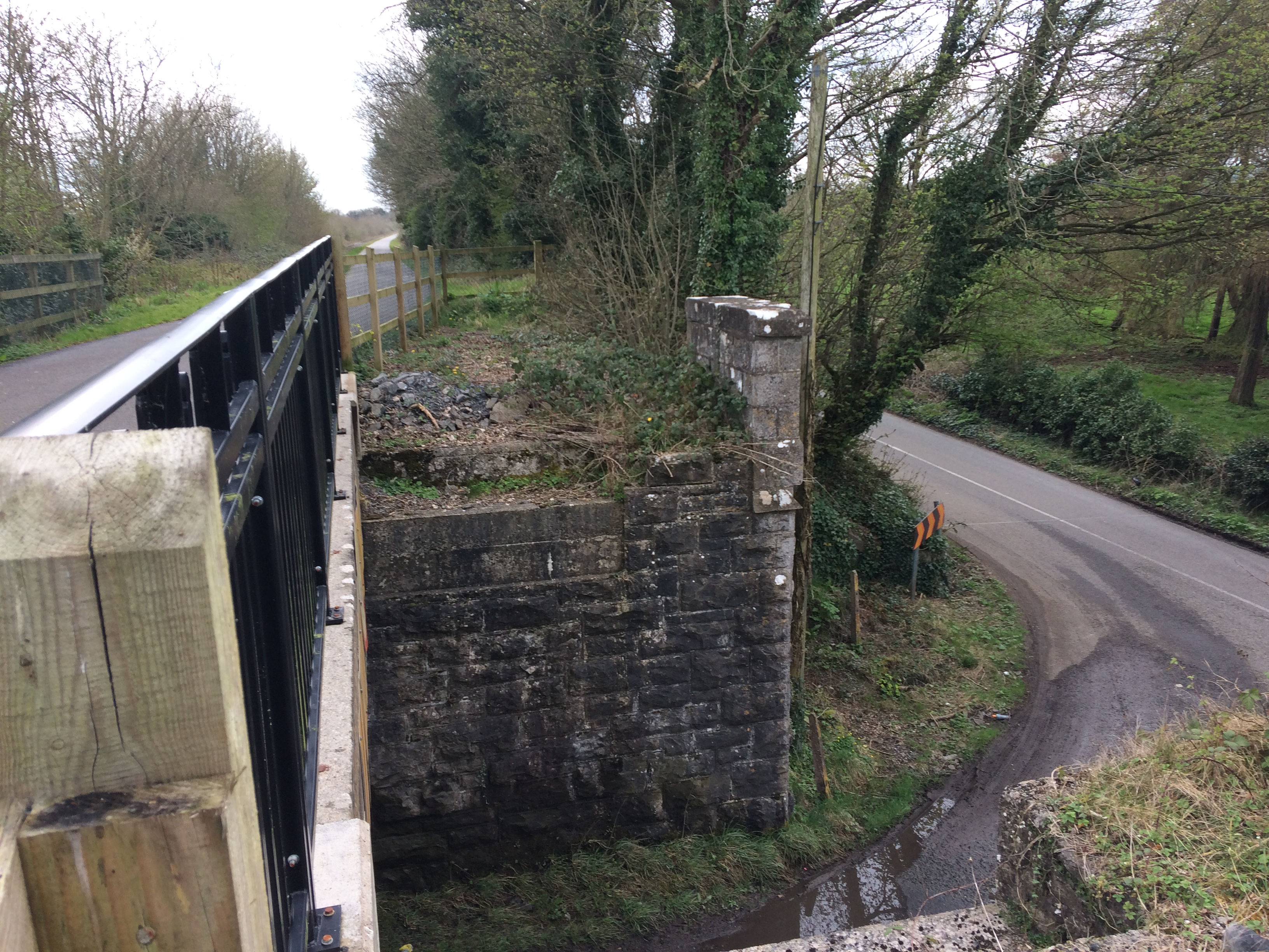
4km from Athlone we reach Tully which has a car park below the trail with a path which brings you up to it. Tully also has a bridge dating from 1851 that would have been built by the Midlands Great Western Railway the railway over a small rural road but now serves to carry the trail. The single arch bridge made of limestone is one of a number of similar bridges encountered on the trail the whole way from Athlone to Mullingar. Some of these bridges have been altered in the laying of the Old Rail Trail. Given the railway is out of use some of the bridges original limestone spans have been removed and replaced with narrower steel and concrete spans. When crossing over these bridges, you can see how the piers of these bridges stand out exposed further than where the bridge spans now and often the railway which is still present in most areas breaks at these points.
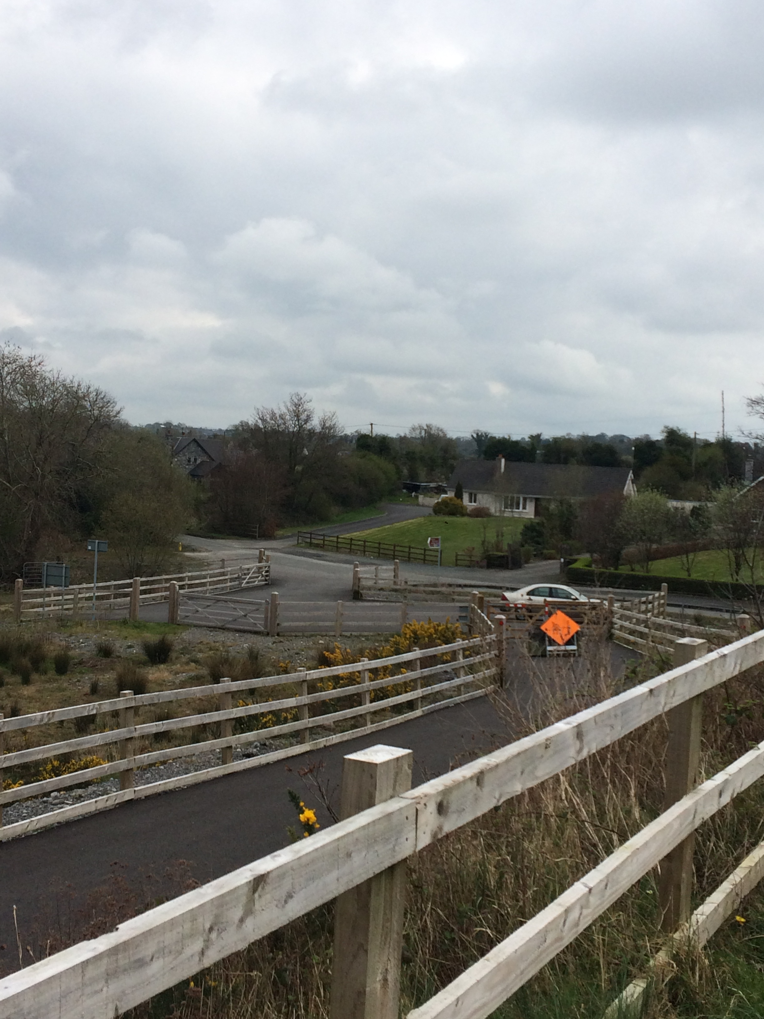
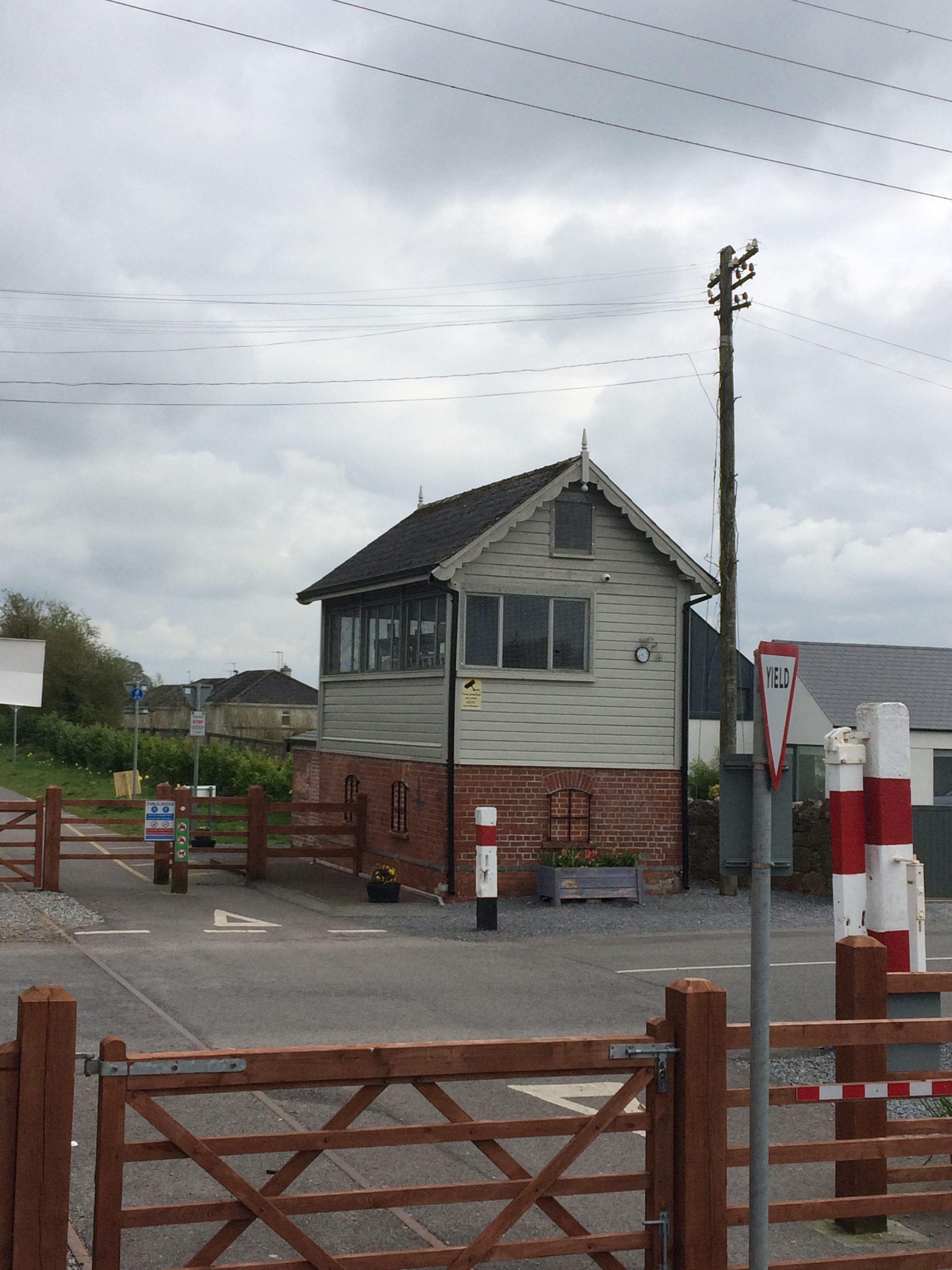
Occasionally there are wooden gates which can be navigated around at points where a road crosses the trail at the same level. At some of these points there are also level crossing guard houses where the Railway Company would have originally lodged staff to open and close gates for the trains as they passed.
In total there are 5 original Midland Great Western Railway Bridges over the railway between Athlone and Moate.
Coming into the Moate the first thing we come across is Jone’s Level Crossing Gates which were erected around 1851. The timber gates with their cast irons fittings are still present as a feature at the crossing but set back from the trail on either side of the crossing. There is a heavily altered, updated and extended level crossing guard’s house to the north east of the crossing. Heading south from this crossing you will find both a Centra and a Circle K garage if you are looking for a quick pit stop to collect some supplies.

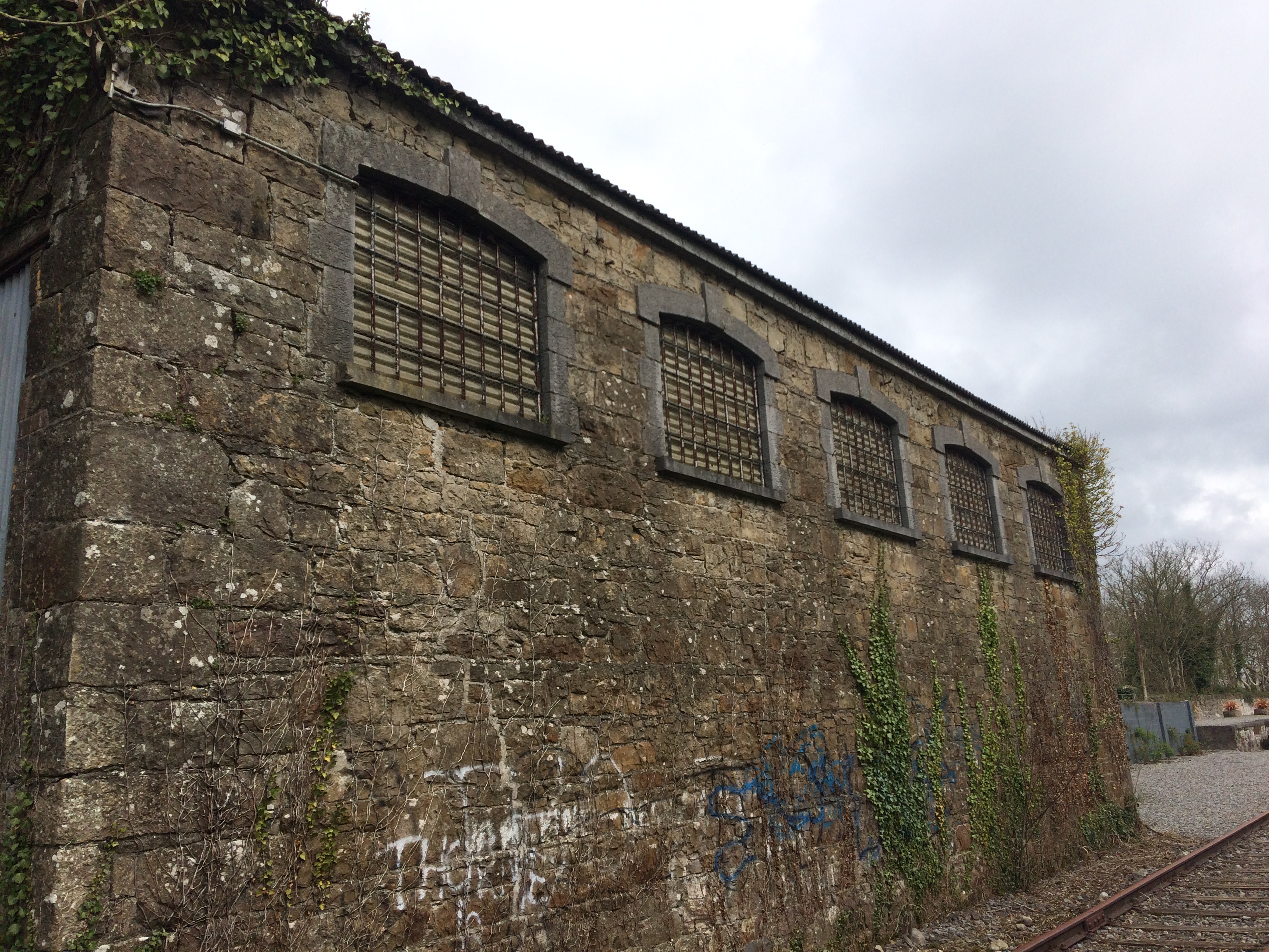
Continuing east you soon pass through what was Moate Train Station. The first building we reach lies just to the west of the north platform. It is a large railway goods shed dating from the 1850s and is now disused. There is a carriage arch on either side of the building and it is possible a siding once ran through the building itself.
The southern platform of Moate Train Station has a freestanding shelter with a pitched roof supported on cast iron supports. Dating back to the 1850s it is an interesting addition to the railway station structures around it. Moate Train Station opened on the 1st of August 1851 and closed to goods traffic on 2nd of December 1974 before finally closing to passenger services on the 9th of May 1987.

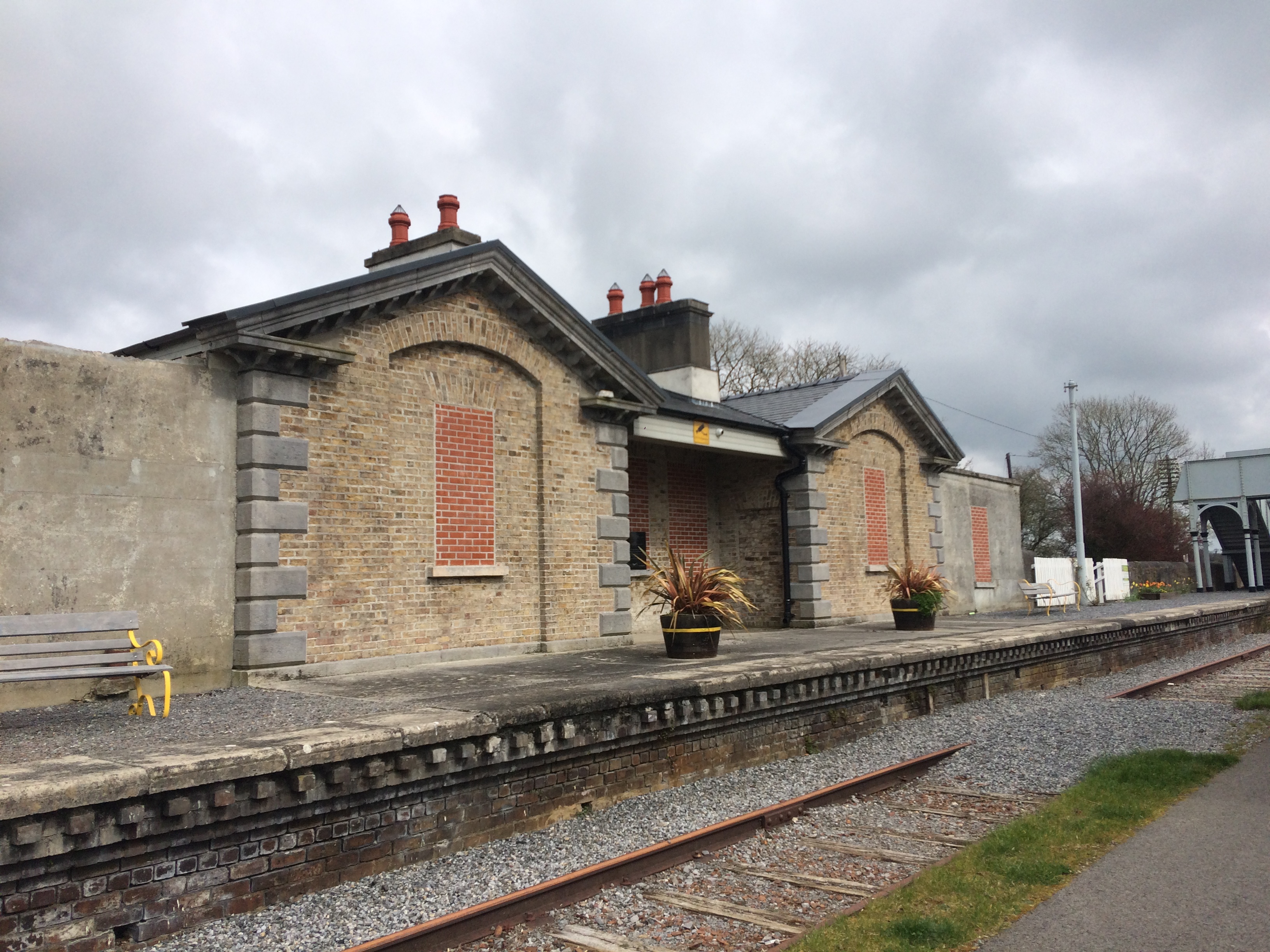
The detached 3 bay train station building with extended gable ends stands on the north platform of the station. The roofs on the extended gable ends have fallen in and all the windows and doors have been bricked up since the opening of the Old Rail Trail. An Taoiseach, Mr. Enda Kenny T.D. unveiled a plaque at the station to mark the official opening of the Old Rail Trail on the 18th of October 2015. While the station building is disused and blocked up considerable effort has been made to clean up and secure the building, hopefully with an aim of restoration at some future point. The platforms at the station have several picnic benches making it the ideal stopping point for those using the trail.
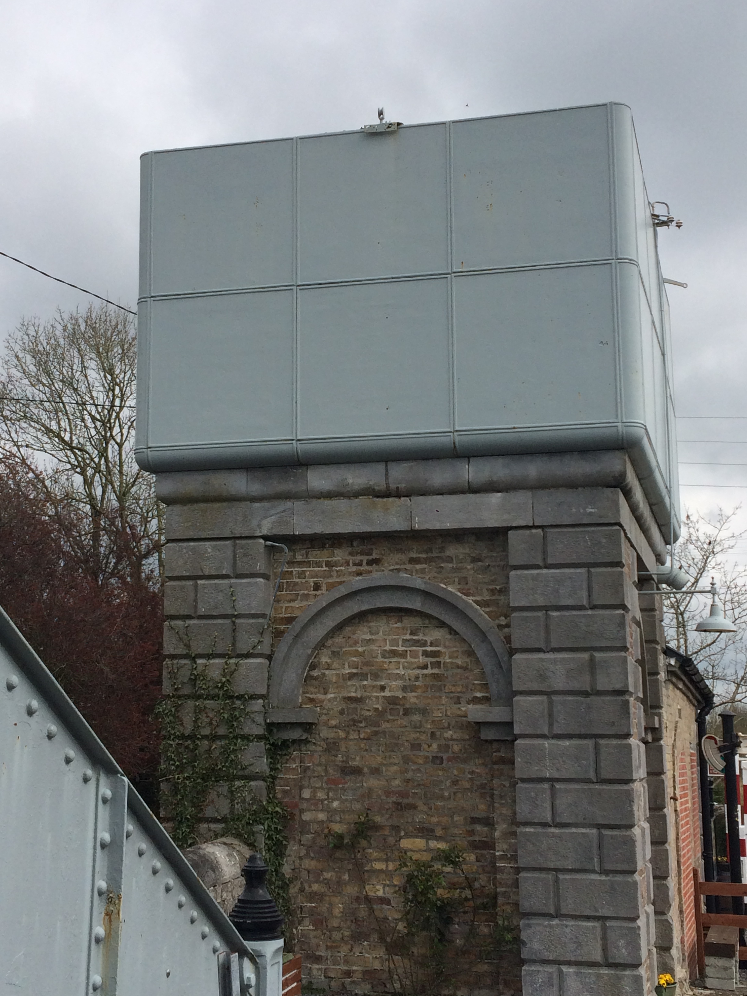
Past the station there is an original freestanding footbridge connecting the platforms. The cast iron bridge was built in Dundalk. There is no access to the footbridge now but like the station building and other features around the station is secure and well maintained. At the end of the northern platform there is a detached square plan water tower. The tower has a red brick and granite base supporting a wrought iron water tank. There is also a single story block attached to the east of the tower. Many of the railway buildings along this line are attributed to architect John Skipton Mulvany (1813 – 1870) who designed the Athlone, Broadstone and Galway Railway Stations for the Midlands Great Western Railway Company as well as the Dun Laoghaire Railway Station.
At the end of the platform is the Moate Crossing Gates which separate the golf club to the north of the station from the town to the south. From here people can leave the trail to go into the town of Moate which includes several cafés, pubs, restaurants and shops. Moate provides the best and being honest the only really option to take a break along the Old Rail Trail unless you have brought your own provisions with you. The last time I passed through on a bike I stopped at Tuar Ard Arts and Enterprise Centre which has a nice café that does soup and sandwiches and has bike stands outside. The town also has the Grand Hotel, several pubs, Supervalu and a Supermacs. The only issue that being 12km from Athlone and 30km from Mullingar, it means you are stopping either really early on route or after completing the best part of it depending on which direction you are heading. Having had a breakfast roll in Athlone and still having a full bottle of Lucozade on me I decided not to stop.
Beyond the Moate Crossing there is the Moate signal box which was built around 1885 but may have been rebuilt in the 1920s as many signal boxes were damaged or destroyed during the Civil War. Like the water tower, the signal box has a brick base and then a wood panelled upper storey. Behind the Signal Box lies a private residence which was altered and redesigned by celebrity architect Dermot Bannon which featured on RTÉ’s series Room to Improve.
Across from this house lies two former railway worker cottages from the 1850s now combined into one single private residence.
We leave Moate passing over two roads to the east of the station complex. Not long after leaving Moate the Old Rail Trail takes a slight turn heading north east where we have been travelling due east up this point. The trail lifts up onto an embankment as it travels east and comes very close to the Westmeath and Offaly border but stays in Westmeath throughout. We pass over and under several bridges and accommodation access ways over the next 11km as we head towards Streamstown Junction Train Station. Halfway between Moate and Streamstown there is an access way onto the Old Rail Trail from the road below near Rosemont. This looks like it is mainly for local access as no car park is there and there are no facilities in the area. It may have been an access way for rail workers in the past that was cut back again for the Old Rail Trail.
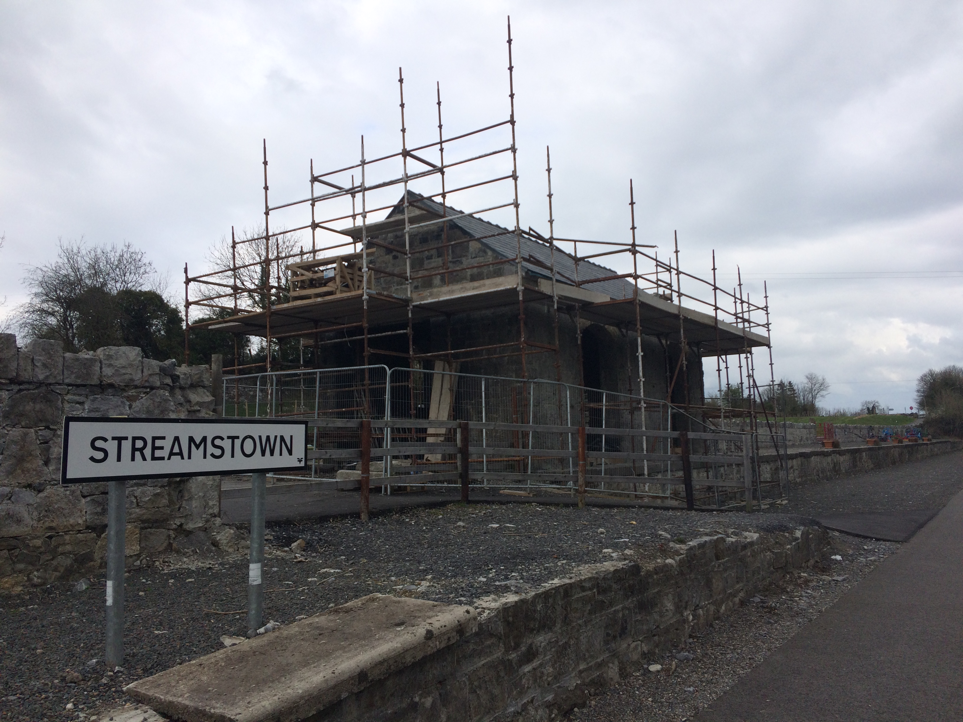
Streamstown Junction Train Station opened on the same date as Moate on the 1st of August 1851 but it closed to both freight and passenger trains on the Athlone line on the 17th of June 1963. Streamstown Junction Station served as the split in the line between the Athlone line and the Clara line where the Midlands Great Western Railway operated a service to until the 2nd of March 1925 when the Midlands Great Western Railway and Great Southern and Western Railway companies were amalgamated to form Great Southern Railways and from then on only the GSW line from Heuston operates through Clara. Little evidence of the MGW line remains. Streamstown has two surviving platforms and a few structures but is in a poor condition compared to Moate Station. The two main structures are a red brick shelter building on the north platform and the station building itself, again on the north platform. The station building currently has scaffolding erected around it and looks like it currently being sealed if not restored. I have heard rumour that the station may be developed as a café but as much of a great amenity as the trail is I don’t see a business being viable out this far though it certainly would be a great place to stop.
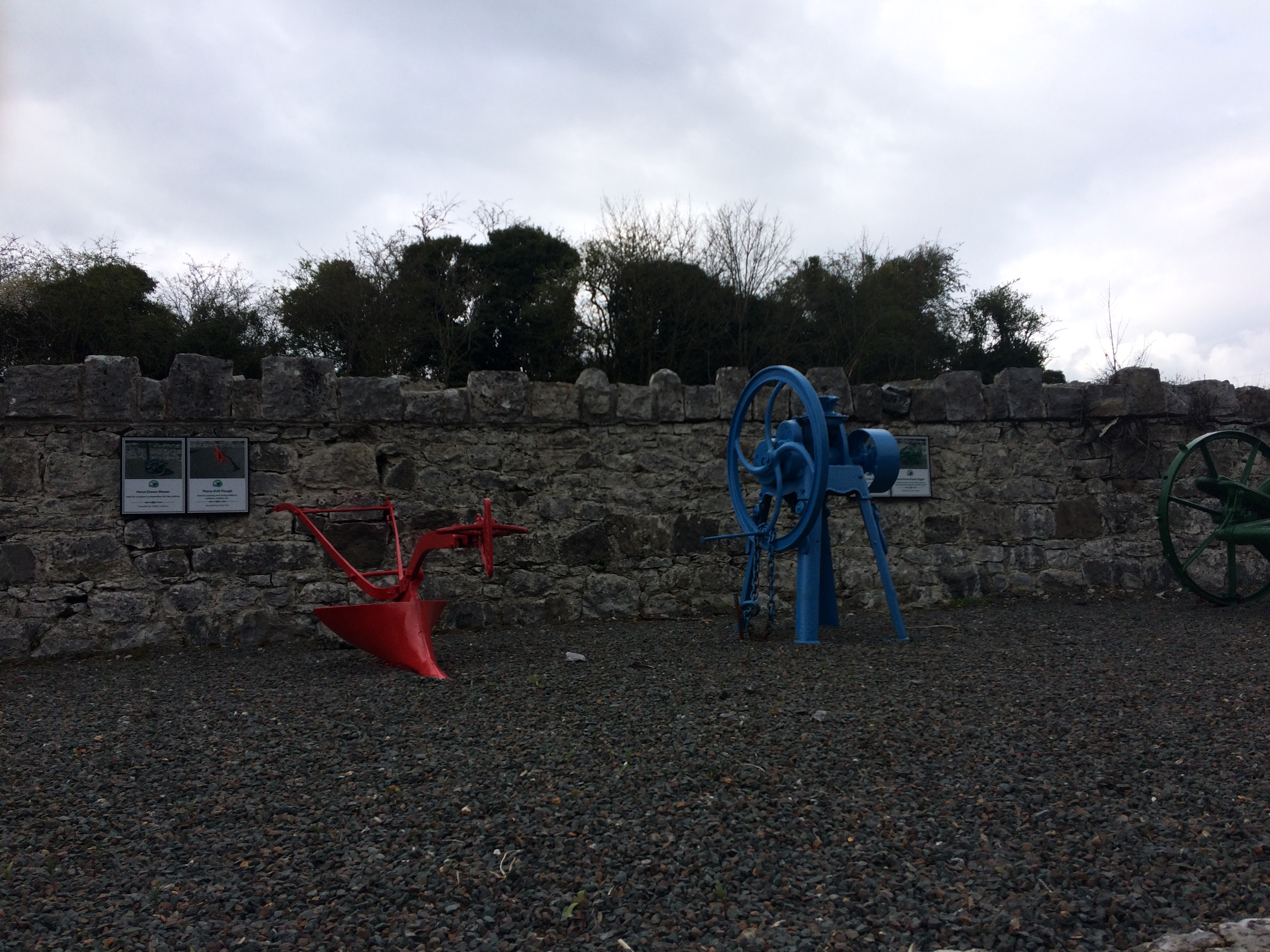
The north platform of Streamstown Junction Train Station is also the venue for an open air farm machinery museum with story boards and infographics about the farm machinery on display.
5km after Streamstown we come to Castletown Station which stands some 3km north of the village of Castletown Geoghegan. Albeit in a rural setting and some distance from the village Castletown Station has many of the same qualities and features as Moate Train Station including a goods shed, two platforms, a station building which has now been converted into a private residence, a signal box and an Edward VII Ciphered post box set into the wall.
The signal box has been restored and carries the name of the station across the front elevation while the north platform respectfully asks passers-by the stay off the platform as it is part of the private residence. While you cannot get close up to the station, the renovation and retention of the house serves to give a good idea of what the station in Moate would have originally looked like as the two buildings seem to be built to the same design. The remains of what I can only assume to be a level crossing guard house stands on the southeast side of the station. Castletown Station closed with the closure of the Athlone line in May 1987.

For some bizarre reason that I cannot understand I thought Castletown Railway Station was the location of the Waterford and Suir Valley Light Railway and for several miles I was looking forward to stopping at the old railway carriage for an ice cream and a drink. It was a sad moment when I realised my mistake and given it would have been a 6km detour out and back to the village in the hope of a shop I decided to push on for Mullingar. Very soon after leaving Castletown I was stopped by two women on bikes enquiring was there anywhere for them to stop and get a bit to eat before Moate. It was much to their disappointment when I told them there wasn’t. They proceeded on but given it was nearing mid-afternoon at that point going as far as Moate and back to Mullingar with hire bikes might have been a challenge for the recreational cyclist.
It is a fairly straight run from Castletown Station to Ballinea on the western side of Mullingar. Ballinea Harbour is where the Midlands Great Western Railway and the Royal Canal part ways after running alongside each other all the way from Dublin, a distance of over 80km. Belmont Bridge is the first bridge we come to that needs to cross both the canal and the Old Rail Trail. The original canal bridge would have been built around 1806 and abutted by the railway bridge in the early 1850s. The Royal Canal Greenway and the Old Rail Trail run alongside each other for much of the way from here into Mullingar separated only by hedgerows and occasionally parting a small distance around fields.

Just over 2km from Mullingar we encounter the Mullingar parkrun route which starts on the Royal Canal Greenway at Grange Bridge and goes out for almost 3km before turning back on the Old Rail Trail and ending beside the old freight platforms west of Mullingar. From here is only a short distance to Grange Bridge where the Old Rail Trail ends and joins the Royal Canal Greenway to make its way east towards Dublin. I would hope that by June of this year the Royal Canal Greenway will be complete from this point to Maynooth harbour.

After travelling the 42.2km from the Whitegates in Athlone I stopped my Garmin and walked the remaining 1.5km towards Mullingar Train Station along the canal. Like in Athlone the Old Rail Trail stops short of reaching the station and it is sad to see the sheds of the Athlone line falling into ruin as we pass by them. The Railway Preservation Society of Ireland used these sheds to restore Locomotive No. 184 in the late 1970s and Mullingar Train Station was also used for the filming of The Great Train Robbery starring Sean Connery and Donald Sutherland. These sheds were also the scene of the notorious murder of station master Thomas Anketell in 1869, supposedly by Ribbonmen, a group of agrarian agitators who also caused a lot of trouble on the Royal Canal earlier in the 1800’s, breaching the canal banks in order that they could create employment to fix them and attacking boats carrying agricultural produce from the west to Dublin when people were going hungry.

Although it is beyond the end (or the start) of the Old Rail Trail I will briefly mention Mullingar Train Station The current train station was built around 1856 and was altered around 1896 when it was extended and roofs added to the platforms. It replaced an earlier temporary station on the site that was built in 1848. Mullingar Train Station is unique in Ireland as it is the only station set between bifurcating railway tracks where it could split off southwest to Athlone and onwards towards Galway or northwest to Sligo. The station would have originally had footbridges linking the platforms but these were replaced by subways in the early 1900’s. The train station has a notable platform with roof and wooden waiting rooms on for the Sligo line with attractive cast iron columns accessed by the subway. A single arch railway bridge from the 1850’s carries the railway bridge and the most eastern part of the platform over a small road.
Mullingar Train Station also has a signal box dating from the 1920’s similar in design to the older ones we saw in Moate and Castletown but much grander in size, constructed with concrete blocks to the base and wooden first storey. Located to the east of the main station this signal box would have views over trains coming in from Dublin, Athlone and Sligo.
With an hour to spare until my train to Maynooth I headed into Mullingar itself for a quick bite to eat before heading home. In total it took me just under 5 hours to run/walk the 42.2km length of the Old Rail Trail with a few extra minutes either side to walk to my starting point and get to Mullingar Station itself.

3 replies on “Old Rail Trail – Athlone to Mullingar – 30th March 2019”
[…] to Galway, the Mullingar to Athlone line hasn’t been used since 1991 and has now become the Old Rail Trail, a 42 kilometre greenway passing through Moate on its way to Athlone and a pleasurable cycle in […]
LikeLike
[…] previously discussed running the Old Rail Trail from Athlone to Mullingar here but in the context of my series of guide posts of the Royal Canal I will revisit the topic here […]
LikeLike
There is a new graphic at Lock 8 commissioned by the developers of the Lock 8 building at Pelletstown/ Ashtown
I have a photo if you want it.
LikeLike