
Distance: 17km
Being honest, Thomastown is as close as you can get to being in the middle of nowhere, which is part of its charm. However unless you are able to drive here to start your day, it is an unlikely place for you to start. For me I think it is a good idea to start in Enfield and cycle to Thomastown like I discussed in Part 6, stop in Nanny Quinn’s for some lunch and then continue on towards Mullingar where you can catch a train back to Enfield. It is a distance of 42km from Enfield to Mullingar. That all said there is ample parking at Thomastown if you do have a car so for this post I am going to discuss cycling from Thomastown to Mullingar where you can stop for some food before cycling back to the start.

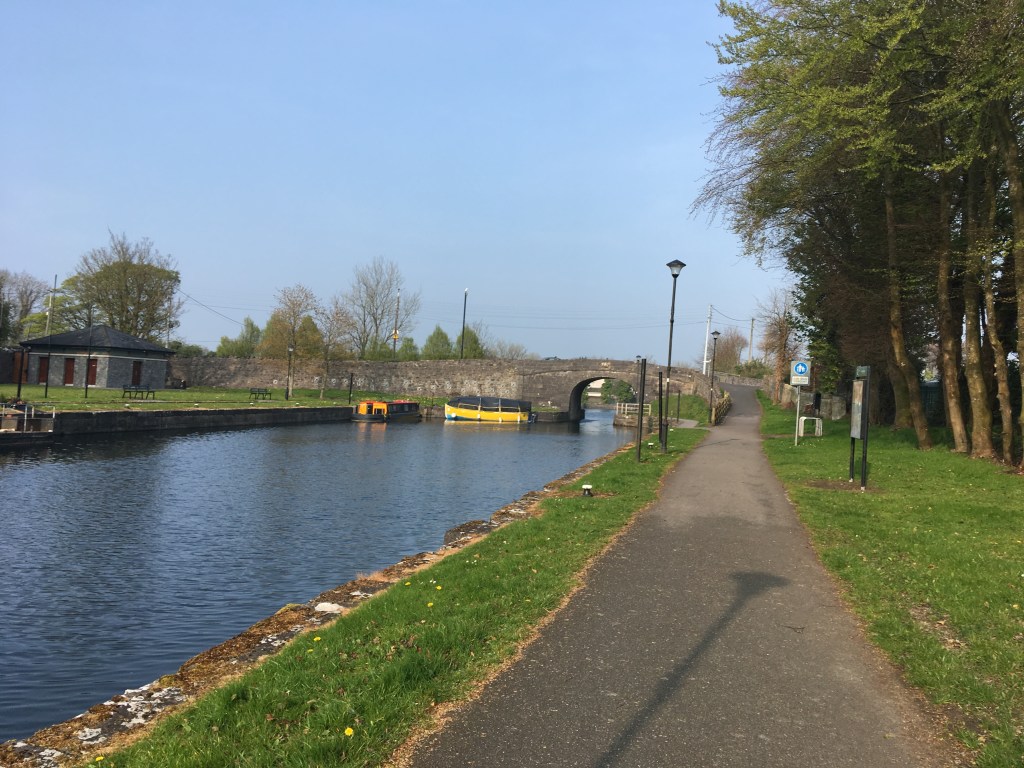
As mentioned in my last post Thomastown marks the end of the 32 kilometre Long Level and marks the start of a flight of 8 locks in just under 3 kilometres. It is a quick climb up to the Summit Level but means once you reach the top you have no more climbing to do and also means you have an nice descent at the end of your day if you choose to come back. We start by crossing Thomastown Bridge onto the south bank at the 18th Lock. The 18th Lock is the shortest lock on the Royal Canal at 22.9 metres long. Waterways Ireland have a depot on the north bank of the lock.

It is only 500 metres to the 19th Lock.

400 metres after the that we come to the 20th Lock. The National Inventory of Architectural Heritage suggests that the 42 Mile Marker is at the 20th Lock but unfortunately the survey was taken some time ago and I have never seen an sign of it. All the same it is worth keeping an eye out for.

Continuing to climb quickly we come to the 21st Lock another 500 metres up the Greenway.

It is worth noting that the section between the 18th Lock and the 22nd Lock is an open road and you should be mindful of traffic as you use the section.

At the 22nd Lock we come to Riverstown Bridge and the road towards Killucan. The 22nd Lock also has a Lock Keeper’s Cottage on the south bank. Now a single private residence, if you look closely you can see it would originally have been two semi-detached workers cottages which makes it stand out from most the other remaining cottages along the canal.

If you take a left at the 22nd Lock leaving the canal for a few moments you will find Cunningham’s Pub and shop just the canal side of the railway. The shop is great for a fresh ice cream and has seating outside suitable for taking a break. Their facebook page can be found here.

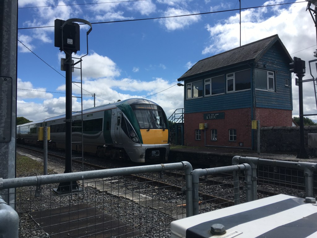
Riverstown was also the site of Killucan Railway Station which closed in November 1947. A Victorian post box can still be found in the wall of the station painted An Post green.

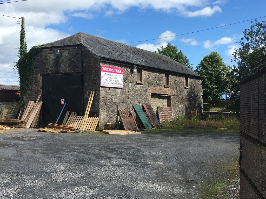
The Railway Sheds in Riverstown played an important role in the restoration of the Royal Canal with a good number of new lock gates made there.

You can read about this in Chapter 15: Under New Management of Ireland’s Royal Canal 1789-2009 where Dr. Ian Bath discusses the amount of work involved in restoring the waterway. Below is also a short video from the Hayden Collection about the Lock Gates that were manufactured in Watling Street in the early days of the Royal Canal restoration.
If you are taking the train from Dublin to Sligo you often stop at the railway sheds as it one of the few points west of Maynooth where there are double tracks allowing two trains to pass each other.
Returning to the canal we must cross over Riverstown Bridge to the north bank to carry on to the 23rd Lock which greets us just around the corner.

A further 500 metres west we come to the 24th Lock and the remains of a Lock Keeper’s Cottage on the south bank.

Then we have the shortest distance to travel between two locks on the Royal Canal as we travel 200 metres up to the 25th Lock and the start of the Summit Level. It is necessary to deviate slightly from the canal here heading right at the lock and up to Footy’s Bridge before continuing back on the north bank.

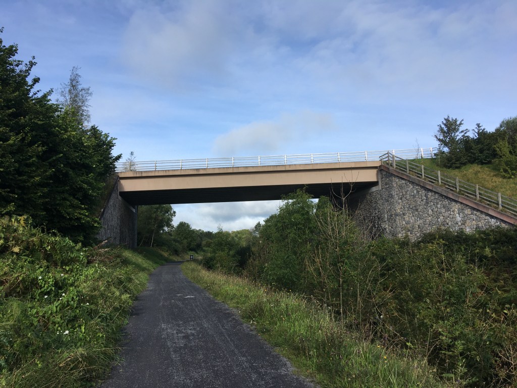
Back on the level with our climbing done we have 2 kilometres to the M4 Road Bridge which carries the main dual carriageway from Dublin to Sligo.

We pass under the N4 and come up at McNead’s Bridge beside Mary Lynch’s Pub. The pub and B&B’s facebook page can be found here. We crss back over to the south bank for the rest of the way into Mullingar.

The original McNead’s Bridge is gone and replaced with a rather boxy concrete structure. There is a car park for the Greenway and Blueway just across the road from the pub giving people a good place to start for a walk or paddle down the canal.

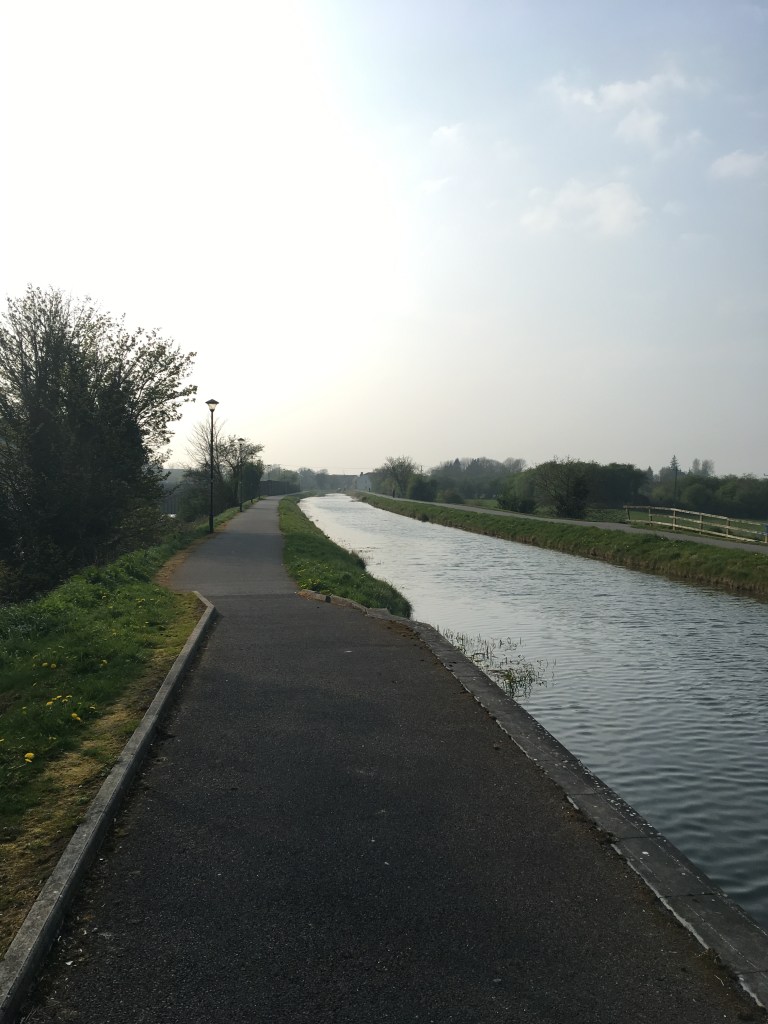
The N4 road keeps us company for a while as we head further west and is the first reminder we have had in quite a while of the bustling traffic of the normal world. A little distance from the pub we would hardly notice passing over a small aqueduct was it not for the pumps that are often in use here bringing up water from the small river below to supply the canal. Its not long before we come to where there was an interesting counterweight lifting bridge at a farm a little further west. This lifting bridge was replaced in the summer of 2020 with a platform that I can only guess needs to be craned out of the way of boats wanting to pass. There are 4 eyelets for hooks to lift the platform. All the more reason to plan boating journeys with Waterways Ireland in advance.

We are now passing through an area known as The Downs and home to Mullingar Pewter who have visitors centre and coffee shop just off the canal that can be reached from Downs Bridge.

We come right alongside the N4 for a short distance before meeting a small footbridge over the canal that now, with the dual carriageway present no longer seems to serve any purpose. From here we take a turn away from the road into open country once again. We head southwest towards Baltrasna Bridge and rejoin the railway which we left back at Mary Lynch’s.

The Baltrasna Boreen Biodiversity Group are active in the area and they monitor local biodiversity along the Royal Canal. A video about the group can be seen here:
Once again we enter a sinking as the canal was cut through the land just west of Mullingar. This sinking is nowhere near as steep though as the one we went through back in Castleknock.

A little further on we pass under Boardstown Bridge which carries the N52 road high over the canal.
Not long after we start to come out of the sinking near Saunder’s Bridge on the outskirts of Mullingar town. We can feel the urban environment once again.

We come to a small harbour at Piper’s Boreen which the Royal Canal reached in 1806. If you remember it took six years to build the canal from Dublin to Kilcock, it took a further ten years to get it this far on the west side of Mullingar. There is a plaque at the harbour to mark the 200th anniversary of the canal getting here.

You may notice more pedestrian traffic as you approach Moran’s Bridge as this section is a popular walking and running route for the people of Mulligar. Like McNead’s Bridge, Moran’s Bridge as you come into Mullingar is a boxy concrete structure built to allow boats pass under it.

When the canal closed in the 1960’s the original Moran’s Bridge was replaced with a culvert too small for most boats but thankfully this mistake was later rectified. We come up at the bridge and have to use a pedestrian crossing to cross the main road. There is a service station on the other side of the road which can be useful to stop for a quick snack.
We now start the horse shoe shape trip the canal takes around Mullingar town. As we round the start of the curve we pass over a small aqueduct and mill race before we come to the bridge over the Lough Owel Feeder.

With that we arrive in the historical site of Mullingar Harbour. Mullingar Harbour is split into two halves by Scanlon’s Bridge. The east side of the bridge was the commercial harbour where all trade goods were handled and several store houses were present. There is also a dry dock at the entrance to the harbour.
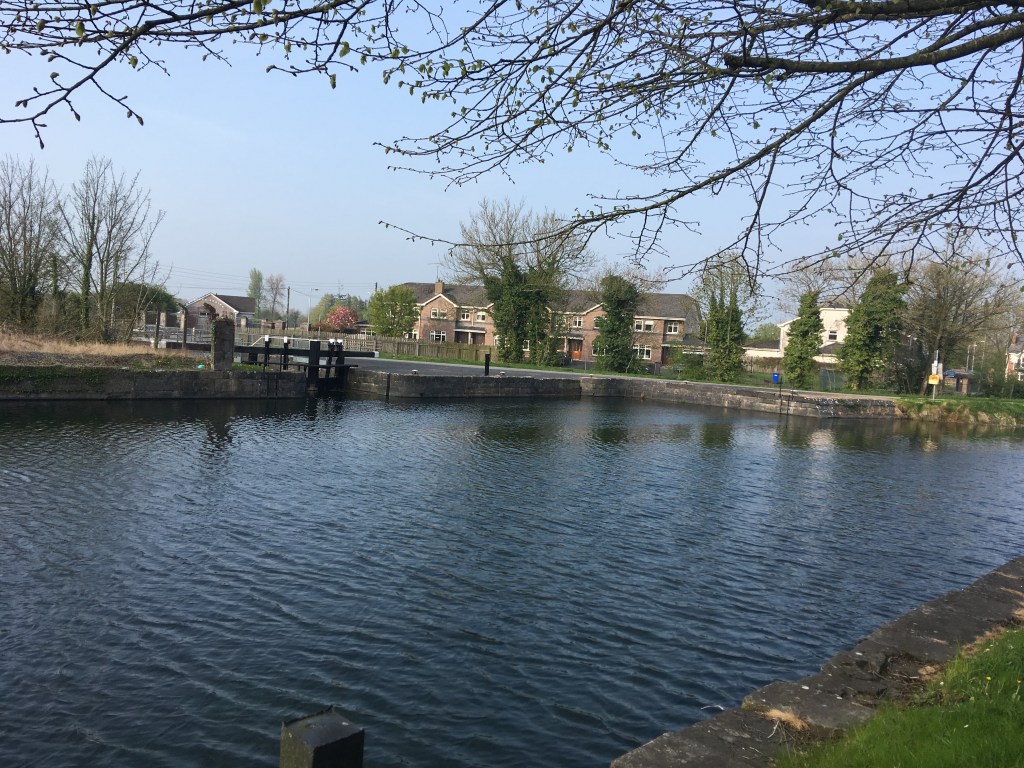
The harbour to the west of the bridge was the passanger harbour. There is now a park on the bank of the west side which retains the original harbour wall.
Several of the Heritage Boat Association vessels wintered in Mullingar Harbour in 2019 into 2020.

These include Horse Boats 4E, 92E and Walvis.
It is only a short distance from Scanlon’s Bridge into the centre of Mullingar where there are plenty of options for food and if you head slightly west you will find the train station if you need it. The train station is also a short distance beyond the harbour for those looking for a train back to Enfield, Maynooth or Dublin or on to Longford or Sligo.
Part 1: North Wall to Cross Guns Bridge
Part 2: Cross Guns Bridge to Castleknock
Part 3: Castleknock to Leixlip Confey
Part 4: Leixlip Confey to Maynooth
Part 8: Mullingar to Coolnahay
Part 9: Coolnahay to Ballynacargy Bridge
Part 10: Ballynacargy to Abbeyshrule
Part 11: Abbeyshrule to Ballybrannigan
Part 12: Ballybrannigan to the 41st Lock
Part 13: 41st Lock to Richmond Harbour

14 replies on “Royal Canal Greenway: Thomastown to Mullingar Harbour”
[…] Part 7: Thomastown to Mullingar Harbour […]
LikeLike
[…] Part 7: Thomastown to Mullingar Harbour […]
LikeLike
[…] Part 7: Thomastown to Mullingar Harbour […]
LikeLike
[…] Part 7: Thomastown to Mullingar Harbour […]
LikeLike
[…] Part 7: Thomastown to Mullingar Harbour […]
LikeLike
[…] Part 7: Thomastown to Mullingar Harbour […]
LikeLike
Thank you, brilliant blog
LikeLiked by 1 person
Thank you. Hopefully we’ll be able to get back out onto it sooner rather than later.
LikeLike
[…] know I have tried to start or finish most my posts at a location with a train station however in my previous post I thought it made sense to stop a little short at Mullingar Harbour rather than going a little […]
LikeLike
[…] Part 7: Thomastown to Mullingar Harbour […]
LikeLike
[…] Part 7: Thomastown to Mullingar Harbour […]
LikeLike
Do you do organised cycle
LikeLike
Hi Teresa. I’m afraid I don’t. It might be worth contacting Brendan at https://www.royalcanaladventures.ie or Dave at https://royalcanalbikehire.ie/ and they might be of assistance. Happy to answer any questions you might have though about the route. Need something to pass the time with parkrun on hold.
LikeLike
[…] the Greenway it is worth crossing Scanlon’s Bridge at Mullingar Harbour as mentioned in my Thomastown to Mullingar post. From there you head back past the dry dock to the small bridge seen above with the Famine Shoes […]
LikeLike