Categories
Royal Canal

Walking on the Royal Canal: Castleknock to Leixlip Confey

Distance: 8.65km

Part 3 of our journey sees us start at Castleknock Train Station and the start of the stretch known as the Deep Sinking, on past Coolmine and Clonsilla before crossing the Dublin and Kildare county line and finishing at Cope Bridge at Leixlip Confey.

Turning to Trail as we enter the Deep Sinking

There are several reasons why I have chosen to do my first few posts as walks rather than runs or cycles. The first being that in the early stages leaving Dublin there are so many prominent landmarks, bridges and locks all worthy of mention that the posts would be extremely long if I was covering a greater distance. The second was for when I reached the Deep Sinking and what lies beyond it to Leixlip Confey and even on to Maynooth.

Narrowing of the Trail in the Deep Sinking

Many who know the area know that unlike from the city centre to Castleknock which has all paths or from west of Maynooth Harbour where the Royal Canal Greenway is complete all the way to Cloondara, the section between Castleknock and Maynooth is more trail like with a variety of surfaces which can be uneven, slippy, mucky and narrow.

One of several gulleys to watch out for leaving Castleknock

By no means should this put you off wandering along this stretch of the canal. Given it is surrounded by houses and railway it still has a rural and secluded feel. What follows here is just a matter of fact account of how the stretch is as of March 2020 and that the reality is it is best walked at a relaxed pace, ideally in hiking boots or trail runners and being honest it is not suitable for bikes. Fingal County Council and Waterways Ireland have plans to upgrade this section and some ground surveys are ongoing (which also leads to the occasional closing of the canal path) but it is unlikely that this work is going to be completed in the near future.

Tree roots on the trail of the Deep Sinking.

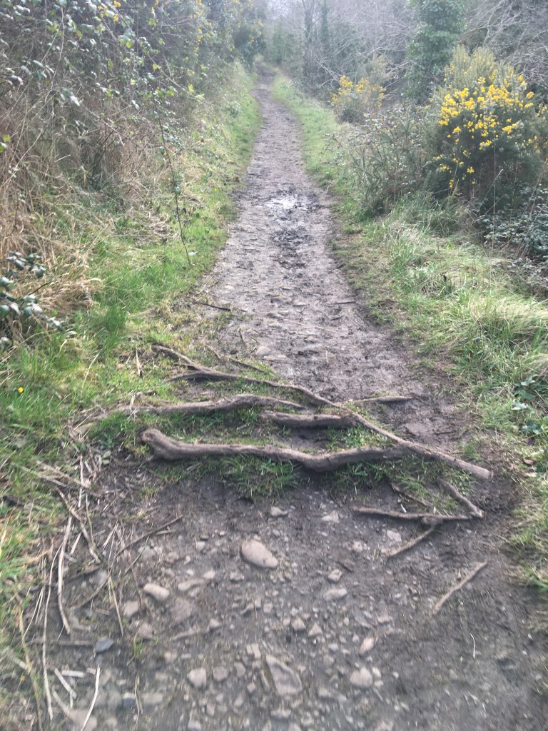
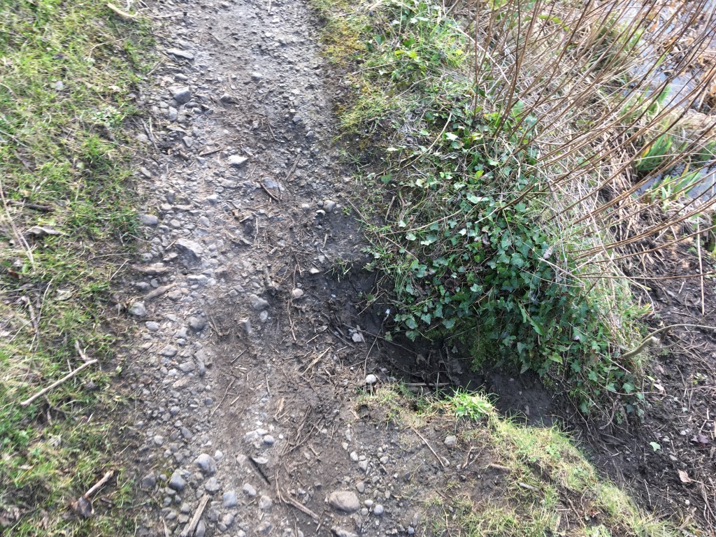
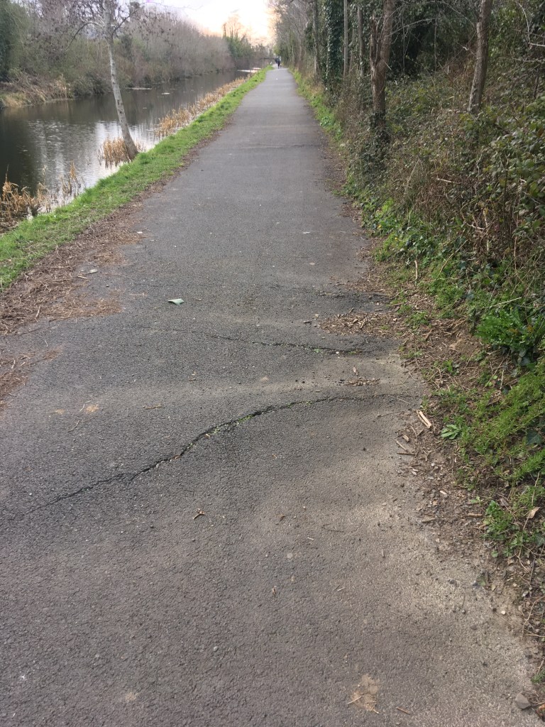
I would consider the trail beside the Deep Sinking in several parts. The first part is a very short wide space which is just grass as you leave Castleknock Train Station. Not long into this though the path narrows to reflect the images above. This narrow path starts to rise up above the canal and for the most part is soft and often muddy ground with gulleys slipping down the slope and tree roots to be mindful of. This section stretches for 1.5 kilometres as far as Kirkpatrick Bridge and Coolmine Train Station.

Pedestrian Bridge obscuring Kirkpatrick Bridge at Coolmine

While the building of the Royal Canal started in 1790, the original survey to find a suitable route across north Leinster was undertaken by Thomas Williams and John Cooley as early as 1755. Their suggested route would have utilised a series of lakes and rivers along the way to the Shannon in an effort to keep construction costs down.

Deep Sinking at Coolmine

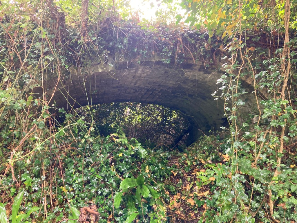
However as the story goes, William Robert Fitzgerald, the 2nd Duke of Leinster, a subscriber of the Royal Canal Company wanted the canal to pass his country residence of Carton House outside Maynooth and this necessitated the routing of the canal through a limestone quarry. A sinking is where a canal is cut through the land to maintain the same level rather than using locks to go over it. The Deep Sinking itself is a cutting through the limestone quarry which was blasted and dug through at great expense. At certain points through the Deep Sinking the towpath can rise up between 8 and 9 metres above the canal. A perilous danger for the horses pulling the barges below.

Looking down the trail from Kirkpatrick Bridge

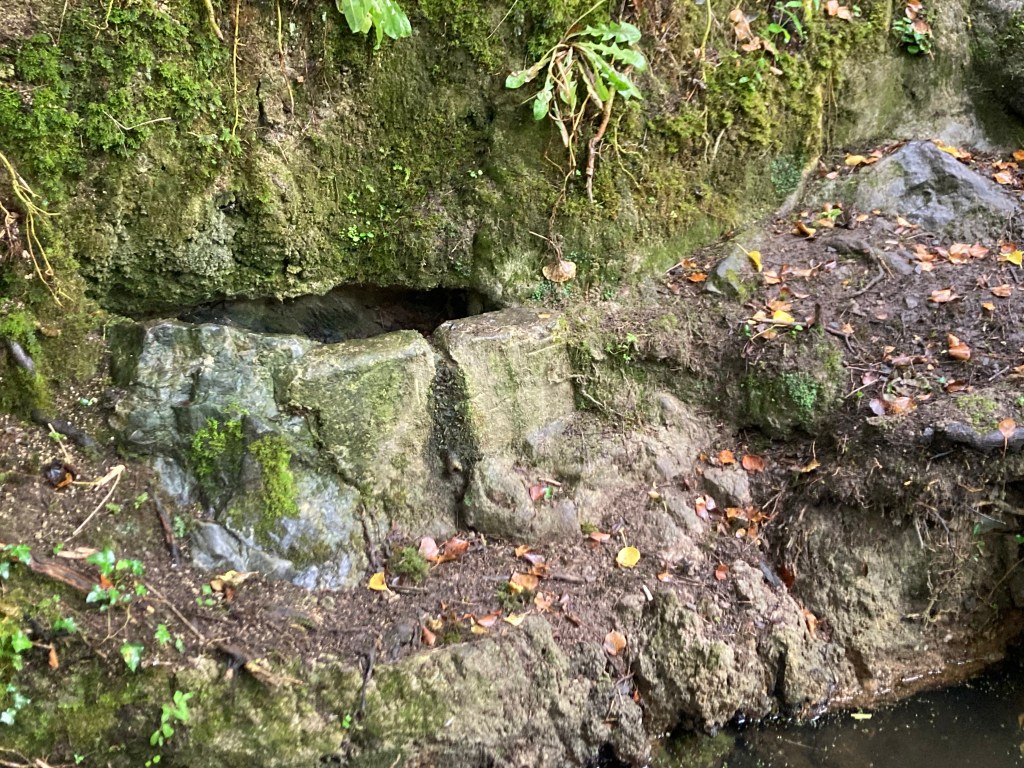
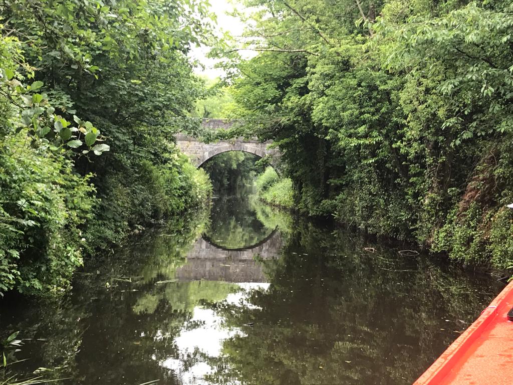
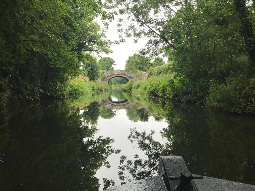
We are unable to go under Kirkpatrick Bridge and so must rise up and cross the main road and level crossing at Coolmine Train Station before proceeding on the second section of the Deep Sinking towards Keenan Bridge. This section is not without its own treasures though, a pair of arches hide away under the trail where most would never even notice and are best seen by taking a boating trip through the Deep Sinking.

One of the hidden arches that carries the trail through the Deep Sinking

The surface on this section is similar to the previous section though there are a few more stony out crops to be mindful not to trip on. A video by Ciaran Whyte showing what it is like from Coolmine to Deey Bridge at the 13th Lock can be viewed here.

Dr. Troy Bridge over the canal and railway

Like the previously discussed Reilly’s Bridge near Broombridge, Keenan Bridge at Porterstown was often the site of long tail backs with the level crossing beside it so before we reach the bridge we pass under Dr. Troy Bridge which rises high above both the canal and railway removing the need for the level crossing.

The muddy approach to Keenan Bridge
Abandoned Gate Keepers Cottage at Keenen Bridge

The area around Keenan’s Bridge in Porterstown could be considered one of sorrow. The first thing we see as we reach the bridge is the abandoned Gate Keepers Railway Cottage at the old level crossing. At this point we must cross over Keenan Bridge from back to the north bank of the canal to continue. As we descend back down to the canal path we see a memorial to the sinking of the Longford Passanger Boat on the other side of the bridge.

Memorial and wreath erected by the RCAG Keenan Bridge

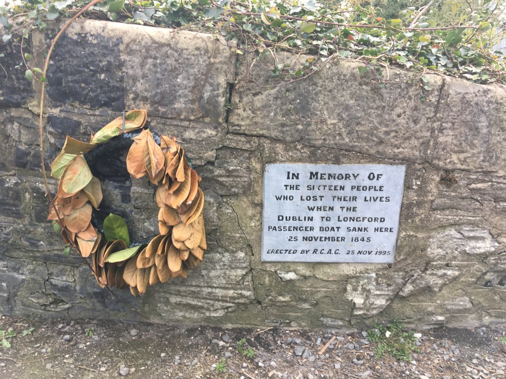
As previously mentioned the massive drop between the towpath and the canal at the Deep Sinking was rather dangerous and 16 people lost their lives when the passenger boat Longford sank near here on the 25th of November 1845. An account of the sinking can be found on the Irish Waterways History website here.

The old Porterstown National School

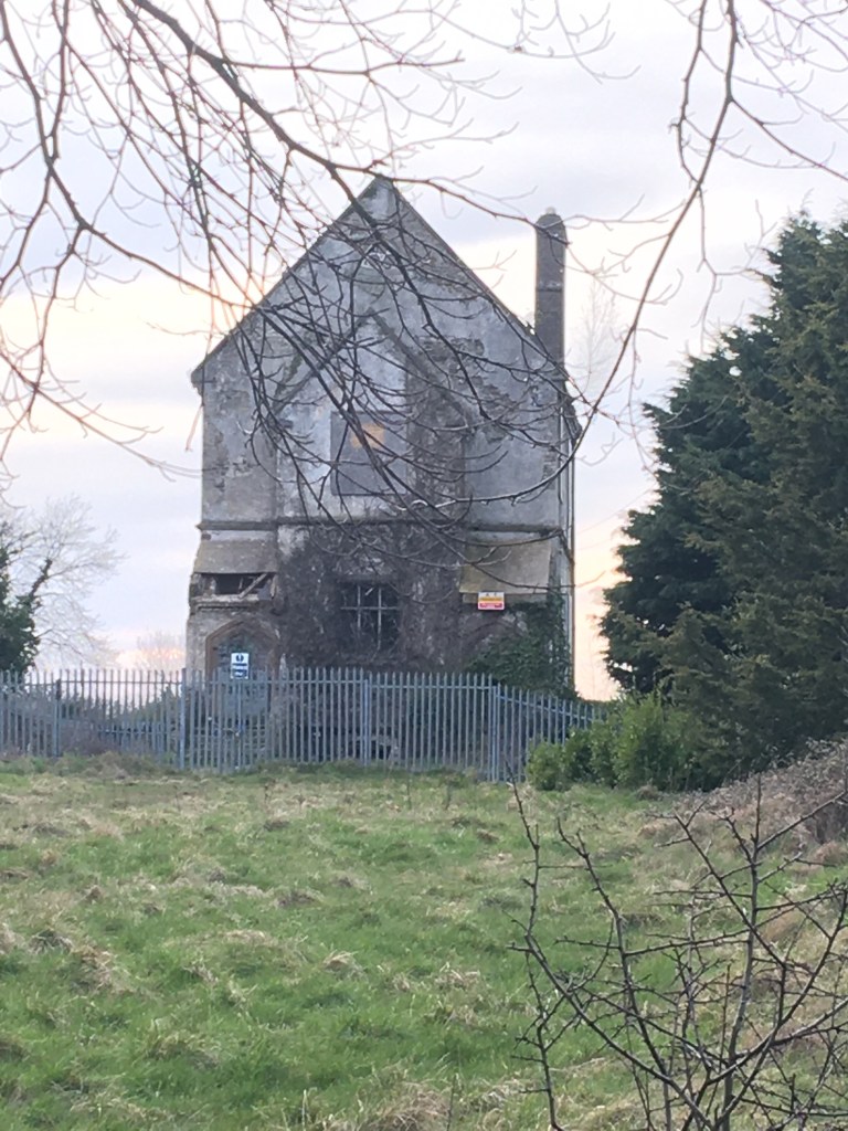
Before carrying on our journey west on the north bank we can see the old Porterstown National School rise high above the canal bank. This abandoned school, closed in 1963, is known by many in the area as the School of Spite as the priest who sought to build it insisted it be built to such a height so as to annoy the local landowner Baron Annaly of Luttrellstown Castle who refused to contribute to the schools construction. In 2010 the building is sadly associated with the murder of a 12 year old girl who went missing in the area giving rise to the building being fenced and secured.

Waterpump near Keenan Bridge

Thankfully I do have some good news as we continue west, after leaving the trail path of the south bank from Castleknock we do get a compacted stone dust path from Keenan Bridge for 1.2 kilometre to Callaghan Bridge in Clonsilla.

Stone path from Keenan Bridge to Clonsilla

As we pass under Callaghan Bridge at Clonsilla we can see the Clonsilla Train Station Signal Box rising high above the canal.

Clonsilla Train Station Signal Box

You must pass under the bridge and come up on the other side to actually get to the train station. There is also an Applegreen service station only a 2 minute walk from the station if you feel the need to top up supplies.

Callaghan Bridge at Clonsilla with name plaque visible over arch

Back down on the canal you might be happy to find the next small second of path is actually tarmac. There has been a lot of discussion about whether or not we should try tarmac the entire route with many advocating that we should instead of the compacted stone dust we find for most of the route beyond Maynooth. While I agree that this would make cycling easier, especially as I own a road bike, it is not without problems.

Tarmac cracks easily from roots below it and weathers badly over time causing trip hazards and requires more frequent maintenance

After our short reprieve from the trails from Keenan Bridge to not long after Callaghan Bridge we return to brief stoney section before a grassy trail surface for most of the rest of our journey to Leixlip Confey.

Pipe over the canal and stoney path west of Clonsilla.

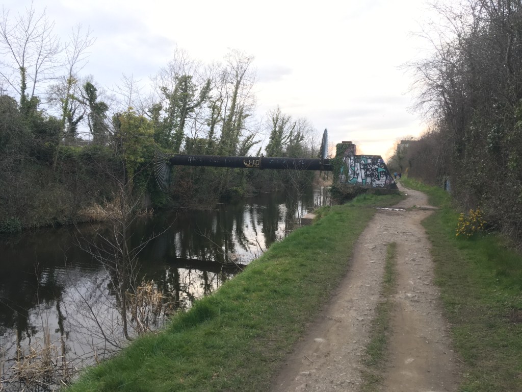
The railway splits just after Clonsilla Train Station with one line continuing west towards Sligo and the other being the reinstated line that crosses the canal and heads north through Dunboyne and on to the M3 Parkway park and ride station. We pass under the new railway bridge not far west of Clonsilla.

Bridge carrying railway over the canal to M3 Parkway

We are back on the grass once we reach the far side of the railway bridge as we proceed on towards Pakenham Bridge. The bridge is most likely named for Thomas Pakenham who became a Rear Admiral in the Royal Navy and later the Master General of Ordnance in Ireland. He was the youngest son of the 1st Baron of Longford.

Approaching Pakenham Bridge from the east. The building on the right is most likely a former gate keepers cottage for the railway.

After going under Pakenham Bridge we have a 1.8 kilometre stretch towards Collins Bridge with Westmanstown Golf Club and sports facilities on the opposite bank. Again this is a manageable soft grass surface which can be muddy when wet.

Collins Bridge from the east.

Passing under Collins Bridge the ground on the other side has a tendency to be very soft even when dry.

Canal towpath west of Collins Bridge

1 kilometre from Collins Bridge we leave Fingal and County Dublin and enter County Kildare, welcomed by the sign of the Royal Canal Amenity Group (RCAG) Boathouse and Slipway.

RCAG Boathouse and slipway near Confey

It is a most welcome sight to see a good number of boats currently tied up here as let us not forget that while we are enjoying our walk, cycle or run, the Royal Canal is first and foremost a navigation. Footage about the work of the RCAG from its early days in the 1970’s can be seen here:

It is only a short walk from the boathouse, past Confey GAA to Cope Bridge and Leixlip Confey Train Station and in total we have covered 8.65 kilometre through the Deep Sinking, past Coolmine and Clonsilla, leaving Dublin behind us and entering Kildare. Close to Cope Bridge there is a Supervalu at Riverforest the far side of the bridge as well as the River Forest Hotel with pub and grub.

Cope Bridge at Leixlip Confey

Part 1: North Wall to Cross Guns Bridge

Part 2: Cross Guns Bridge to Castleknock

Part 4: Leixlip Confey to Maynooth

Part 5: Maynooth to Enfield

Part 6: Enfield to Thomastown

Part 7: Thomastown to Mullingar Harbour

Part 8: Mullingar to Coolnahay

Part 9: Coolnahay to Ballynacargy Bridge

Part 10: Ballynacargy to Abbeyshrule

Part 11: Abbeyshrule to Ballybrannigan

Part 12: Ballybrannigan to the 41st Lock

Part 13: 41st Lock to Richmond Harbour

Part 14: The Lough Owel Feeder

Part 15: The Longford Branch

Annex 1: The Old Rail Trail – Mullingar to Athlone

Categories
Royal Canal

Cruising on the Royal Canal: Travelling through the Deep Sinking by Barge

Running the length of the Royal Canal in a single day is a fairly unique way to experience the joys of travelling along its banks. However, a promise I made to myself that mid-summers day in 2019 was that one day I would return to see the canal the way it is truly meant to be seen, to be experienced, from the water. It took me over two years to finally book a trip with Royal Canal Boat Trips and the charismatic skipper Jenny.

Jenny and her barge passing the Maynooth Swans and cygnets

2021 has certainly been the year of the Royal Canal. While the navigation itself fully reopened in 2010, 2021 has seen the launch of the Royal Canal Greenway, Ireland’s longest greenway, linking Maynooth to the Shannon at Cloondara with options to also travel the Old Rail Trail to Athlone or take the Longford Branch off the main line to Longford town. Following on from the launch of the greenway, RTÉ’s Nationwide also dedicated a weeks worth of their programming to exploring the canal with hosts Anne Cassin and Bláthnaid Ní Chofaigh starting at opposite ends and meeting each other in Mullingar.

While the Greenway has been getting the majority of the focus of late, the setting for my short cruise is the marvelous Deep Sinking, casting off from the 12th Lock in Castleknock and heading west through a true man made wonderland, largely untouched by development since its difficult and costly construction in the 1790’s.

Heading towards Granard Bridge and the Deep Sinking

I have already covered the Deep Sinking from the towpath on my page here but I think it is fair to say it is an area like no other on the Royal Canal for intrigue, controversy, expense and tragedy, all of which take on a much greater meaning when seen from the water rather than from the heights above.

Magical Reflections from the water of the Deep Sinking

Let me first start with the intrigue. Why was it that over 200 years ago the board of the original Royal Canal Company decided to deviate away from the surveys that told them that it would be more practical and cost effective to build the canal on a more northerly route rather than to dig and blast their way through a limestone quarry? As knowledge of history of the Royal Canal grows, many would now tell you that this was done at the behest of the William Fitzgerald, 2nd Duke of Leinster, a subscriber to the Royal Canal Company, so that the canal would pass alongside his country seat of Carton House, now a luxury hotel and golf course.

Tool marks at Kirkpatrick Bridge

Unfortunately with all the records of the original Royal Canal Company lost, it is not something I think we can ever be 100% sure of. That said the Deep Sinking was a mammoth undertaking in terms of cost and labour, taking several years to dig out of the hard rock. Fast forward to today and considerable attention has been drawn to the existence of 4 arches built into the south bank of the Deep Sinking between Kirkpatrick and Keenan Bridges. Awareness of these arches has gained traction through the Friends of the Deep Sinking Facebook group while their true function remains a mystery. My own personal thinking is that they were build to provide stability to weak parts of the towpath where the horses would have once pulled the barges through the Deep Sinking from a considerable height above the canal.

Arch hidden by overgrowth as seen from the barge

As Jenny navigates her daily charter back and forth along the Deep Sinking she has well established the location of the 4 arches. While I know exactly where 2 are from the towpath and have been down in both, one of them is definitely inaccessible from land and I think it was with sense of glee and adventure that she waited patiently to unveil another arch to the world from its mask and curtain of thorny overgrowth. As she stopped the barge alongside the arch pointing out its keystone and light coming through from the other side, it didn’t take any encouragement for me to clamber up the bank and see it from the inside.

Looking back at skipper Jenny and my wife from the arch

Of course now that I made my way up here, it was time to document what I found. The most startling object that caught my attention first was an old motorcycle helmet, lord knows how long that has been down there.

A motorcycle helmet found in the arch

So while I had a sense of adventure, it would seem I am not the only one to have been down here in recent years despite how inaccessible I think the place is. The arch itself is built of brick and is the width of the towpath it carries above.

Several bricks are missing and it can be seen how the arch is built into the bedrock below it.

Vegetation from above has caused some damage as roots have spread over years and a large root now sprouts out of canal facing side of the arch having forced some bricks free and splitting others around it.

Roots protruding out through the brickwork near the centre of the arch

Of course a structure like this is not something that should be kept secret or hidden, especially if we are to have any hope of it being preserved given its delicate condition. Jenny came prepared and passed me up a set of pincer shears which I was able to use to remove some of the curtain, allowing light flow in from the canal side so that passers-by on the canal can marvel at another wonder of the Deep Sinking.

The arch after its haircut, opened up for all to see

After getting my feet firmly back on the barge, we proceeded gently west again, stopping a short distance further at the site of an old well just before Keenan Bridge. While the well was dry you could see how steps had been fashioned down to it from the towpath and how a pipe had been installed so water could be taken from the well. It gave me an amazing sense of joy to be shown these things that I knew nothing of before, highlighting that no matter how often you pass through a place, there are always little treasures and secrets to find.

Well on the south back with small pipe at its base

It is at Keenan Bridge that we come to the tragedy I mentioned earlier. Sensitive souls can feel an eerie feeling of loss passing through the bridge, not far from where the sinking of the Longford passenger boat, with the loss of 16 lives happened in 1845. A better account than I can offer can be read on the Irish Waterways History website. A memorial plaque was erected by the Royal Canal Amenity Group on the bridge on the 150th anniversary in 1995.

Keenan Bridge as viewed from the Clonsilla side near the location of the sinking of the Longford passenger boat

From Keenan Bridge we headed for our turn around point just short of Callaghan Bridge at Clonsilla Train Station, a distance of 2.5 miles in about 90 minutes. This is the true pleasure of travelling by barge. When running I would expect to cover 9 miles in 90 minutes and would still think that I have taken in my surroundings but in reality I have missed so much and have a whole new appreciation for the Deep Sinking by taking the time to travel its waterway and conversing with those who have a shared love of the canal, its history and its heritage, each of us filling in a little bit of the rich tapestry that makes up the fascinating tale of its past and those who have gone before us, be they navvies, engineers, merchants or travellers.

Approaching the turn around point near Callaghan Bridge

I mentioned earlier that the Deep Sinking was also the site of controversy and expense. This started indeed with its construction in the 1790s and between making the Deep Sinking navigable and building the Rye Water Aqueduct in Leixlip, the Royal Canal Company had drained its financial resources barely getting out of Dublin, let alone making it to the Shannon. What followed was protracted funding requests to government allowing the canal be finished first to Kilcock in 1796, eventually on to Mullingar in 1806 before the company fell bankrupt after reaching Coolnahay around 1813. From there the canal was finished to the Shannon under the control of the Directors for Inland Navigation, finally being completed to Richmond Harbour in 1817.

The canopy above the Deep Sinking on a soft day

It seems this controversy continues on into the 21st century with the planning for the completion of the Greenway into Dublin from Maynooth and the intention of developers to build apartments very close to the canal bank. I cannot deny that I am an advocate for the completion of the Greenway and I hope that a solution that allows that completion can be found, however I am very mindful that the Deep Sinking is a place steeped in wildlife, built heritage and also a spiritual resting place. All these factors must be considered in advance of any work undertaken. The canal is man-made, built over 200 years ago and while it needed substantial work to restore it for navigation, the craftsmanship on display shows it was built not only to outlast those who started it, but the many generations that would follow in its wake from a commercial route to a leisure amenity.

Kirkpatrick Bridge built into the bedrock of the Deep Sinking with tool marks visible

The short trip only heightened my desire to one day travel the full length of the canal once again, only this time at an easy pace, by barge, all the best explorers went by boat right? I will take it one step at a time though, the next step is to see if I can book another trip with Royal Canal Boat Trips as far as Maynooth and get to experience transiting through a lock. After our return to Castleknock my wife and I were a little early for lunch in the 12th Lock so we walked on along the canal to The Lock Keeper at the 10th Lock in Ashtown.

Finished the day with lunch at the Lock Keeper in Ashtown

PS – Many thanks to my wife Niamh for many of the photos used here, recording what I was only taking in in my own minds eye as the skipper and I shared stories of travelling the canal.