
Like the Royal Canal, following the Grand Canal is a pleasurable experience be it walking, running or cycling but knowing which side of the canal you should be on at any given time can be a tricky one. The last thing you need when you have some distance in your legs is to find out you’ve hit a dead end or worse still on the Grand Canal taken the wrong branch and ending up in Naas when you thought you were on your way to Robertstown.
This post is a quick reference guide for those who want to follow the Main Line Branch from the Sea Locks at the Liffey to Shannon Harbour.
Note: This post only goes as far as Downshire Bridge where the Edenderry Branch splits from the Main Line. There is a link at the bottom of the page which links to a post covering Edenderry to Tullamore and another that looks at the Naas Branch.. I will add additional posts as I complete the rest of the route and hopefully I will add in the Barrow Way as separate posts in the future.
This post will also give an indication of the surface types you can expect as you travel. I ran the first 65km of this route over two dry August days so the trail parts were for the most part dry and the grass well maintained however I can imagine that a lot of the route could be a quagmire in winter months and would recommend you keep this in mind. A runner or walker who doesn’t mind getting muddy should have no concerns covering the route and a cyclist on a mountain bike would have no issues, personally I wouldn’t recommend taking a road bike on the route.
The Grand Canal has a few twists and turns but for the most part it runs East to West so regardless of its turns I will indicate if you should be on the North or South Banks based on the overall direction of the canal.
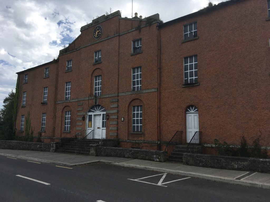
So let us begin at Grand Canal Dock:
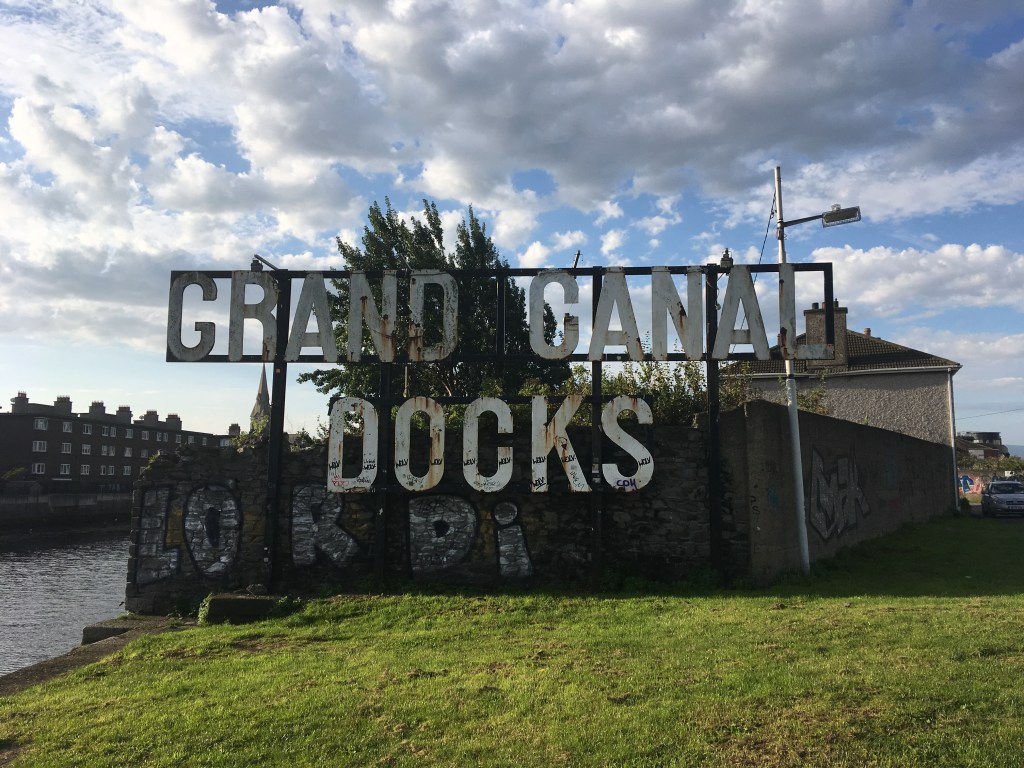
Leaving the Sea Lock we follow the Canal around Grand Canal Dock on the North Bank. A few buildings will separate you from the canal briefly as you cross Pearse Street, go under the railway line and come back out at Grand Canal Street at the C1 Lock. From there you follow the Circular Line up past Locks C1 to C7 as far as Robert Emmet Bridge at Clanbrassil Street. This is a distance of approximately 4.2km.

Crossing Robert Emmet Bridge to the South bank we now have a long stretch of paths from here up to the Main Line Junction just after Griffith Bridge at Suir Road (where the LUAS now goes along the original path of the Main Line).

The path then continues all the way out to the 12th Lock at Lucan. This is a total distance of 13.8km including the Grand Canal Way Green route from the 3rd Lock to the 12th Lock. A bit of caution is needed at the start of this section as you will have to cross over several busy roads.
At the 12th Lock we must cross Lucan Road Bridge back onto the North Bank and we encounter our first bit of trail. This section of trail can be mucky in winter but was totally fine for me on a dry August day. This section of grassy trail extends for 4.6km out to Hazelhatch where you might get to see some of the original Grand Canal Company M boats tied up.
Information about many of these boats can be found on the Heritage Boat Association website which I link to were I mention any of the Heritage Boats I come across. For those with a real interest in the history of these boats I highly recommend the Associations Clear Water books series which can be bought from their website here.


At Hazelhatch you cross over the bridge (mind the traffic lights) and are back on the South Bank where you are welcomed by a a solid path for 6.4km taking you by Lyons Estate as far as Ponsonby Bridge.

It is possible to go under Ponsonby Bridge but as you emerge on the other side you are back onto a trail path, still on the South Bank of the canal. This continues for 6.2km the whole way to Sallins however you should note the roughest section of the trail is between the Railway Bridge and Sallins town and I would imagine this sheltered section becomes a tough, muddier trail after a few days of rain regardless of the time of year.

When you reach Sallins Bridge you must cross again over to the North Bank. It’s a busy bridge so it’s worth using the pedestrian lights on your left as you approach the bridge. (Staying on the South Bank will lead you via a warren of housing estates to the Naas Branch which I will cover another day).

The North Bank has a road to take you out west of Sallins to the Leinster Aqueduct and the road lasts for some 800m past the Aqueduct giving a distance of 2.6km of solid ground.

You stay on the North Bank when you meet the trail and it takes you along for 2.4km as far as the 17th Lock at Landenstown Bridge.
Staying on the North Bank at the 17th Lock you join a busy road for 1.2km. After this distance the road and the canal part ways and you are back on a grassy trail.
This grassy trail continues on the North Bank for 3.2km as far as Bonygne or Healy’s Bridge.

You must come up onto the road and cross the bridge back over to the South Bank and the grassy trail continues for 2.2km as far as Binn’s Bridge in Robertstown.
Finally, crossing over Binn’s Bridge back onto the North Bank you follow the road for 1.4 km and the 19th Lock at Lowtown.
When you reach the 19th Lock at Lowtown you are at the end of the Summit Level. Just after the Lock is Fenton Bridge which if you cross will bring you onto the Barrow Way but for our purposes we stay on the solid path on the North Side of the Canal and continue on towards Allenwood.

As we continue west we pass the Barrow Way navigation as it splits with the Main Line and heads south towards Athy. The path on the North Bank remains good all the way up to Bond Bridge in Allenwood, a distance of 1.8km.

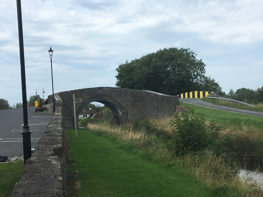
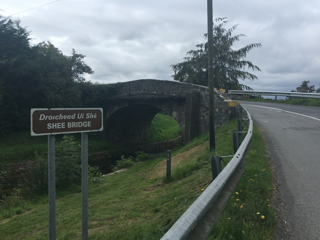
After passing under Bond Bridge and remaining on the North Bank we come to a grassy trail for the short distance up the Shee Bridge. It is only 1.4km between the bridges. At Shee Bridge we must cross over to the South Bank. The main road to Rathagan goes over this narrow bridge and we must go along the road for 200m before we enter a grassy stretch of 650m along the canal bank.
Emerging from the grassy section which some know as Allenwoods Millennium Park we rejoin a country road which takes us all the way up to Hamilton Bridge on the South Bank, a distance of 2.4km. At Hamilton Bridge we cross back over to the North Bank again where we will remain for the considerable future distance.

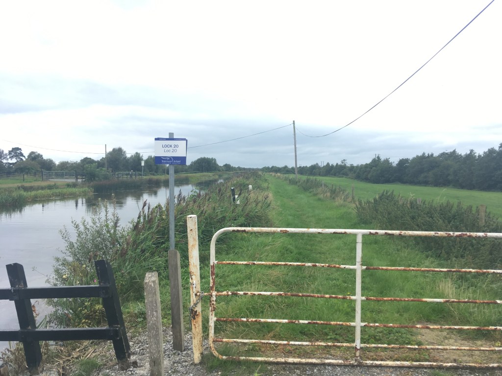
After Hamilton Bridge we are on a mix of road and rough path all the way to the the 20th Lock. There is no risk of mud here but with many potholes it would be easy to see puddles building up and trip hazards for walkers and runners as well as a chance of getting a puncture for cyclists. It is a total distance of 4.2km from Hamilton Bridge to the 20th Lock.
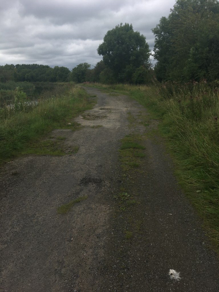
After passing the 20th Lock we are back on a grassy trail for the remainder of the distance to the Edenderry Branch but at least we don’t have to worry about crossing sides again. It is a distance of 6.4km to Downshire Bridge which is a narrow bridge that crosses over the Edenderry Branch adjacent to the main line.
Downshire Bridge is 63.8km from where we started at the Sea Lock. From here it is possible to take a path for 1.6km into Edenderry Harbour if you wanted to stop for a snack. This is where I stopped for now.

A Guide to Staying on the Right Side of the Grand Canal: Edenderry Branch to Tullamore
Walking on the Grand Canal: Hazelhatch to Sallins
Walking on the Grand Canal: Sallins to Robertstown
Walking on the Grand Canal: Naas Branch
Walking on the Grand Canal: Naas Harbour to Corbally Harbour

14 replies on “A Guide to Staying on the Right Side of the Grand Canal: Grand Canal Dock to Edenderry”
[…] Part 1: Grand Canal Dock to Edenderry […]
LikeLike
[…] Grand Canal: A Guide from Grand Canal Dock to Edenderry […]
LikeLike
[…] A Guide to Staying on the Right Side of the Grand Canal: Grand Canal Dock to Edenderry […]
LikeLike
[…] A Guide to Staying on the Right Side of the Grand Canal: Grand Canal Dock to Edenderry […]
LikeLike
[…] A Guide to Staying on the Right Side of the Grand Canal: Grand Canal Dock to Edenderry […]
LikeLike
[…] A Guide to Staying on the Right Side of the Grand Canal: Grand Canal Dock to Edenderry […]
LikeLike
Having cycled most of the canals and Barrow way this is one of the few accurate guides on the towpath surfaces and which side of the canal to be on! Well done.
LikeLiked by 1 person
Thank you, hopefully I’ll be able to finish Tullamore to Shannon Harbour soon and then I can make a start on the Barrow way.
LikeLike
I cycled the Barrow way from Robertstown to Carlow recently very scenic and a great facility that’s not appreciated, but some of it is unpassable at this time of year! Cycling in a foot of water!
LikeLike
[…] to be on and what type of surface those travelling the Grand Canal Way can expect, the first being Grand Canal Docks to the Edenderry Branch and the other from Edenderry Branch to Tullamore. Unfortunately it took a lot longer than planned […]
LikeLike
I’ve just finished as far as Sallins. It’s a solid path all the way from hazelhatch to Sallins now. From Lucan to Hazelhatch still grass and muddy when wet. I read in an online newspaper the 2.4 million euro provided to make this a solid path in 2024.
Iano
LikeLike
Thanks Ian. I was aware of the work but I’ve seen a small bit of it east of Sallins. The website is in dire need of updating as a lot of areas have been or are due to be worked on. Great to see the investment going into both the canals, albeit the paths seem to be getting more attention than the waterways themselves.
LikeLike
hiya me again. Just wondering would you know of any site/blog with suggestions for accommodation along the grand canal? I know there is one on the Royal canal.
thanks.
LikeLiked by 1 person
Hi Ian. I don’t know of any sites myself but I’ll do up a reply in the morning with some pointers that may be of assistance.
LikeLike