
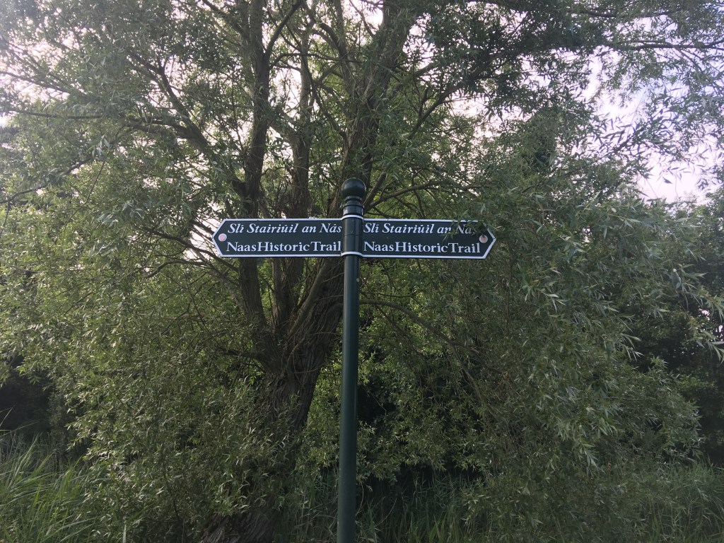
Although long closed to navigation by boats the stretch of the Grand Canal from Naas Harbour to Corbally Harbour offers the walker and runner a fine route of just over 8km on which to travel, almost all of which is expansive countryside, ideal for those looking to escape the urban landscape of Naas.
The Corbally extension has been closed to navigation since the building of the Newbridge Road at canal level in 1954, the line remains in water as a the water source for the Naas Branch comes into the system at Corbally Harbour and flows the whole way down the the main line at Soldier’s Island.

Built between 1808 and 1810, the Grand Canal Company contracted the Civil Engineering firm of Henry, Mullins & McMahon to construct the extension as well as restoring and adapting some of the Naas Branch after the collapse of the County of Kildare Canal Company. This would be the first job for the firm that also went on to finish the Royal Canal from Coolnahay to Richmond Harbour as well as building the Ballinasloe and Mountmellick Branches of the Grand Canal. While John Killaly did survey a route through Kilcullen and Baltinglas, plans to extend the line beyond Corbally were abandoned.
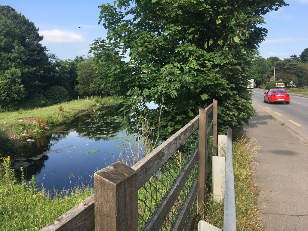
Passing the Naas Community Library as you leave the Naas Harbour on the south bank you follow the path through Sarto Park to a tree lined trail on the bank and on to Ploopluck Bridge.
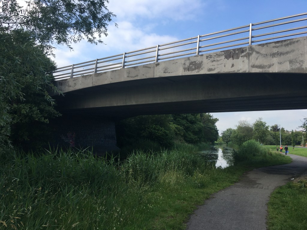
Continuing west and skirting behind several housing estates you then pass under the more modern Caragh Road Bridge which carries traffic high over the canal.
It is only a short distance from the Caragh Road Bridge to Jigginstown Bridge (may also be known as Terry Bridge) which now acts as pedestrian access to Naas Sports Centre on the opposite side of the canal.

It is necessary to leave the canal at the bridge and move up to the main Newbridge Road and the ruins of Jigginstown House. When this road was built over the canal in the 1950’s it was decided to use a culvert instead of a bridge, therefore sealing the fate of the line as closed to navigation.
We leave the canal as we cross the road and travel on down Jigginstown Green. The canal passes behind several house before we rejoin it about 500m later at Limerick Bridge.

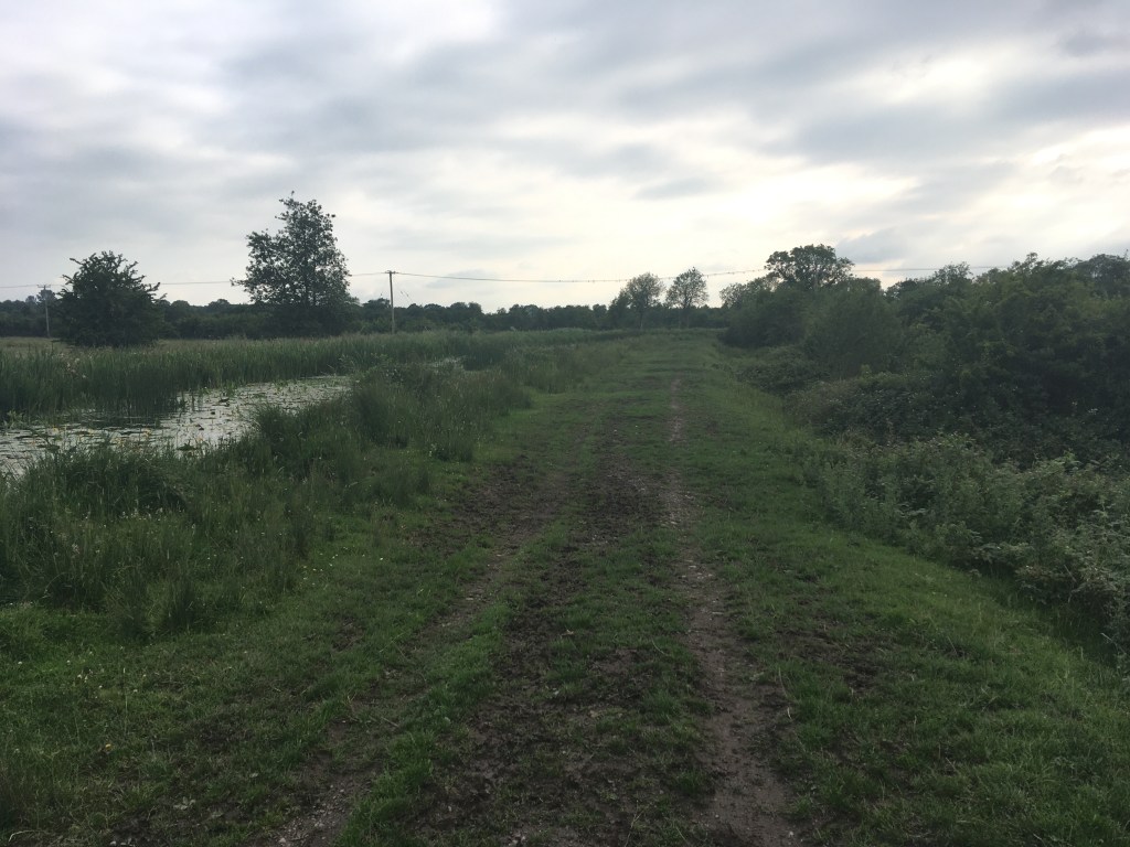
Staying on the south bank of the canal we proceed on west as the canal takes a turn south, now walking on a grassy trail and leaving behind the urban neighbourhoods of Naas. I did this section in mid-summer after a prolonged dry spell so the surface was ideal for me but many have warned me that this area can be overgrown and wet in winter so a good pair of trail runners or boots is advised. It is nearly a 2km stretch before we reach the next landmark of Connaught Bridge.

When you get to Connaught Bridge you must first pass under it before coming up to cross over it and descend down on the other side to what has now become the west bank of the canal. From here on in, we will meet several gates along the path. It is important to be mindful to close the gates behind us as we pass through them as there are free roaming cattle in the fields along the canal. That being the case it is also important to be mindful of where you step!
It is 2km from Connaught Bridge along the trail before your come to a canal spillway just before the The Cowhouse at Williow Cottage. From here you are briefly back on a hard surface to Hoare Bridge.

It is easier to come up to the road level and back down on the other side at Hoare’s Bridge rather than squeeze through the overgrowth under the bridge. We have a good surface for a short while as we pass along some houses and driveways but before long we are back on the grassy and on a wet day, muddy trail towards Corbally Harbour.

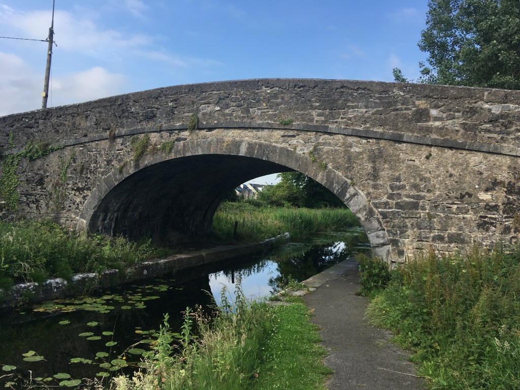
1km further on from Hoare’s bridge you come to the remains of Mooney’s Bridge. A low level flat accommodation bridge has been built alongside the humpback Mooney’s bridge to allow farmers access to both sides of the canal. Sadly a good part of the wall of Mooney’s Bridge has fallen away on one side.

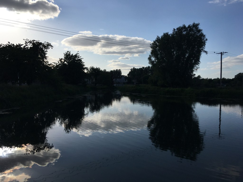
From Mooney’s Bridge it is less than 1km to the end of the line at Corbally Harbour and the water source for the Naas Branch. The harbour itself is slightly overgrown but the harbour walls are still visible as are the remains of the harbour stores on the opposite bank.

The Corbally Extension is a hidden gem of a route well worth exploring when out by Naas on the Grand Canal. Unfortunately it must be said that it does finish in an area with little around it so it advisable to bring a picnic with you on your walk as you will need to make the return trip to Naas back the way you came.
Walking on the Grand Canal: Naas Branch
Walking on the Grand Canal: Hazelhatch to Sallins
Walking on the Grand Canal: Sallins to Robertstown
A Guide to Staying on the Right Side of the Grand Canal: Grand Canal Dock to Edenderry
A Guide to Staying on the Right Side of the Grand Canal: Edenderry Branch to Tullamore

11 replies on “Walking on the Grand Canal: Naas Harbour to Corbally Harbour”
[…] Walking on the Grand Canal: Naas Harbour to Corbally Harbour […]
LikeLike
[…] Walking on the Grand Canal: Naas Harbour to Corbally Harbour […]
LikeLike
[…] Walking on the Grand Canal: Naas Harbour to Corbally Harbour […]
LikeLike
[…] Walking on the Grand Canal: Naas Harbour to Corbally Harbour […]
LikeLike
[…] Walking on the Grand Canal: Naas Harbour to Corbally Harbour […]
LikeLike
[…] For those interested in the history of the building of the Royal Canal, Coolnahay also marks a very important point in the construction of the canal. The canal reached Coolnahay in 1809, some 19 years after construction first began in Dublin and by this stage the company was heavily in debt and unable to cover the construction costs to complete the canal. It was decided that the Royal Canal Company would be dissolved and the canal completed to the Shannon using public funds. In 1813 the Directors General of Inland Navigation took on to complete the canal under engineer John Killaly and contractors Henry, Mullins and McMahon. You may remember we previously came across the formation of this firm when they tendered for the restoration and extension of the Naas Branch of the Grand Canal as to Corbally Harbour. […]
LikeLike
Is it possible to cycle any of the Grand Canal Greenway, starting in Dublin. How far would I get?
LikeLike
I would say it is possible to cycle the entire Main Line of the Grand Canal from the Liffey to the Shannon on a mountain bike or a solid gravel bike but I wouldn’t do it on a light gravel bike or a road bike. As with any bike trip I would also make sure to have spare tubes and a repair kit. If you have a look my post here: https://royalcanalrunner.com/2020/05/10/a-guide-to-staying-on-the-right-side-of-the-grand-canal/ and the following two posts you’ll get a better idea of the surfaces you’d encounter. Each stretch has its own issues but it’s not something you can’t get by. The Circular Line from Grand Canal Dock to Suir Road has a lot of traffic and road crossings, from the 1st Lock at Suir Road to the 12th Lock at Lucan has a great surface away from the road but there are kissing gates which will slow you down getting around and there can be safety issues along that stretch. From the 12th Lock to Hazelhatch, it’s a grass trail and can be soft going/mucky in wet weather. Hazelhatch to Ardclough has a great surface before turning back to grass to Sallins. After that you alternate between surfaces like grass trails, compacted soft stone, tar and quiet roads which a mountain bike should be well able to handle. Work is planned to improve the surface in different areas that will likely start over next winter.
LikeLike
Ok Great. Thanks for your detailed reply.
Would Naas to Grand Canal Dock be realistic in one day? On a hybrid bike, we plan to do it Thursday! Time wise, what would you estimate. We are leisurely cyclists!
LikeLike
I’ve walked it in about 6 hours so it’s definitely doable on bike but I would do it on a dry day the section just east of Sallins and just east of Hazelhatch can be muddy and as I said the traffic and crossings on the last bit will slow you down but I reckon you could do it in 4 hours easily.
LikeLike
I enjoy exploring waterways like this one.
LikeLike