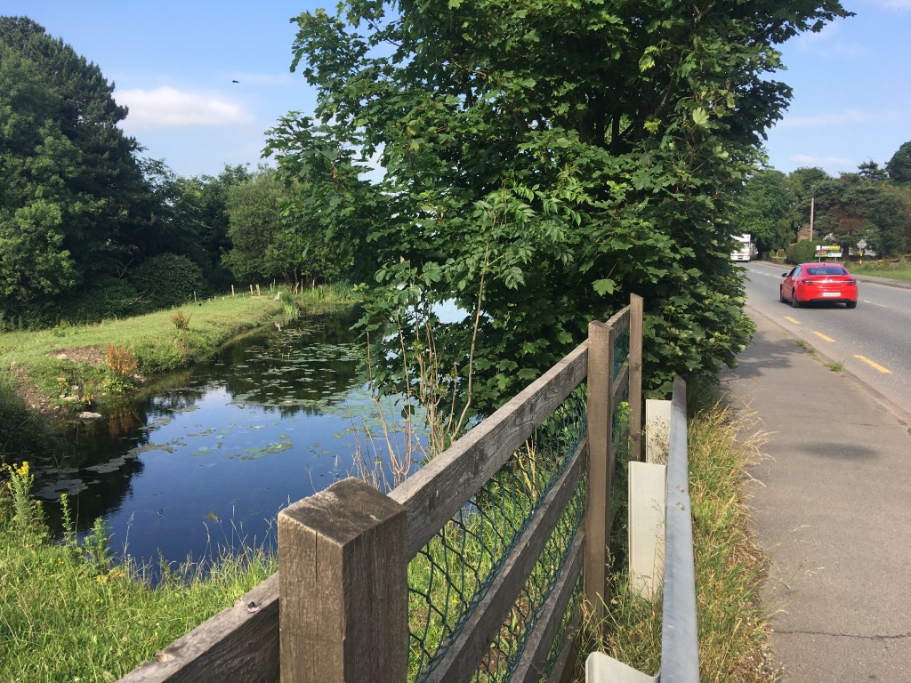
Unfortunately, due to ongoing works and closures of the Blueway on the Barrow Line of the Grand Canal between Monasterevin and Rathangan, it will not be possible to hold the Barrow Line Race on the Barrow Line in 2022.
The event will now take place on the Main Line of the Grand Canal, starting at Tullamore and running 30 miles east to Robertstown. This means there will be no change to the meeting location for the bus, the finish line or the distance for the event.
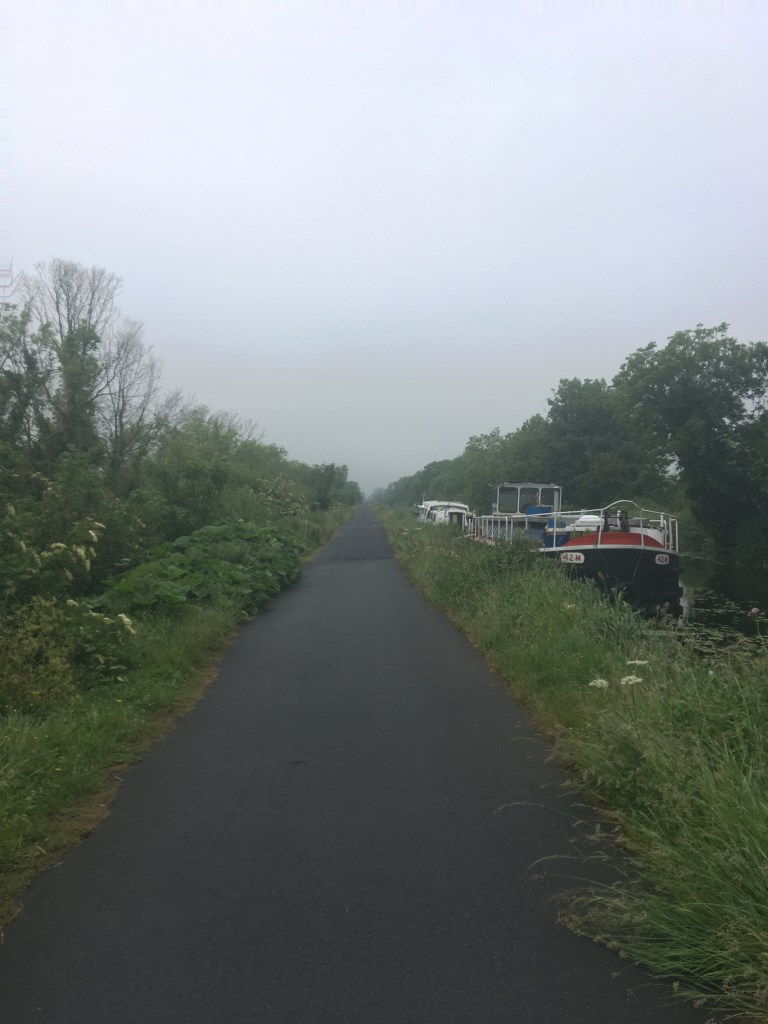
The race will go ahead as planned meeting at Robertstown on Saturday 21st of May, getting on a bus which will leave all the runners to the start line now in Tullamore and they will run the 30 miles back to the finish at Robertstown. The entire run is on the Grand Canal Way and there will also be two bag drops along the route near Daingean (about 10 miles in) and Edenderry (about 20 miles in).
New route from Tullamore to Robertstown along the Main Line of the Grand Canal
Course Description
The run will now start out on the north bank of the Grand Canal at the start of Fiona Pender Way on the east side of Tullamore.
Bury Bridge, Tullamore Harbour where the run will start.
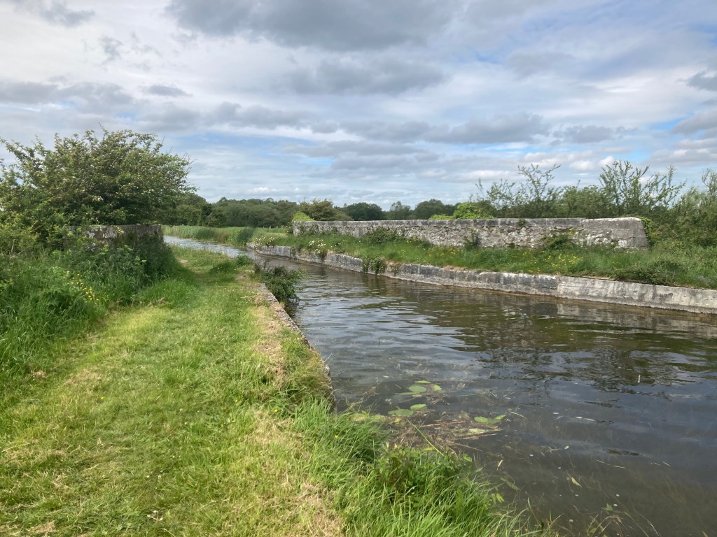
Heading east back towards Robertstown runners will stay on the north bank gradually climbing up from the 26th Lock just outside Tullamore to the 21st Lock at Ballycommon in a distance of 5 miles or 8km.
Bolands Lock Keeper Cottage, 26th Lock Tullamore
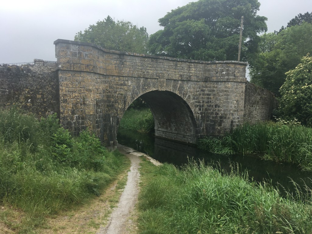
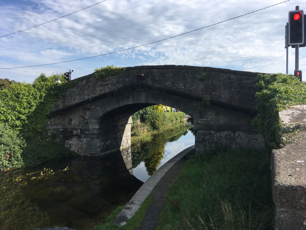
After passing the 21st Lock runners will then cross over the dam in front of Campbell’s Bridge which is the entrance to the former Kilbeggan Line of the Grand Canal.
Campbell’s Bridge and Dam over the old dry Kilbeggan Line at Ballycommon.
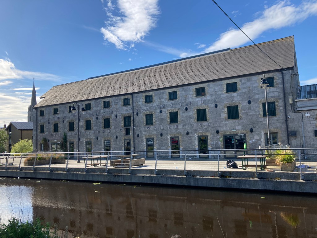
Staying on the main line with the water on your right hand side the Grand Canal Greenway passes through some bogland before reaching Daingean about 14km into the run.
Warehouse at Daingean
After Daingean, at the next bridge, Killeen Bridge will be the first bag drop. This is roughly 10 miles / 16km into the route.
Runners will encounter several more bridges over the next 9 miles /15km all the while staying on the north bank of the Grand Canal with the water on your right, passing through Rhode on the way towards Edenderry.
Rhode Bridge
The 2nd bag drop will be just before Edenderry at Colgan’s Bridge 18 miles /30 km into the run. Just after Colgan’s Bridge runners will run up the steep Downshire Bridge to cross over the Edenderry Branch of the Grand Canal before coming down on the other side.
Downshire Bridge over the Edenderry Branch
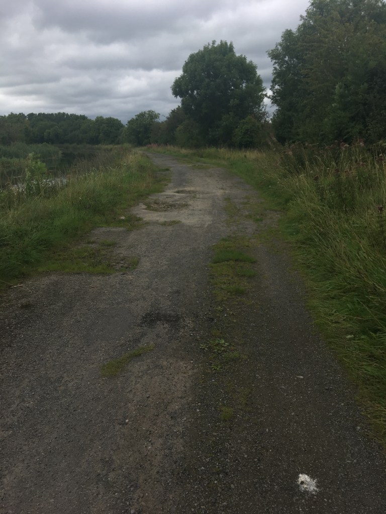
The first 18miles /30km of the run is on a soft stone, tar or road surface. Once past Edenderry runners have a 4 mile /7km stretch on grass as they move towards the 20th Lock at Ticknevin.
Looking east from Bord Na Móna Bridge between Hartley Bridge and Hamilton Bridge
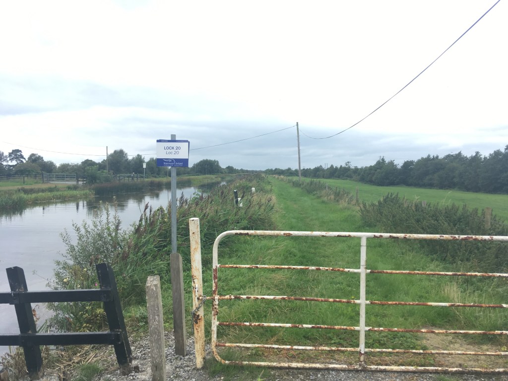
After passing the 20th Lock, it is back to a road surface again and it is a short run to Hartley Bridge at Ticknevin where runners need to be cautious as they cross the road over to the other side while still remaining on the north bank of the canal.
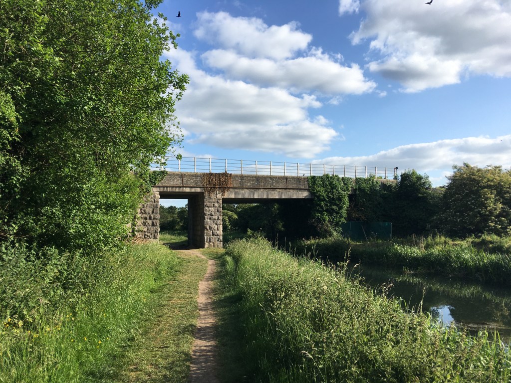
It is another 3km before runners come to Hamilton Bridge where runners need to cross to the south bank of the canal. This is the first time the canal is crossed on the run and comes 25 miles/ 40km into the run.
Hamilton Bridge which must be crossed.
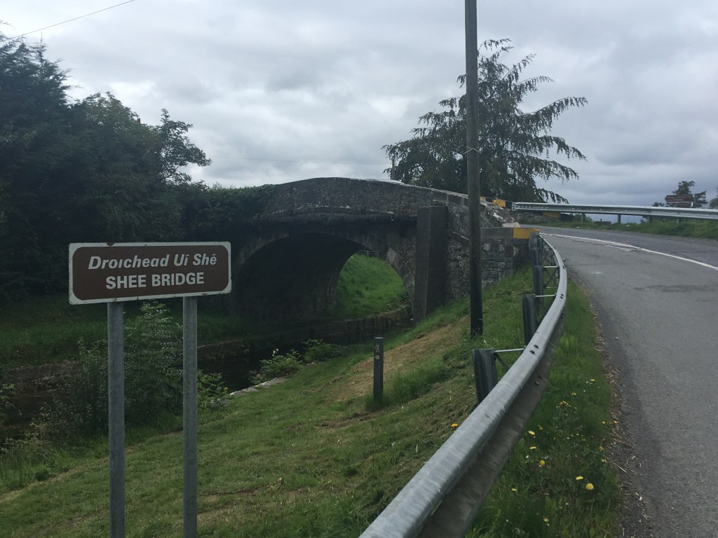
Once on the other side it is just short of 3km before runners reach a gate for a short grass stretch coming into Allenwood. After the short grass stretch, runners come on to a main road approaching Shee or Scow Bridge which they most cross back onto the north bank of the Canal to rejoin the Grand Canal Greenway. This crossing is at 27 miles /45km into the run.
Shee Bridge which must be crossed
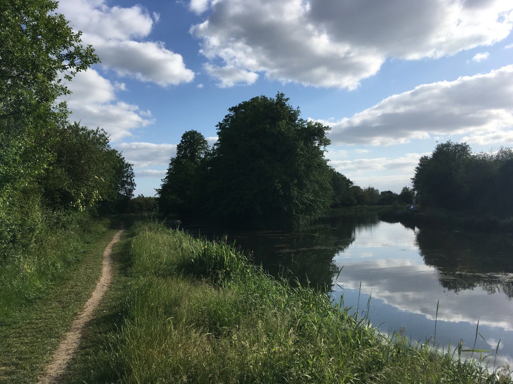
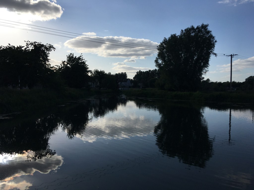
Once back on the north bank it is a straight run in for the last 3 miles towards Robertstown, passing south of Allenwood, by the 19th lock Lowtown and the split for the Barrow Line and finally the last leg towards Binn’s Bridge and Robertstown.
The Barrow Line Race #BLR30 is the first of three events that make up the Irish Canal Ultra Series. The inaugural event will take place on Saturday 21 May 2022 and is now open for entry on Pop Up Races.
28th Lock where the race starts
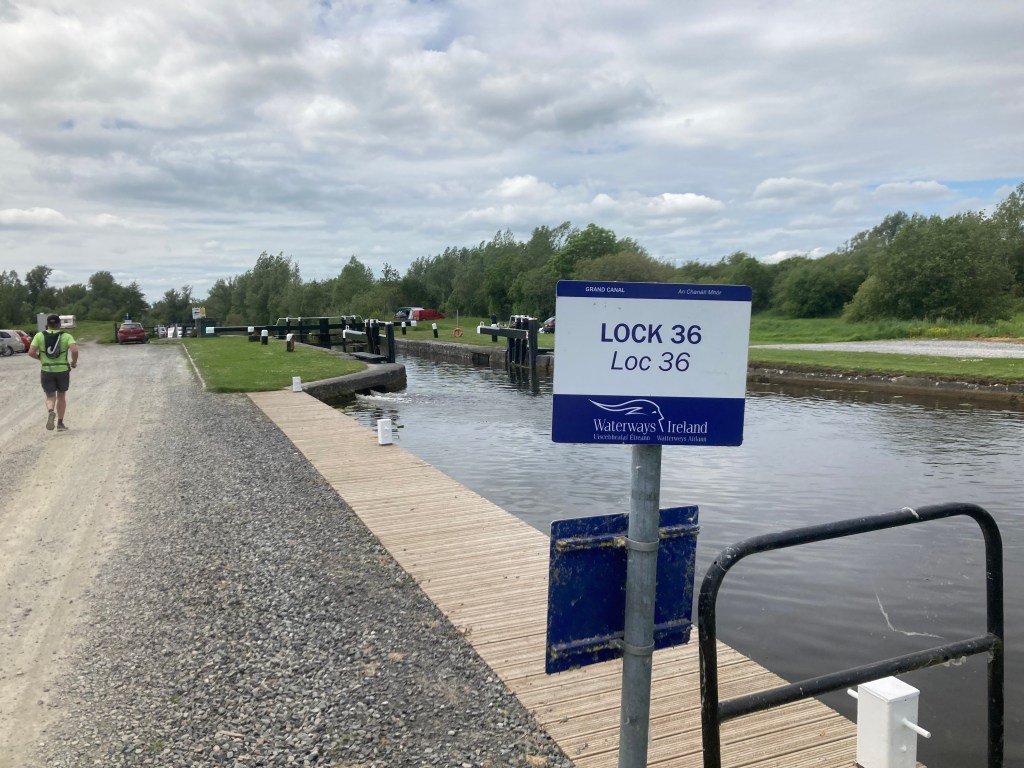
The race follows the path of the Barrow Line of the Grand Canal north for 30 miles from the canal junction with the River Barrow at the 28th Lock in Athy (google maps) to the village of Robertstown (google maps), passing through mostly rural countryside but also the towns of Monasterevin and Rathangan. The route has a total climb of 10 Locks.
The finish at Robertstown
Runners will gather at the finish line in Robertsown before being getting a bus down to the start line in Athy.
Junction of the Barrow Line and the Barrow River, Athy
Considerable work has been done in recent times to improve the path of the canal which now has a compacted smooth stone surface for about 50% of the route but runners should be aware there are several areas where this path is a shared space with local access vehicles and some of the bridges carry main roads that they may need to cross. The rest of the route is made up of grassy trails. The route is easy to navigate and includes only a very small climb over the total distance with long flat stretches between the locks.
It is recommended that runners carry their own supplies for the day but a small number of aid stations will be available at checkpoints along the route.
27th Lock from Augustus Bridge
From the start line runners will climb up past the 27th and 26th Locks as they run through Athy heading north towards Milltown Bridge (google maps) and Castlemitchell GAA Club before passing from County Kildare into County Laois.
Surface after the 26th Lock
It is a 21km stretch before we will meet the 25th Lock just south of Monasterevin which is also the first point at which runners must cross over the canal.
Shared space road approaching Milltown Bridge – Canal is on the right
10km into the run runners will pass over the River Stradbally on the Camac Aqueduct before reaching the small village of Vicarstown.
Stone surface approaching Vicarstown over the Camac Aqueduct
Vicarstown Bridge (google maps) is an ideal location for supporters to meet their runners. It should be noted that Vicarstown is home to a parkrun event which may be on at the same time runners will be passing through the area. Please be mindful and respectful of the runners participating in parkrun.
Vicarstown Bridge
5km further on from Vicarstown runners will come to Fishertown Bridge (google maps) which is another good spot for supporters to cheer on runners.
Fisherstown Bridge
North of Fishertown Bridge runners will pass under the M7 Motorway before re-entering County Kildare on the approach to Monasterevin, the main town on route and just short of the halfway point.
M7 Passing over a shared space road by the canal/
Coming into the town runners must briefly leave the canal bank approaching Clogheen Bridge rising up and crossing over the main road before dropping down to the canal again on the other side.
Approach to Clogheen Bridge is extremely narrow so it is best to divert up and over the main road and back down the other side.
Moore’s Bridge at the 25th Lock in Monasterevin will be the first time runners need to cross over the canal. Some awareness is required going through Monasterevin as it has a maze of waterways including the Barrow Line of the Grand Canal, the now derelict Mountmellick Branch of the Canal and the River Barrow itself.
Looking back at Moore’s Bridge from the 25th Lock
After crossing over the canal, the canal itself crosses over the Barrow Aqueduct and continues north. The Lifting Bridge (google maps) by the Harbour in Monasterevin is another good location for supporters see runners.
Lifting Bridge in Monasterevin
2km north of Monasterevin runners will ascend up past the double chambered 24th Lock at Macartney’s Bridge.
Approaching Macartney’s Bridge – This section is mainly a grass trail along the right handside bank of the canal.
It is then 7km’s of flat ground to the double chambered 23rd Lock at Spencer Bridge on the south side of Rathangan passing Umeras Bridge and Wilson’s Bridge. Once past Wilson’s Bridge it is a solid stone or road surface for the last 15km to the finish.
Wilson’s Bridge between the 24th and 23rd Locks
Rathangan Bridge (google maps) is less than 1km further on.
Rathangan Bridge
There is a Top Garage at the bridge which has a shop for supplies and is another good spot for supporters to see their runners.
22nd Lock at Glenaree Bridge
It is 4km on to the 22nd Lock at Glenaree Bridge (google maps) and a further 5km to the 21st Lock at Ballyteague.
Approaching the 21st Lock at Ballyteague
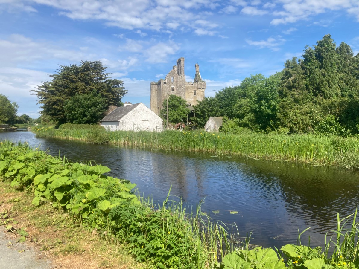
A very short distance separates the 21st and the 20th Lock, both in Ballyteague and after passing the 20th Lock it is necessary to cross the canal over the concrete bridge (google maps) beside the castle.
Ballyteague Castle as seen from the Bridge.
The runners are now on the approach to Lowtown where the Barrow Line divides between the new line on the left and the old line on the right. For the purposes of the race the runners will cross back over the Canal at Ballyteague Bridge (google maps) and follow the old line past the old 19th Lock.
Ballyteague Bridge which carries runners over the New Barrow Line to the Old Line on the right.
A short distance past the old 19th Lock Runners will see the Huband/Greene Bridge over the Milltown Feeder which comes from Pollardstown Fen and is the water source for much of the Grand Canal.
Huband/Greene Bridge on the Old Barrow Line
Caution is needed approaching Littletown Bridge (google maps) beside the Travellers Rest as runners will have to cross a main road as the ascend up the bridge and down the other side.
Littletown Bridge which carries a main road that runners must cross.
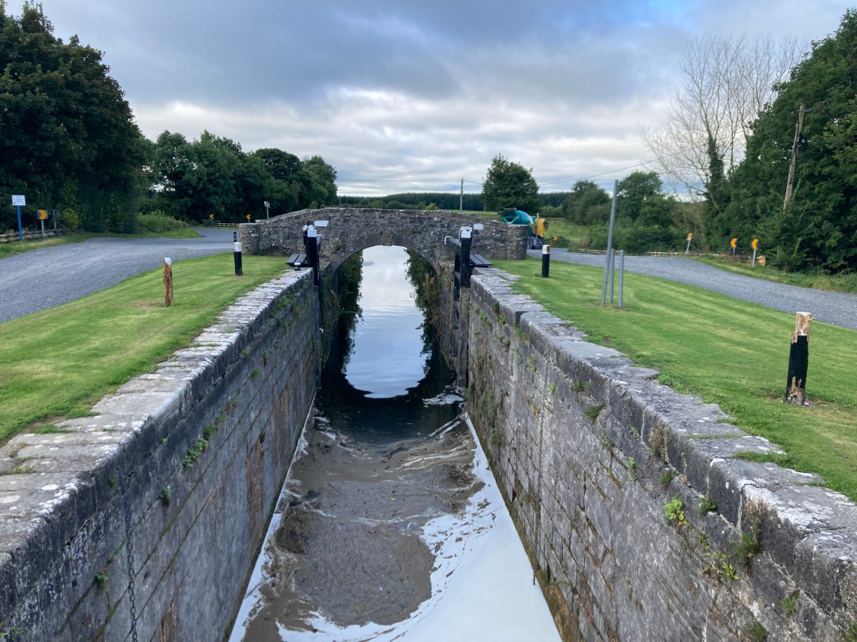
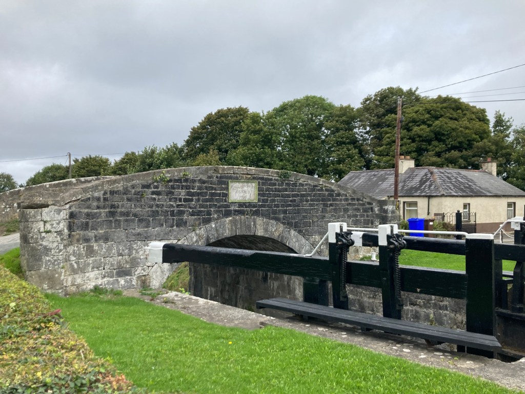
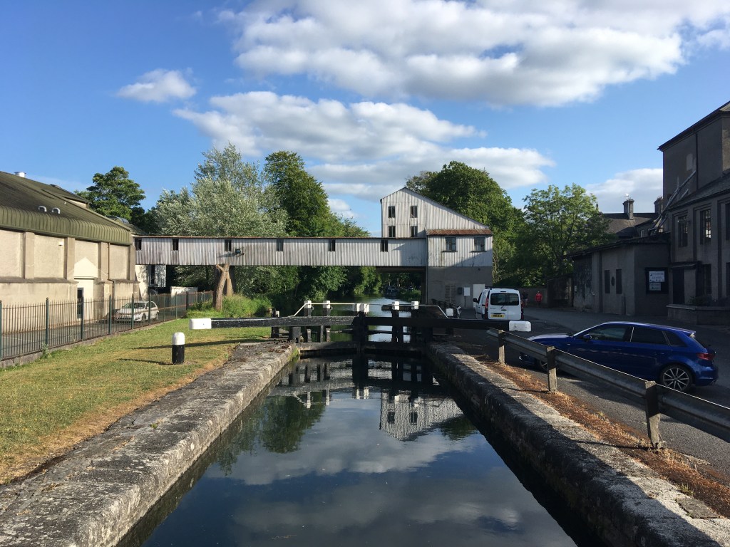
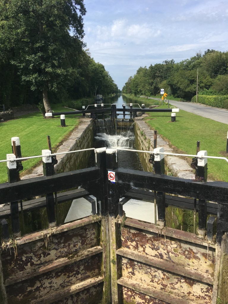
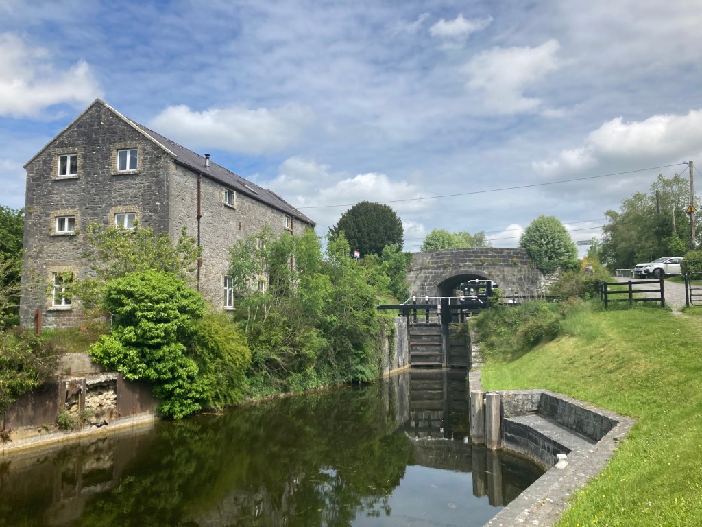
It is 1.4km from Littletown Bridge to the 19th Lock at Lowtown where the Barrow Line meets the Main Line of the Grand Canal. On reaching the 19th Lock Runners cross Fenton Bridge (google maps) turning right for the final approach to Robertstown and the finish line.
Fenton Bridge and the 19th Lock at Lowtown
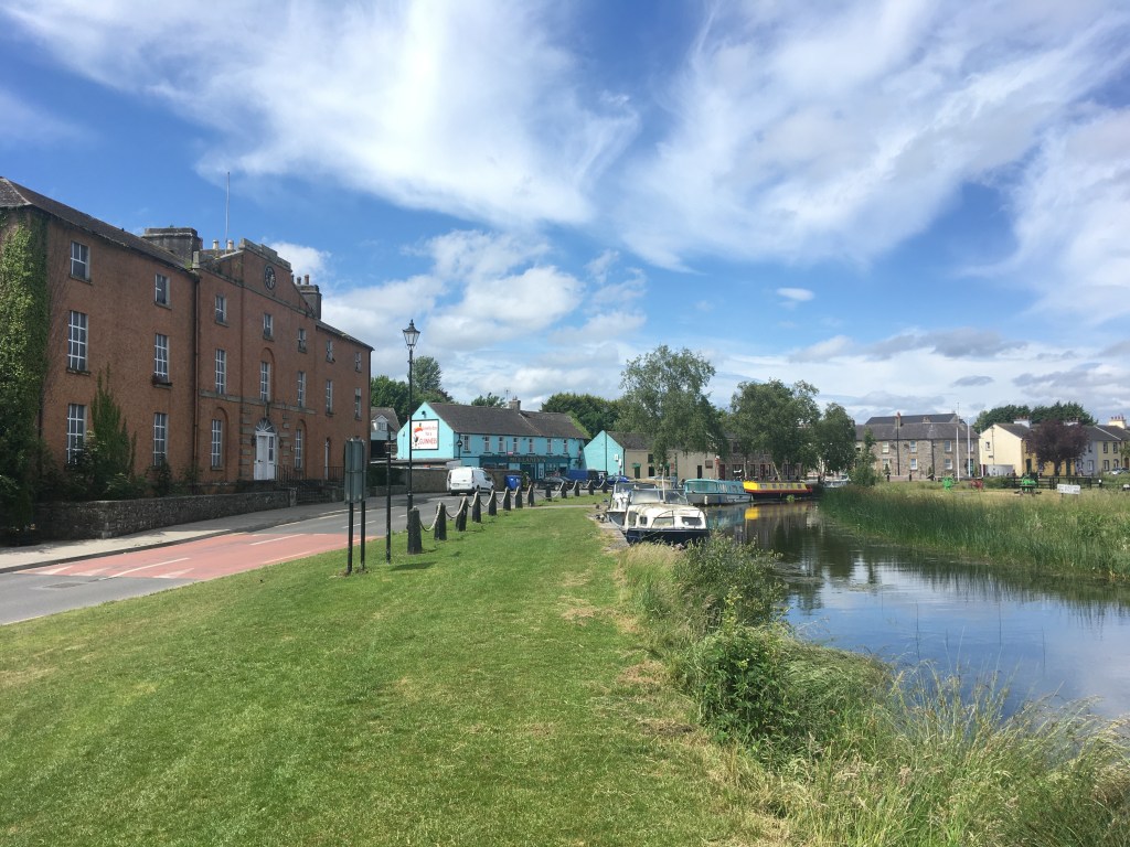
Soup, sambos and coffee will be provided at the finish line by DB Beans. Robertstown is also home to Weld’s, Dowling’s, Mullaney’s Pubs and Robertstown GAA.
The 13km section of the Royal Canal between Hazelhatch and Sallins is a very accessible and enjoyable stretch for walkers, runners and cyclists alike. It can easily reached by taking the short train journey to Hazelhatch Railway Station from Heuston Station in Dublin and then it is possible to get the train back to either Hazelhatch or Heuston from Sallins, both stations only a few minutes walk off the canal. Both Hazelhatch and Sallins also have car parks at the stations if you are travelling by car.
Old Station House at Hazelhatch Train Station
Hazelhatch is located just a little bit outside Celbridge on the Dublin and Kildare border and the canal can be accessed at the narrow Hazelhatch Bridge.
Hazelhatch Bridge looking west
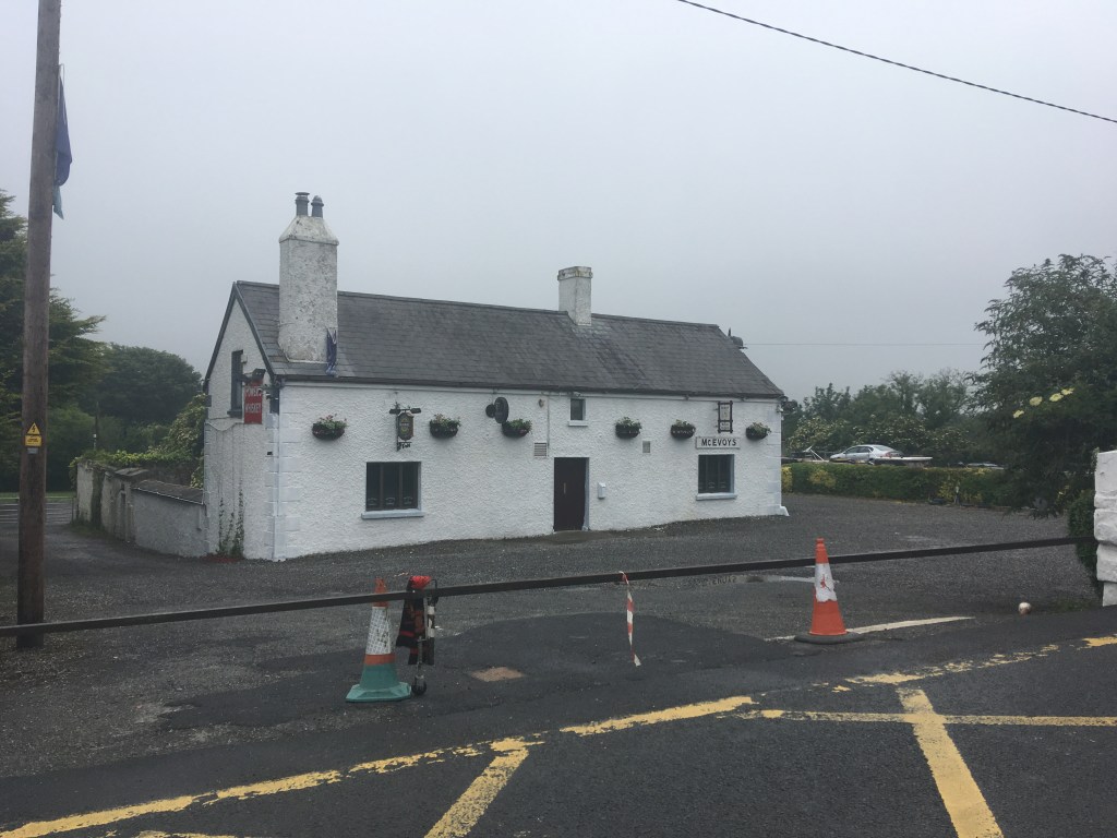
McEvoys pub is also located beside the bridge and is a good place to have a pint to close out an evening or as a place to stop as you pass by on a longer trek.
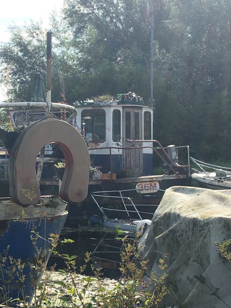
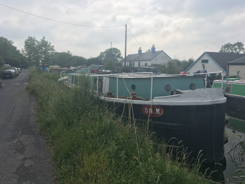
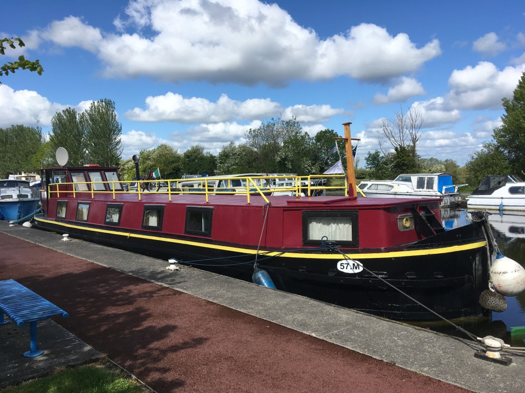
Hazelhatch is home to a good number of boats, many of them live-aboard’s and includes some Heritage Boats like the former Grand Canal Company boats 36M, 42M, 56M and 58M as well as the older Horse Boat No. 1 now known as Misneach.
36M
42M
56M
58M
Misneach
The canal path from Hazelhatch to Sallins is entirely traveled on the south bank of the canal and is of good surface quality for the majority of the route but it is necessary to be mindful of cars for a good part of it also.
Canal Path west of Hazelhatch
About 1.5km west of Hazelhatch you come to Aylmer Bridge named for the Aylmer family of Donadea Demense. The bridge also marks the start of the boundary wall of the Lyons Estate in the area of Lyons Hill which runs alongside the canal for several kilometres.
Aylmer Bridge looking west
1km on from Aylmer Bridge is the double chambered 13th Lock. The 13th Lock lies close to a cemetery just below it on the south leading to the suggestion that the 13th Lock is haunted. There are also stories that the 13th Lock on the Royal is haunted. I have never found out for certain to which one Arthur Griffith’s poem refers.
Lower Chamber of the 13th Lock
Above the 13th Lock lies the Lock Yard including the Pantry. Part of the Cliff at Lyons, it is an ideal place to stop for a snack or take away cake and coffee. The Lock Yard was originally the site of a mill which was built by Valentine Lawless, 2nd Baron Cloncurry who was noted as a canal enthusiast and also served as the Chairman of the Grand Canal Company. The mill was later run by the Shackleton family, related to Antarctic explorer Ernest Shackleton until it burned down in 1903. Botanical artist Lydia Shackleton, the Royal Botanical Garden Dublin’s first artist in residence lived here for several years. After the Cloncurry title became extinct in 1929 the Lyons Estate fell into disrepair and was bought and restored by Ryanair founder Tony Ryan from the mid 1990’s on.
Henry Bridge
Just a little over a kilometre on from the 14th Lock we come to Henry Bridge named for a family from nearby Straffan. Henry Bridge is located in the village of Ardclough, resting place of Arthur Guinness. A small shop is located just north of the bridge past Ardclough GAA club for anyone looking for supplies and the burial place of Arthur Guinness can be visited by travelling south of the bridge for a few minutes. A little further west of the bridge we pass the original Ardclough National School that was build in 1839.
Ardclough National School of 1839
We continue along the narrow road on the south bank for another 2.5km when we reach Ponsonby Bridge. When passing under the bridge you can see that it has been widened on both sides for the road traffic it carries and as a result the original faces of the bridge have been lost.
Ponsonby Bridge
When we emerge on the other side of the bridge we have lost the smooth path and road we have enjoyed from Hazelhatch to this point and enter a more grassy section. Most of the remainder of the distance to Sallins is soft ground. The majority of it is fine for walking and cycling with a hybrid or a mountain bike but a few small sections tend to remain muddy throughout the year.
Canal path west of Ponsonby Bridge
It is a further 2.5km to Devonshire Bridge. This stretch tends to be a lot quieter than the section around Hazelhatch and the Lyons Estate and offers a real rural feel even though we are still well within the commuter belt of Dublin. The railway is not far to the north of the canal and trains can often be heard but unlike the Royal Canal, they are rarely seen.
Devonshire Bridge
The 14th Lock follows shortly after passing under Devonshire Bridge. The original Lock Keeper’s Cottage has been restored and extended as a private residence.
Looking down into the 14th Lock Chamber
It is just over half a kilometre then to the 15th Lock and the remains of it’s Lock Keeper’s Cottage.
15th Lock with remains of the Lock Keeper’s Cottage in the background.
Leaving Dublin, it is noticeable that the Grand Canal follows very long straight lines south west. Not long after passing the 15th Lock the canal takes an obvious turn to the west as it leads towards Sallins. 2km from the lock we are greeted by the Railway Bridge that passes over the canal bringing trains into Sallins from Dublin.
Railway Bridge Crossing the canal before Sallins
It is just over 1km from the railway bridge into Sallins. The canal path narrows here and as it is sheltered it can get quiet mucky for a few hundred metres along this stretch.
Narrow path coming into Sallins
Like Hazelhatch, Sallins is the home to a good many boats and you can even see plenty of post boxes for each of the live aboard’s along the jetty on the east side of Sallins Bridge.
Sallins Bridge
Sallins is where we finish today. The small town just outside Naas has a good selection of take-away’s just off the canal, a Supervalu and even though we are on the 15th level the 13th Lock Gastro and Brew Pub is a great spot to stop for a bite and a few drinks. For those who would like to see the canal as it should be seen it is possible to book a cruise on a barge in Sallins on the blue and white barge in the picture above.
For those who don’t fancy the walk back to Hazelhatch, Sallins Railway Station is only a 3 minute walk off the canal.
Leaving Sallins on the north bank of the Grand Canal we pass a Waterways Ireland service block and like the eastern side of Sallins Bridge there is always a good number of boats found tied up across from the old Odlums mill. It is a 12km journey to Robertstown.
Looking west from Sallins Branch
Not long after we leave Sallins we pass by the remains of an old dry dock on the opposite bank. If you look closely you can see the wall at the entrance of the now filled in dock which is also beside the access point to the tow path for the Naas Branch of the canal.
Wall of the filled in Dry Dock before the Naas Branch
Beyond the dry dock we come to the triangular Soldier’s Island and the junction with the Naas Branch. Past the island we pass under the new bridge that carries the Sallin’s Ring Road over the canal before we reach the Leinster Aqueduct which carries the canal over the River Liffey.
Leinster Aqueduct from the bank of the Liffey
Not far beyond the Leinster Aqueduct we find a rather unique circular stone overflow. The Guide to the Grand Canal refers to it as “the big pot, the little pot, the boolawn and the skillet”. The workings of the overflow are explained by The Helpful Engineer. It is an interesting albeit overgrown feature of the Grand Canal. It would be great to see the overgrowth cut back to see the actual workings of this unusual piece of engineering. The overflow itself would have spilled into a stream behind it that then flows down into the Liffey
The inner basin of the overflow west of the Leinster Aqueduct.
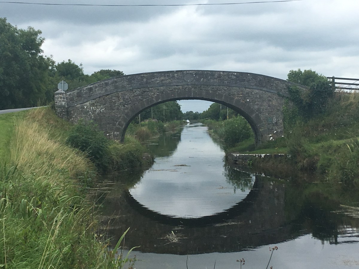
As we round the next corner we come to Digby Bridge and the 16th Lock. This bridge is one of two to bear the name Digby along the Grand Canal. Another can be found just east of Tullamore at the 25th Lock.
Digby Bridge with the 16th Lock behind it.
The canal path turns to grass again when we cross over the road but staying on the north bank of the canal. It is little over 1km to Landenstown Bridge and the 17th Lock. On the opposite side of the canal is the gate into Landenstown Estate which is boasts a Palladian country house and large farm in much need of renovation. Landenstown House was built for the Digby family around 1740. The Digby family who apart from being land owners in Kildare, at one stage also owned the Aran Islands. The house and grounds were owned and farmed by a German man from the 1940’s until the early 2000’s. Yeomanstown Stud purchased the vast property in 2017.
17th Lock Chamber and Landenstown Bridge
After Landenstown Bridge we have just over 1km of road to travel along before we join up again with a grass path as the canal takes a turn away from the road towards the 18th Lock.
Approaching the 18th Lock
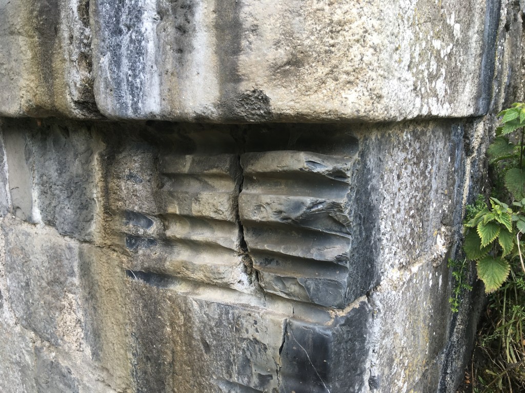
It is 1.5km from the 18th Lock to the Burgh Bridge. It is usually around this stretch that you will hear hear the engines of the cars racing around nearby Mondello Park which lies just 1km south of the Bridge. Burgh Bridge boasts several rope grooves that would have been carved into the stone over the years by horses pulling barges past the bridge, a great reminder of the working past of the canal. It is worth looking out for rope grooves on many canal bridges.
Rope Grooves on the east corner of Burgh Bridge
It is nearly two 2km on the grass bank to Bonynge or Healy’s Bridge. At Healy’s Bridge it is best to come up and cross over to the other side to finish out the last stretch to Robertstown. Standing on top of the bridge you can see where the Blackwater Feeder once entered the canal to the right of the main line towards Robertstown. It once connected an artificial reservoir, Ballinafagh Lake to the canal but was closed in 1952 and is now partly filled in. The lake is now protected as a Special Area of Conservation.
Looking west from Healy’s Bridge
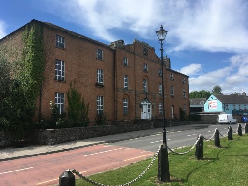
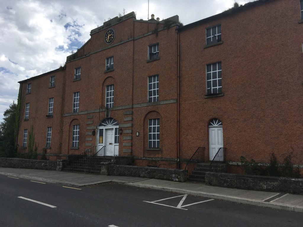
We are now on the final 2km approach to our destination at Robertstown. On reaching Robertstown you are greeted by what was the Grand Canal Hotel. A splendid hotel in the early life of the canal the hotel later became an RIC Barracks and also served as a community centre. Currently unused one can only hope it will find new life and not fall into dereliction much like the similar looking Grand Canal Hotel in Shannon Harbour.
Former Grand Canal Hotel
You will generally find several boats in Robertstown Harbour and there are several pubs, shops and a cafe in the village to stock up or get a feed. Robertstown Community Amenities Association are currently in the process of trying to restore Heritage Boat 52M. An outboard engine was fitted during the summer of 2019 and the barge made its own way down the canal to Shannon Harbour for an inspection to take place. I finish this section at Binn’s Bridge.
I am taking a break today from the Royal Canal to instead look at the short branch off the Grand Canal to Naas town. Since the start of the Covid-19 Pandemic I have been confined to Maynooth and areas on the Royal Canal which I have already covered but when restrictions eased briefly I saw it as the perfect time to take a look at a branch of the Royal’s southerly competitor.
Soldier’s Island at the split between the Main Line (R) and Naas Branch (L)
From where the canal branches off the Main Line of the Grand Canal at Soldier’s Island it is less than 3.5km to the Harbour in Naas itself. However for the assistance of those who wish to follow this route it is best that we start a little further back at Sallins Bridge where it is necessary to come off the Grand Canal and through a warren of estates to join the Naas Branch on the south bank of the Grand Canal rather than follow the Main Line out on the north bank.
View from Sallins Bridge looking west. As you cannot follow the bank on the left to the Naas Branch it is necessary to divert through the Oberstown Housing Estates.
If you come to Sallins along the Grand Canal towpath from Dublin you come into the village on the south bank along Church Avenue. To get to the Naas Branch you must come up to the bridge level and take a left down to the entrance of Oberstown Court on your right (before the road rises over the railway). Follow the road the whole way down Oberstown Court to Sallins Wharf following it around until you come to a large green space. Cross over the green space in front of the Sallins Pier houses to the line of trees by the canal. If you follow these line of trees down you will find a break through which you can access the towpath that will lead you to the Naas Branch.
Entrance of filled in Dry Dock
As you pass through the trees you are passing over the remains of a filled in Dry Dock of the Grand Canal Company. Little seems to be known about this dry dock and what little information I can find is best described on the Irish Waterways History website here.
Stonework on the corner of the Dry Dock
Following the canal around to the left you will see the split with the main line and the triangular shaped Soldier’s Island. The Naas Branch was originally independently built by The County of Kildare Canal Company and was overseen by engineer William Chapman who was renowned for his use of Skew Bridges. The Naas Branch had three but these were later modified to give more headroom. Started in 1786/7 it was originally envisioned that the branch would go down to Kilcullen and possibly even as far as Baltinglass however the company did not survive long and was acquired by the Grand Canal Company by 1807/8. The Grand Canal Company extended the line as far as Corbally by 1810 and that is as far as it ever got.
Railway Bridge at the start of the branch.
At the start of the branch we immediately pass under the Great Southern and Western Railway Bridge as we head south towards Oberstown Bridge and the first lock N1. There are a total of 5 Locks on the Naas Branch rising all the way up from the main line to Naas Harbour. Leaving the towpath, we cross over Oberstown Bridge and join the road that will bring us almost the whole way into Naas.
Osberstown (Oberstown) Bridge
The Naas Branch was one of the first sections of the Irish Canal systems to see a completed restoration. New lock gates were made for the Naas Branch in Watling Street in the mid 1980’s where the Royal Canal Amenity Group had already been making new gates for many of the locks on the Royal Canal. This restoration work was undertaken by volunteer work parties of the Inland Waterways Association of Ireland, the Office of Public Works along with FÁS trainees and was completed in May 1987.
N1 Lock at Osberstown Bridge
A little further down the canal we first pass under the M7 Motorway before passing under the Millennium Park Link Road. We then come to the second lock N2 at the Old Odlum’s Mill which closed in 1989 after nearly 200 years in operation. The Mill structures span both sides of the canal. The mill opened as the Leinster Mills in 1790 only a year after the branch itself opened. An article from the Leinster Leader about the closure of the Mill can be found here. Both the Mill and the Mill House were listed for sale in 2019.
N2 Lock at Leinster (Odlums) Mill
It is 800 m from the Mill to the third lock, Burgh’s Lock N3 and a short distance further we come to Tandy’s Bridge.
Tandy’s Bridge (Note support wall under arch)
Staying on the western bank we come up to the fourth lock N4 and across on the east bank we can see the remains of the old Naas Gas Works. It is clear that the canal had a profound effect on the industrial development of Naas with such sites as this and the Mill built along its banks not to mention the market trade the canal would have brought to the town.
Old Naas Gas Works
We then come to the fifth and last lock N5 on the branch about 600m short of the harbour itself.
N5 Lock
Between Lock N5 and the harbour is Abbey Bridge also known as Finlay Bridge which we rise up and cross over to the east bank to bring us into the Naas Harbour.
Old Harbour Store (Now a youth centre) Note CIE marked crane in the centre.
Naas Market House
Just off the harbour you can also see the start of the Corbally Branch that while disused is still in water as it provides the feeder for the Naas Branch. See below link to carry on your journey to Corbally Harbour.
Although long closed to navigation by boats the stretch of the Grand Canal from Naas Harbour to Corbally Harbour offers the walker and runner a fine route of just over 8km on which to travel, almost all of which is expansive countryside, ideal for those looking to escape the urban landscape of Naas.
Looking towards the Corbally Extension from Naas Harbour
The Corbally extension has been closed to navigation since the building of the Newbridge Road at canal level in 1954, the line remains in water as a the water source for the Naas Branch comes into the system at Corbally Harbour and flows the whole way down the the main line at Soldier’s Island.
Water Source for the Naas Branch at Corbally Harbour
Built between 1808 and 1810, the Grand Canal Company contracted the Civil Engineering firm of Henry, Mullins & McMahon to construct the extension as well as restoring and adapting some of the Naas Branch after the collapse of the County of Kildare Canal Company. This would be the first job for the firm that also went on to finish the Royal Canal from Coolnahay to Richmond Harbour as well as building the Ballinasloe and Mountmellick Branches of the Grand Canal. While John Killaly did survey a route through Kilcullen and Baltinglas, plans to extend the line beyond Corbally were abandoned.
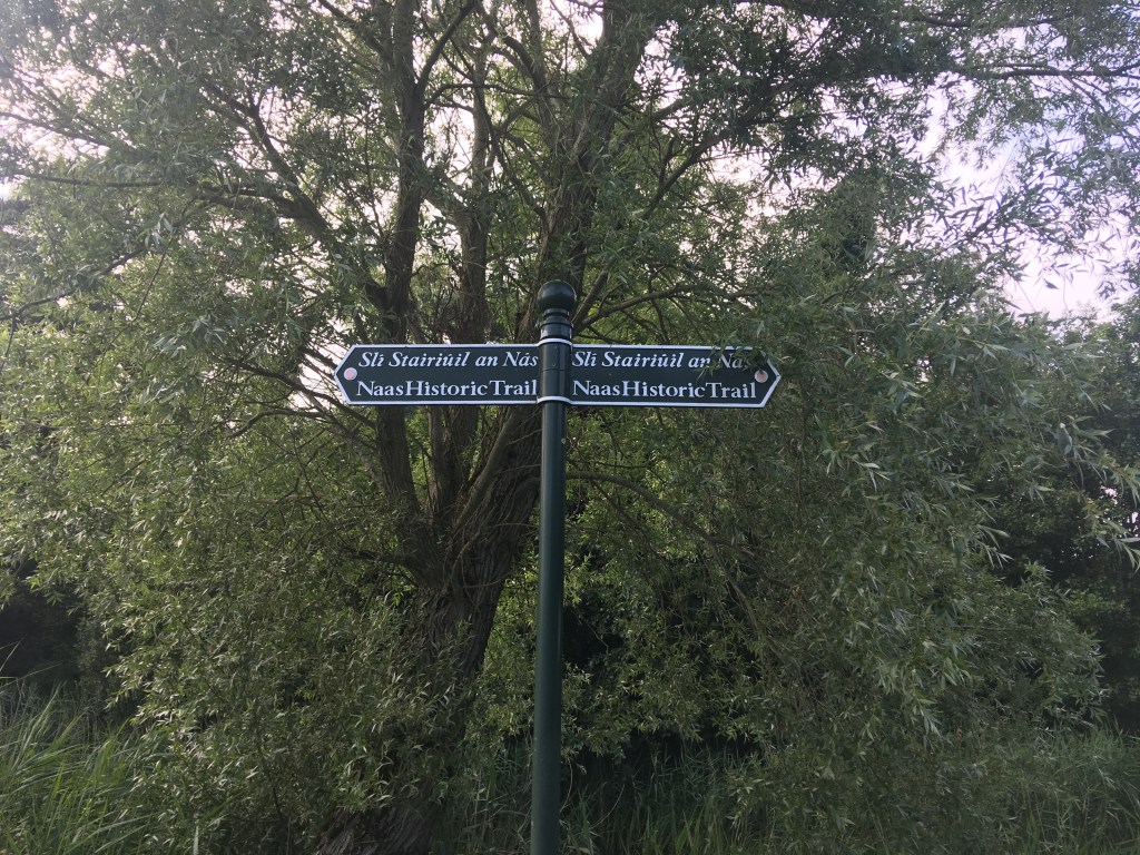
Signs for the Naas Historic Trail. You can follow these for the first part of the extension from Naas Harbour to Jigginstown Bridge
Passing the Naas Community Library as you leave the Naas Harbour on the south bank you follow the path through Sarto Park to a tree lined trail on the bank and on to Ploopluck Bridge.
Ploopluck Bridge
Continuing west and skirting behind several housing estates you then pass under the more modern Caragh Road Bridge which carries traffic high over the canal.
Canal and Naas Historic Trail passing under the Caragh Road Bridge
It is only a short distance from the Caragh Road Bridge to Jigginstown Bridge (may also be known as Terry Bridge) which now acts as pedestrian access to Naas Sports Centre on the opposite side of the canal.
Sun setting on Jigginstown Bridge
It is necessary to leave the canal at the bridge and move up to the main Newbridge Road and the ruins of Jigginstown House. When this road was built over the canal in the 1950’s it was decided to use a culvert instead of a bridge, therefore sealing the fate of the line as closed to navigation.
Corbally extension meeting the Newbridge Road
We leave the canal as we cross the road and travel on down Jigginstown Green. The canal passes behind several house before we rejoin it about 500m later at Limerick Bridge.
Limerick Bridge
Staying on the south bank of the canal we proceed on west as the canal takes a turn south, now walking on a grassy trail and leaving behind the urban neighbourhoods of Naas. I did this section in mid-summer after a prolonged dry spell so the surface was ideal for me but many have warned me that this area can be overgrown and wet in winter so a good pair of trail runners or boots is advised. It is nearly a 2km stretch before we reach the next landmark of Connaught Bridge.
Connaught Bridge
When you get to Connaught Bridge you must first pass under it before coming up to cross over it and descend down on the other side to what has now become the west bank of the canal. From here on in, we will meet several gates along the path. It is important to be mindful to close the gates behind us as we pass through them as there are free roaming cattle in the fields along the canal. That being the case it is also important to be mindful of where you step!
Canal path after Connaught Bridge
It is 2km from Connaught Bridge along the trail before your come to a canal spillway just before the The Cowhouse at Williow Cottage. From here you are briefly back on a hard surface to Hoare Bridge.
Looking back at Hoare Bridge from Corbally side. The bridge has lost its original features after being widened for traffic on both sides.
It is easier to come up to the road level and back down on the other side at Hoare’s Bridge rather than squeeze through the overgrowth under the bridge. We have a good surface for a short while as we pass along some houses and driveways but before long we are back on the grassy and on a wet day, muddy trail towards Corbally Harbour.
Canal Path between Hoare’s Bridge and Mooney’s Bridge
1km further on from Hoare’s bridge you come to the remains of Mooney’s Bridge. A low level flat accommodation bridge has been built alongside the humpback Mooney’s bridge to allow farmers access to both sides of the canal. Sadly a good part of the wall of Mooney’s Bridge has fallen away on one side.
Looking across Mooney’s Bridge with the flat bridge visible on the left.
From Mooney’s Bridge it is less than 1km to the end of the line at Corbally Harbour and the water source for the Naas Branch. The harbour itself is slightly overgrown but the harbour walls are still visible as are the remains of the harbour stores on the opposite bank.
Looking across Corbally Harbour at the old Harbour Building.
The Corbally Extension is a hidden gem of a route well worth exploring when out by Naas on the Grand Canal. Unfortunately it must be said that it does finish in an area with little around it so it advisable to bring a picnic with you on your walk as you will need to make the return trip to Naas back the way you came.
Like the Royal Canal, following the Grand Canal is a pleasurable experience be it walking, running or cycling but knowing which side of the canal you should be on at any given time can be a tricky one. The last thing you need when you have some distance in your legs is to find out you’ve hit a dead end or worse still on the Grand Canal taken the wrong branch and ending up in Naas when you thought you were on your way to Robertstown.
This post is a quick reference guide for those who want to follow the Main Line Branch from the Sea Locks at the Liffey to Shannon Harbour.
Note: This post only goes as far as Downshire Bridge where the Edenderry Branch splits from the Main Line. There is a link at the bottom of the page which links to a post covering Edenderry to Tullamore and another that looks at the Naas Branch.. I will add additional posts as I complete the rest of the route and hopefully I will add in the Barrow Way as separate posts in the future.
This post will also give an indication of the surface types you can expect as you travel. I ran the first 65km of this route over two dry August days so the trail parts were for the most part dry and the grass well maintained however I can imagine that a lot of the route could be a quagmire in winter months and would recommend you keep this in mind. A runner or walker who doesn’t mind getting muddy should have no concerns covering the route and a cyclist on a mountain bike would have no issues, personally I wouldn’t recommend taking a road bike on the route.
The Grand Canal has a few twists and turns but for the most part it runs East to West so regardless of its turns I will indicate if you should be on the North or South Banks based on the overall direction of the canal.
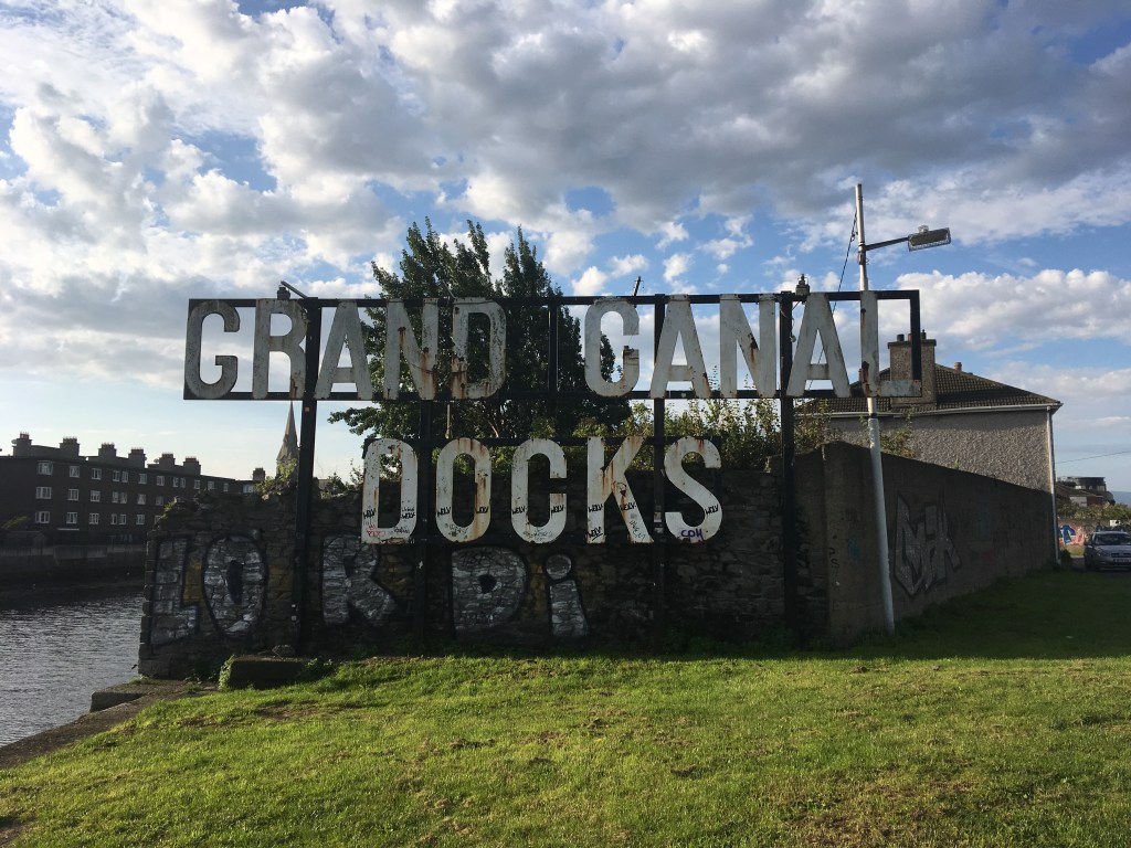
Grand Canal Docks sign facing the Liffey between the Dodder and the Sea Locks
Leaving the Sea Lock we follow the Canal around Grand Canal Dock on the North Bank. A few buildings will separate you from the canal briefly as you cross Pearse Street, go under the railway line and come back out at Grand Canal Street at the C1 Lock. From there you follow the Circular Line up past Locks C1 to C7 as far as Robert Emmet Bridge at Clanbrassil Street. This is a distance of approximately 4.2km.
Statue of Patrick Kavanagh on the Circular Line
Crossing Robert Emmet Bridge to the South bank we now have a long stretch of paths from here up to the Main Line Junction just after Griffith Bridge at Suir Road (where the LUAS now goes along the original path of the Main Line).
Works to fix a breach after the 1st Lock in Inchicore
The path then continues all the way out to the 12th Lock at Lucan. This is a total distance of 13.8km including the Grand Canal Way Green route from the 3rd Lock to the 12th Lock. A bit of caution is needed at the start of this section as you will have to cross over several busy roads.
The 12th Lock at Lucan Road Bridge
At the 12th Lock we must cross Lucan Road Bridge back onto the North Bank and we encounter our first bit of trail. This section of trail can be mucky in winter but was totally fine for me on a dry August day. This section of grassy trail extends for 4.6km out to Hazelhatch where you might get to see some of the original Grand Canal Company M boats tied up.
Hazelhatch Bridge
Information about many of these boats can be found on the Heritage Boat Association website which I link to were I mention any of the Heritage Boats I come across. For those with a real interest in the history of these boats I highly recommend the Associations Clear Water books series which can be bought from their website here.
At Hazelhatch you cross over the bridge (mind the traffic lights) and are back on the South Bank where you are welcomed by a a solid path for 6.4km taking you by Lyons Estate as far as Ponsonby Bridge.
The trail heading west from Ponsonby Bridge
It is possible to go under Ponsonby Bridge but as you emerge on the other side you are back onto a trail path, still on the South Bank of the canal. This continues for 6.2km the whole way to Sallins however you should note the roughest section of the trail is between the Railway Bridge and Sallins town and I would imagine this sheltered section becomes a tough, muddier trail after a few days of rain regardless of the time of year.
View from Sallins Bridge looking west.
When you reach Sallins Bridge you must cross again over to the North Bank. It’s a busy bridge so it’s worth using the pedestrian lights on your left as you approach the bridge. (Staying on the South Bank will lead you via a warren of housing estates to the Naas Branch which I will cover another day).
River Liffey from the Leinster Aqueduct
The North Bank has a road to take you out west of Sallins to the Leinster Aqueduct and the road lasts for some 800m past the Aqueduct giving a distance of 2.6km of solid ground.
Path over the Leinster Aqueduct before it turns into trail.
You stay on the North Bank when you meet the trail and it takes you along for 2.4km as far as the 17th Lock at Landenstown Bridge.
17th Lock from Landenstown Bridge
Staying on the North Bank at the 17th Lock you join a busy road for 1.2km. After this distance the road and the canal part ways and you are back on a grassy trail.
This grassy trail continues on the North Bank for 3.2km as far as Bonygne or Healy’s Bridge.
Bonynge or Healy’s Bridge looking west.
You must come up onto the road and cross the bridge back over to the South Bank and the grassy trail continues for 2.2km as far as Binn’s Bridge in Robertstown.
Finally, crossing over Binn’s Bridge back onto the North Bank you follow the road for 1.4 km and the 19th Lock at Lowtown.
Binn’s Bridge, Robertstown
When you reach the 19th Lock at Lowtown you are at the end of the Summit Level. Just after the Lock is Fenton Bridge which if you cross will bring you onto the Barrow Way but for our purposes we stay on the solid path on the North Side of the Canal and continue on towards Allenwood.
19th Lock with Fenton Bridge in the background.
As we continue west we pass the Barrow Way navigation as it splits with the Main Line and heads south towards Athy. The path on the North Bank remains good all the way up to Bond Bridge in Allenwood, a distance of 1.8km.
Bond Bridge Looking East
After passing under Bond Bridge and remaining on the North Bank we come to a grassy trail for the short distance up the Shee Bridge. It is only 1.4km between the bridges. At Shee Bridge we must cross over to the South Bank. The main road to Rathagan goes over this narrow bridge and we must go along the road for 200m before we enter a grassy stretch of 650m along the canal bank.
Shee Bridge west of Allenwood which we must cross to the South Bank.
Emerging from the grassy section which some know as Allenwoods Millennium Park we rejoin a country road which takes us all the way up to Hamilton Bridge on the South Bank, a distance of 2.4km. At Hamilton Bridge we cross back over to the North Bank again where we will remain for the considerable future distance.
Hamilton Bridge Looking West.
After Hamilton Bridge we are on a mix of road and rough path all the way to the the 20th Lock. There is no risk of mud here but with many potholes it would be easy to see puddles building up and trip hazards for walkers and runners as well as a chance of getting a puncture for cyclists. It is a total distance of 4.2km from Hamilton Bridge to the 20th Lock.
Picture of the surface between Hamilton Bridge and the 20th Lock.
After passing the 20th Lock we are back on a grassy trail for the remainder of the distance to the Edenderry Branch but at least we don’t have to worry about crossing sides again. It is a distance of 6.4km to Downshire Bridge which is a narrow bridge that crosses over the Edenderry Branch adjacent to the main line.
The grassy trail from the 20th Lock to Downshire Bridge
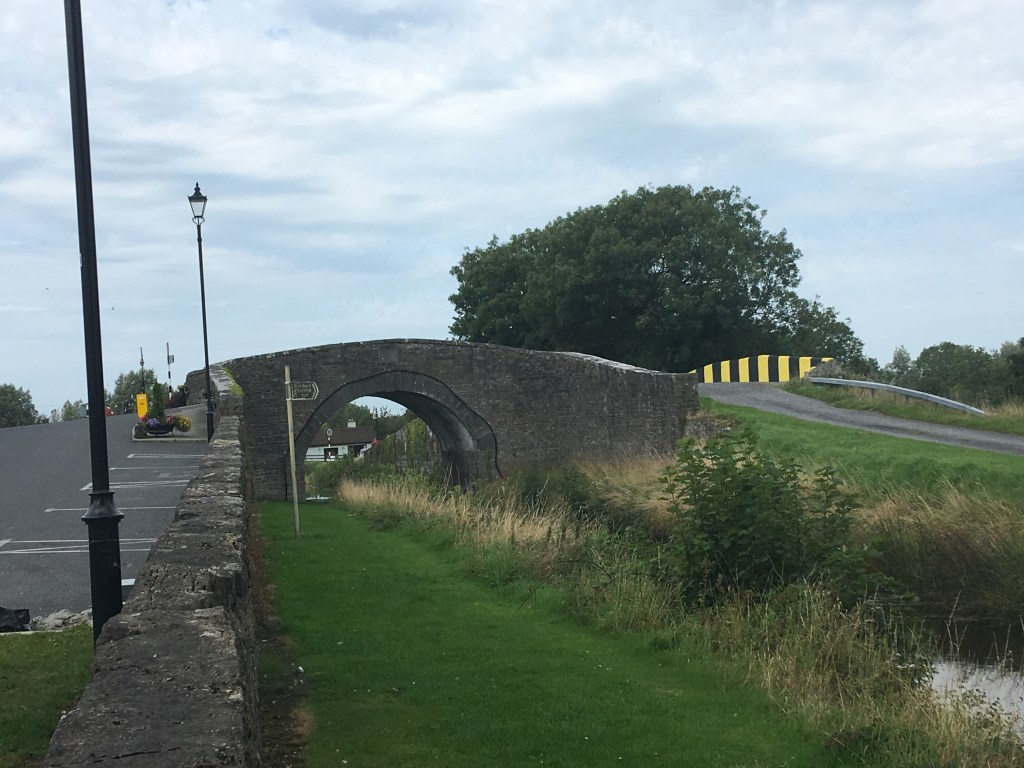
Downshire Bridge is 63.8km from where we started at the Sea Lock. From here it is possible to take a path for 1.6km into Edenderry Harbour if you wanted to stop for a snack. This is where I stopped for now.
Downshire Bridge looking out towards the Main Line from the Edenderry Branch.
When I originally set up this website, the main reason behind it was to provide a place to post a run report for my Fastest Known Time attempt on the Royal Canal. In preparation for that I fell down a rabbit hole of information about the Royal Canal and came out an Irish Inland Waterways enthusiast. So not long after finishing the run I set about writing section-by-section guides to the Royal Canal with the intention of doing the same for the Grand Canal.
Tullamore Bonded Whiskey Warehouse – Home of the Tullamore D.E.W. Visitor Centre (due to move to the new Distillery in 2021)
I managed to post up two descriptive guides in Autumn 2019 detailing what side of the canal to be on and what type of surface those travelling the Grand Canal Way can expect, the first being Grand Canal Docks to the Edenderry Branch and the other from Edenderry Branch to Tullamore. Unfortunately it took a lot longer than planned to finally cover the last section from Tullamore to Shannon Harbour where the Grand Canal meets the River Shannon. I will soon be posting a far more descriptive piece about this area but for those looking for a quick guide for the last 36km of the Main Line please read on.
Cox’s Bridge on the western edge of Tullamore
We start where I finished in my last post on the north bank of the Grand Canal at Kilbeggan Bridge in the centre of Tullamore. Moving along the path for 400m, passing the old bonded warehouse on the opposite bank, we come to Cox’s Bridge and the 27th Lock.
From here there is a dedicated Greenway with a smooth surface for 3.5km continuing on the north bank as far out as Ballycowan Bridge and the 29th Lock.
29th Lock and Ballycowan Bridge
We must cross over Ballycowan Bridge to the south bank but the good news is that this is the last time we are required to cross the canal and the we remain on the south bank for the last 31km to the River Shannon.
The surface after crossing Ballycowan Bridge to the south bank remains smooth but is more similar to the dust covering of the Royal Canal Greenway rather than tarmac which has we had for several kilometres either side of Tullamore.
Surface passing under Becan’s Bridge, Rahan
Once you leave Tullamore, you truly enter a wonderful rural green corridor along the canal with few places to stop for supplies. The first opportunity is at Rahan, about 8km west of Tullamore.
It is important to be mindful however, that the Grand Canal Way can be a shared space and a road like surface is likely a sign that it is to allow for local access to houses and farms along the canal so don’t be surprised if you see the occasional car or tractor and be aware that one may come up behind you.
Pollagh Church beside Plunkett Bridge
Probably the most accessible rest stop and conveniently located halfway between Tullamore and Shannon Harbour is The Pull Inn in Pollagh. The pub can be reached by crossing over Plunkett Bridge by the church and coming back on yourself on the north bank.
Bord Na Móna Light Railway Swivel Bridge over the canal
With Pollagh behind the next landmark is the old Bord Na Móna Light Railway Swivel Bridge, 4km on, the railway runs to the now closed West Offaly Power Station at Shannonbridge. These railways criss cross the bogs of Ireland and while the turf burning stations are mostly finished producing energy, many of the railways remain. Just before reaching the swivel bridge the Offaly Way joins the Grand Canal Way coming from Lough Boora Discovery Park to the south.
Derry Bridge
The surface becomes softer the further west you go, not long after the swivel bridge we come to Derry Bridge where the surface is a decent soft stone, ideal for running or cycling on, but with grass growing in the middle. I would recommend anyone cycling west of this point though to have at least a durable tire and spare tube and a mountain bike would be best.
Grass surface at Macartney Aqueduct
Not long after Derry Bridge, the surface turns to a grass trail. I undertook my trip on the June Bank Holiday weekend when the ground was dry and was recently cut so it is maintained and pleasant to travel on. The grass continues for several kilometres as we move towards Belmont.
Passing the wonderful built heritage at Belmont we return to a hardened surface for the remaining 6km to the 36th Lock at Shannon Harbour. On the way we descend down the 34th Lock and before long are greeted by the sight of leisure boats moored up before the village. If you look closely you may even come across an original trading boat of the Grand Canal Company, often denoted by a number and the letter ‘M’ (Motor), though occasionally you will also see an ‘E’ (Engineering) or ‘B’ (Bye-trader). These boats make up a large number of the Heritage Boat Fleet.
So ever since I completed my Royal Canal Run I’ve felt like a barge without a rudder, stuck up out of the water and unable to go anywhere.
It would be wrong to say that I didn’t need the rest, a holiday and some time to recover. Aching joints demanded it and I think it took a while for me to realize I needed to increase my food intake to promote recovery.
That said in the last few days I’ve accepted that my recent stress levels haven’t been helped by my lack of having a normal adherence to a plan, to having a goal to strive for.
After achieving two major goals (100 Marathons and The Royal Canal Run) within 3 weeks of each other I really have had nothing to focus on since the end of June.
Financial realities and some other travel commitments next year really mean I have to take my eyes off the big ticket items I want to shoot for so I need to look for something closer to home.
So given I’ve ran the Royal Canal I guess it makes perfect sense to go for the double, look south and go for the Grand Canal.
Some would say the Grand Canal should be that bit easier as it is several miles shorter than the Royal. However the quality of the towpath on the Grand Canal is considerably less than that of the Royal so I expect it may actually be tougher.
I don’t think I will put in the same level of research into running the Grand as I did the Royal. Living by the Royal I was fascinated by its history (and misfortune) and the dogged persistence of those involved in bringing it back from desolation to the thriving Greenway and navigable inland waterway it is now.
There’s no denying that the Grand Canal was the more successful of the pair and with the great fleet of barges that once worked it has a deep and detailed history but for now my focus is going to be on just running it from Camden Lock at the Liffey to where it meets the Shannon just west of Shannon Harbour.
My first task will be to get my distance legs back. Up until today my next planned distance event was to be the Dublin Marathon but I am eager to get started and to also move on from being able to say “I’ve ran 100 marathons” to being able to say “I’ve ran more than 100 marathons”.
So I have signed up for the East of Ireland Marathon in Tirmoghan on the 31st of August to get me motivated. From there I will need to start recceing the route, breaking it down into sections so I can build up a map and find out what I’m letting myself in for. This was one of the more enjoyable parts of the logistics of running the Royal Canal, albeit it was easier as the adjacent train line made it easier to get to and from my start and finish points.
This time I won’t be limiting myself by starting at midnight and trying to run it inside a single day, nor will I tie myself to doing it on the summer solstice and a weekday. It will be my intention to declare a Fastest Known Time route and it will be my intention to record an FKT on the route but this time I will keep things a little simpler.
So let the research begin, let the training plan come together and should anyone fancy a long slow run along the banks of the Grand Canal give me a shout. I hope to bring this altogether over the winter for a run in late spring.