
Leaving Sallins on the north bank of the Grand Canal we pass a Waterways Ireland service block and like the eastern side of Sallins Bridge there is always a good number of boats found tied up across from the old Odlums mill. It is a 12km journey to Robertstown.
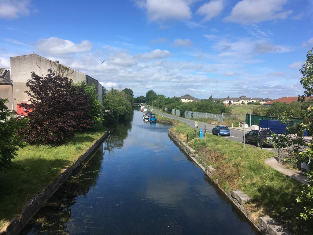
Not long after we leave Sallins we pass by the remains of an old dry dock on the opposite bank. If you look closely you can see the wall at the entrance of the now filled in dock which is also beside the access point to the tow path for the Naas Branch of the canal.

Beyond the dry dock we come to the triangular Soldier’s Island and the junction with the Naas Branch. Past the island we pass under the new bridge that carries the Sallin’s Ring Road over the canal before we reach the Leinster Aqueduct which carries the canal over the River Liffey.

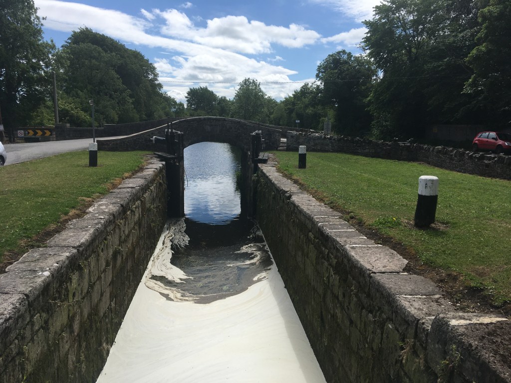
Not far beyond the Leinster Aqueduct we find a rather unique circular stone overflow. The Guide to the Grand Canal refers to it as “the big pot, the little pot, the boolawn and the skillet”. The workings of the overflow are explained by The Helpful Engineer. It is an interesting albeit overgrown feature of the Grand Canal. It would be great to see the overgrowth cut back to see the actual workings of this unusual piece of engineering. The overflow itself would have spilled into a stream behind it that then flows down into the Liffey

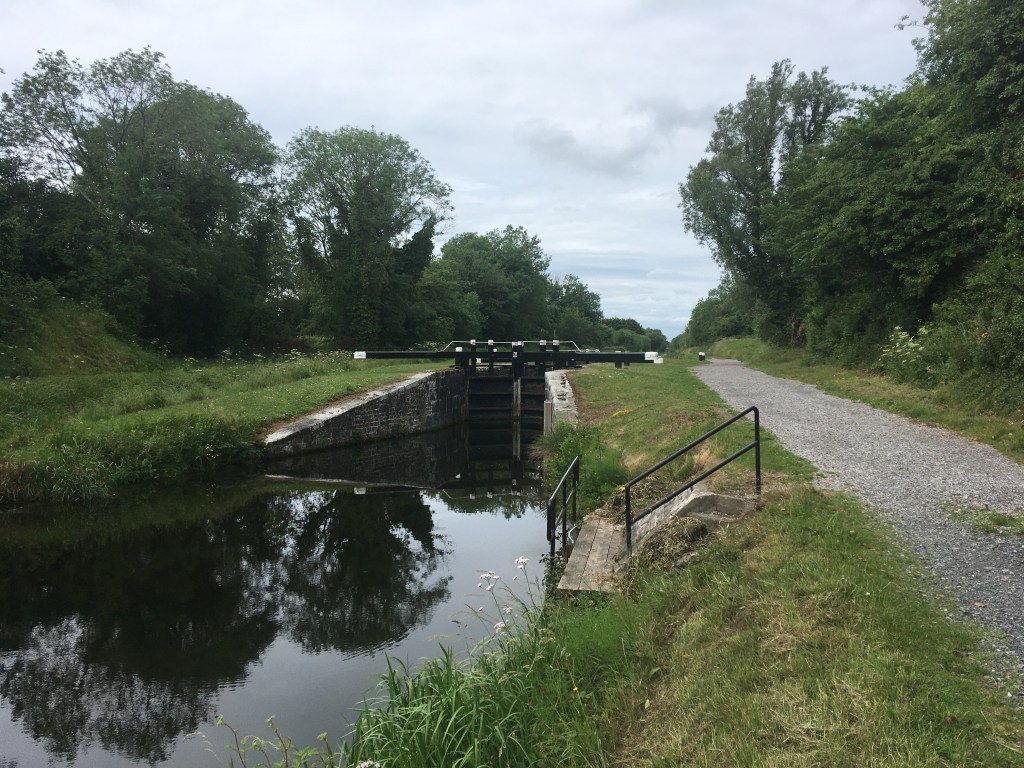
As we round the next corner we come to Digby Bridge and the 16th Lock. This bridge is one of two to bear the name Digby along the Grand Canal. Another can be found just east of Tullamore at the 25th Lock.

The canal path turns to grass again when we cross over the road but staying on the north bank of the canal. It is little over 1km to Landenstown Bridge and the 17th Lock. On the opposite side of the canal is the gate into Landenstown Estate which is boasts a Palladian country house and large farm in much need of renovation. Landenstown House was built for the Digby family around 1740. The Digby family who apart from being land owners in Kildare, at one stage also owned the Aran Islands. The house and grounds were owned and farmed by a German man from the 1940’s until the early 2000’s. Yeomanstown Stud purchased the vast property in 2017.
After Landenstown Bridge we have just over 1km of road to travel along before we join up again with a grass path as the canal takes a turn away from the road towards the 18th Lock.
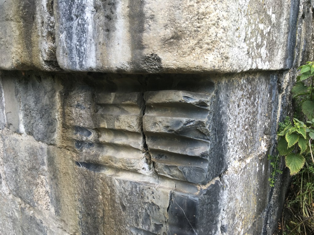
It is 1.5km from the 18th Lock to the Burgh Bridge. It is usually around this stretch that you will hear hear the engines of the cars racing around nearby Mondello Park which lies just 1km south of the Bridge. Burgh Bridge boasts several rope grooves that would have been carved into the stone over the years by horses pulling barges past the bridge, a great reminder of the working past of the canal. It is worth looking out for rope grooves on many canal bridges.
It is nearly two 2km on the grass bank to Bonynge or Healy’s Bridge. At Healy’s Bridge it is best to come up and cross over to the other side to finish out the last stretch to Robertstown. Standing on top of the bridge you can see where the Blackwater Feeder once entered the canal to the right of the main line towards Robertstown. It once connected an artificial reservoir, Ballinafagh Lake to the canal but was closed in 1952 and is now partly filled in. The lake is now protected as a Special Area of Conservation.

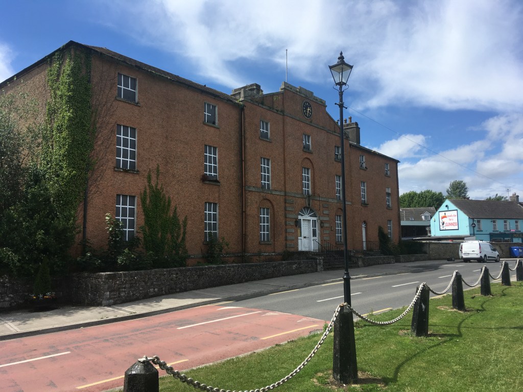
We are now on the final 2km approach to our destination at Robertstown. On reaching Robertstown you are greeted by what was the Grand Canal Hotel. A splendid hotel in the early life of the canal the hotel later became an RIC Barracks and also served as a community centre. Currently unused one can only hope it will find new life and not fall into dereliction much like the similar looking Grand Canal Hotel in Shannon Harbour.
You will generally find several boats in Robertstown Harbour and there are several pubs, shops and a cafe in the village to stock up or get a feed. Robertstown Community Amenities Association are currently in the process of trying to restore Heritage Boat 52M. An outboard engine was fitted during the summer of 2019 and the barge made its own way down the canal to Shannon Harbour for an inspection to take place. I finish this section at Binn’s Bridge.

Walking on the Grand Canal: Hazelhatch to Sallins
Walking on the Grand Canal: Naas Branch
Walking on the Grand Canal: Naas Harbour to Corbally Harbour
A Guide to Staying on the Right Side of the Grand Canal: Grand Canal Dock to Edenderry
A Guide to Staying on the Right Side of the Grand Canal: Edenderry Branch to Tullamore

10 replies on “Walking on the Grand Canal: Sallins to Robertstown”
[…] Walking on the Grand Canal: Sallins to Robertstown […]
LikeLike
[…] Walking on the Grand Canal: Sallins to Robertstown […]
LikeLike
[…] Walking on the Grand Canal: Sallins to Robertstown […]
LikeLike
[…] Walking on the Grand Canal: Sallins to Robertstown […]
LikeLike
[…] Walking on the Grand Canal: Sallins to Robertstown […]
LikeLike
[…] Digby Bridge, as opposed to the other one on the canal by the same name down near Tullamore, is on the stretch of water between Sallins and Robertstown. It was built around 1794 and is home to Lock […]
LikeLike
Hi
Are there plans to surface the toepath from Sallins to Robertstown?
LikeLike
As part of Project Ireland 2040 there are plans to do it but while I know the works on the east of Sallins are due this year I don’t know of any plans to start on the surface west of Sallins yet. The Kildare County Council part of the Grand Canal Greenway can be found here: https://kildare.ie/CountyCouncil/AllServices/Planning/Part8Schemes/RoadsandTransportation/GrandCanalGreenway/Planning%20Report%201.pdf
LikeLike
I’ve been lucky enough to find your site through googling routes. Thanks so much for beautifully documenting the routes and most importantly tips to stay on the ‘right’ side of the canal!! Looking forward to leveraging other route blogs in the future!
LikeLiked by 1 person
[…] cosy and inviting, with rustic wooden interiors and large windows that offer stunning views of the Grand Canal. Whether you’re seated indoors by the roaring fire or enjoying a pint on their outdoor terrace, […]
LikeLike