
Distance: 13km
From our starting point at the 41st Lock we will reach the end of the Royal Canal where it joins the Camlin River at the 46th Lock just beyond Richmond Harbour in Cloondara.

We are now over 130km from our starting point at the Sea Lock on the Liffey. We have left urban Dublin, passed through the commuter towns of north Kildare, eased by the green pastures of Meath, summitted the canal as we passed through Westmeath and are now gently descending towards the Shannon in Longford.

We start on the south or what could more likely described as the west bank of the Royal Canal as we now head north towards our destination. It is 1.5km to Ard’s Bridge, an accommodation bridge that can be walked under or ascended over depending on the view you want.

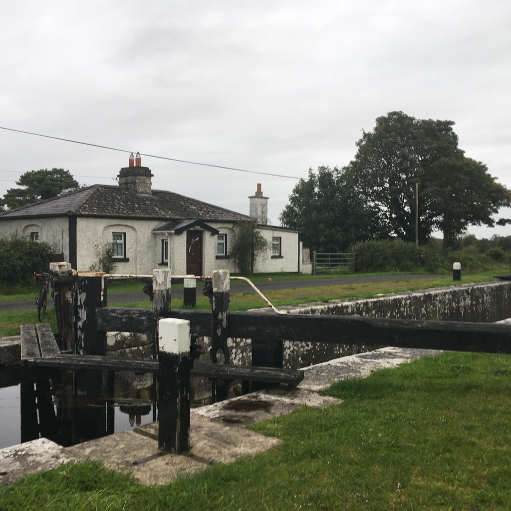
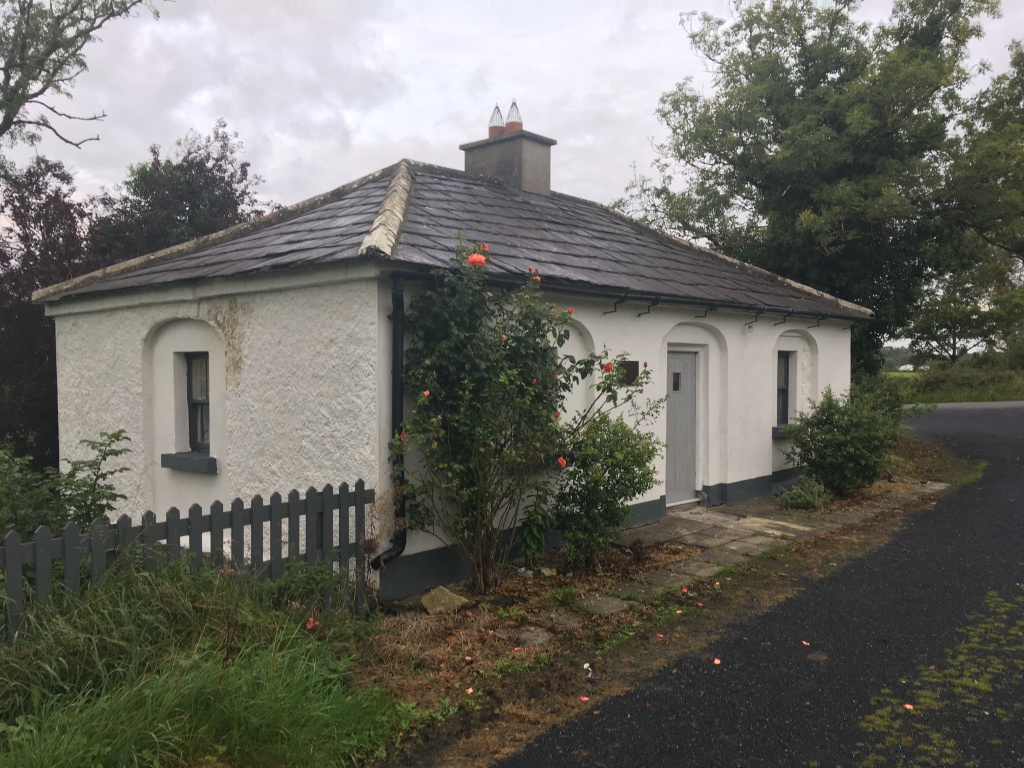
400m on from Ards Bridge we come to the 42nd Lock and it’s Lock Keeper’s Cottage.
Less than 1km from the lock we reach the Lyneen or Ballinamore Bridges which similar to several bridges we have come to west of Mullingar includes the original canal crossing beside a much newer road bridge. It is necessary to ascend up the road bridge and cross the canal over to the other side to continue our journey but be mindful that this is a busy road.
Down on the other side we continue on for 1km to the Lower Lyneen or Crossover Bridge. This bridge is on the approach to the Longford Junction of the canal and was originally built to enable horses which would have towed boats from the western bank of the canal to Cloondara to cross over the canal so that they could tow their boats on towards Longford Harbour. As the Greenway travels along the east bank now there is no need to cross the bridge but it does afford the wanderer a chance to rise up and take a good view.
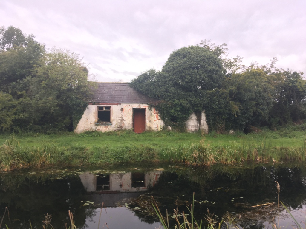
A little further on from the bridge are the ruins of a small canal building on the opposite bank.
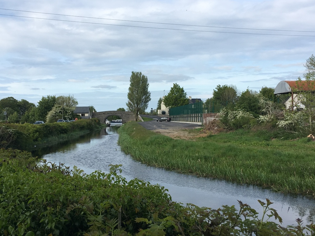
Not much further on we come to the junction with the Longford Branch at Cloonsheerin. There is a decent path the whole way from the junction into Longford town and for those using a train it may be more useful to take this route which I discuss here. The Longford Branch is roughly 8.5km long so is similar in distance from this point to Cloondara.

Crossing the Longford Branch is simple as the Greenway is carried over the junction on the dam between the main line and the branch. It is just under 1.5km from here to the 43rd Lock and Aghnaskea Bridge. There is also a restored Lock Keeper’s Cottage at the 43rd Lock.

Behind the cottage is St. Patrick’s Church. The church was built in 1829. Cruciform in plan, it was built by the Rev. Richard Farrell on land donated by the New Royal Canal Company.

Aghnaskea is roughly 1km from Killashee village and is the best opportunity along this section to pick up supplies from a shop in the village. Magans is a popular pub in the village and a stopping point for many a traveler.

Returning to the canal on the western bank it is a little over 500m to the 44th Lock and Savage Bridge. There is also a restored Lock Keeper’s Cottage at the lock including a plaque honouring Frances K. Kelly of Forrest Hills, New York who paid for the restoration of the house in 1990.
1km on from the 44th Lock is Ballydrum Bridge just before the canal enters Begnagh Bog.

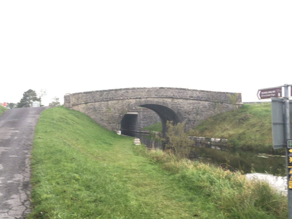
As we pass through the bog we come to the Begnagh Lifting Bridge and the original Begnagh Bridge. The lifting bridge carries the main road between Killashee and Cloondara and this road must be crossed also to carry on along the Greenway. The bridge’s operation is generally automatic, with boats triggering sensors that close the road barriers and lift the bridge for passage underneath.

1.5km on there is another lifting bridge, this time carrying a Bord Na Mona narrow gauge railway over the canal. The railway connects to Lanesborough Power Station which is due to close by the end of 2020.

A walking and cycling trail is under construction across sections of bogland to connect Lanesborough to the Royal Canal Greenway. This trail will link Kilnacarrow, a short walk from Lanesborough, with Cloondara. I will endeavour to post further information about this link in the near future. There is also a vehicle access bridge just beyond the lifting bridge giving machinery access to both sides of the bog.

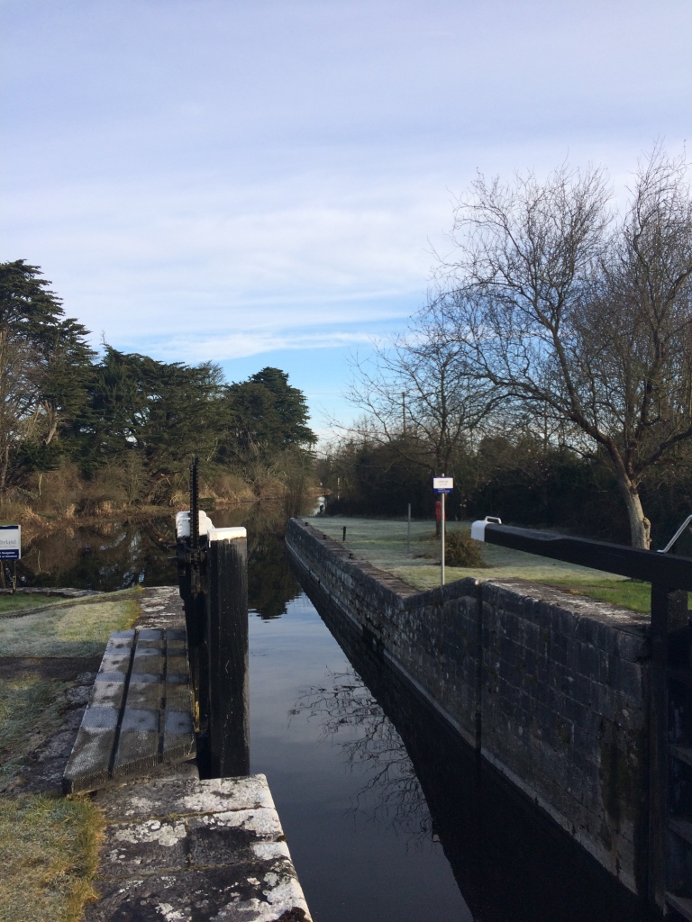
As we reach the end of the bog we get to the 45th Lock at Rinnmount. After we leave the 45th Lock the Royal Canal takes one final turn north east before entering Cloondara which name comes from the Irish Cluain Dá Ráth meaning ‘pasture of two ringforts’.
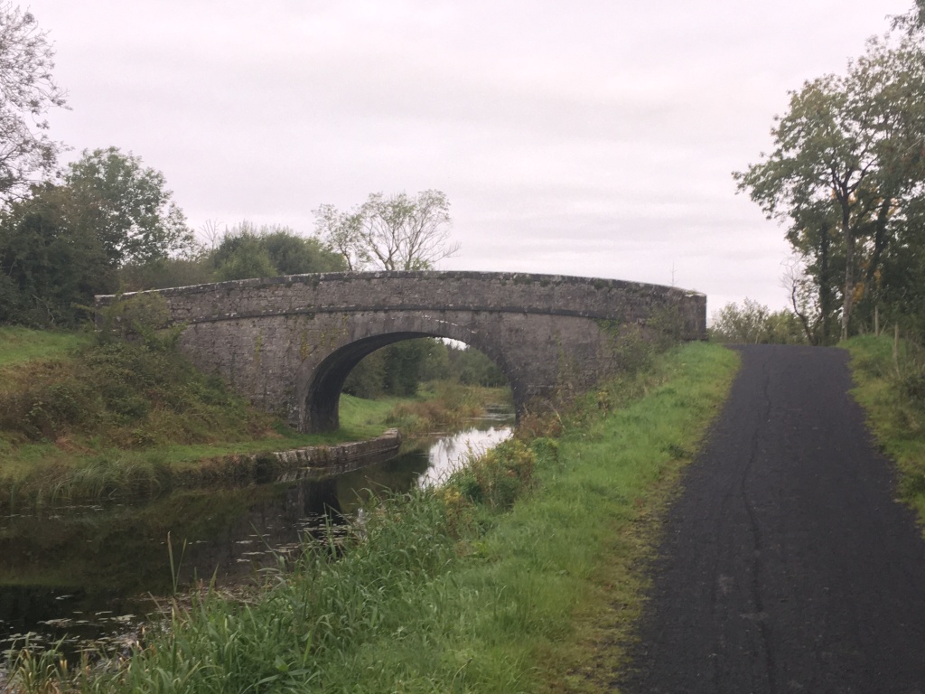
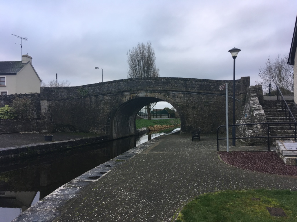
Entry into the village is gained by passing under the horse shoe arch of Richmond Bridge. As with the previous bridges, the towpath is on the western side of the canal.
This opens out into Richmond Harbour, the focal point of the village where many of the buildings around it were built to service trade on the canal. The west bank of the harbour has been developed as a local amenity with a service block including toilets, showers and a Waterways Ireland office beside the bridge as well as a small car park and playground adjacent to the harbour and its moorings.

The Richmond Inn lies at the entrance to the harbour on the east bank. Originally a flax mill built in 1821, this four storey building now serves as a pub and guest house and is the perfect place for any explorer to finish their travels along the Royal Canal with five guest rooms and food served daily. Although it has been altered and changed to reflect its modern function, the scale of the building overlooking the harbour is suggestive of its past and the industrious nature of the canal itself.

Two doors down from The Richmond Inn is the former Harbour Master’s Office which was built around 1825 and is now in use as a private residence. It has a carved limestone date plaque beside the doorway. A slightly earlier office from about 1820 lies attached next door with a square headed carriage arch. Again this has been converted into a private residence.

Aside from the dry dock we encountered in Mullingar Harbour, Richmond Harbour has the only other remaining dry dock on the Royal Canal. Built in 1817, the dry dock in oblong in shape with a central drainage channel and integral staircase. Access is through a set of gates on the south side of the dry dock at the harbour and there is a sluice/drainage gate to the north side of the dry dock.

Slightly to the west of the dry dock at the northern end of the harbour is the last Lock Keeper’s Cottage on the Royal Canal. The cottage is adjacent to the 46th Lock which lies to the northwest of the harbour and marks the last lock on the Royal Canal and where it meets the Camlin River.
It is not possible for the walker or cyclist to proceed beyond this point and I would suggest they go back to the Richmond Inn for a pint but for the purposes of completeness (and boaters) I will briefly mention the last small stretch along the Camlin River required to get a boat out onto the River Shannon.

After transiting through the 46th Lock down onto the Camlin River you must head north to avoid the weir which lies on the other side of Richmond Harbour. The cut limestone weir on the river predates the canal by about 50 years. Before reaching the road bridge which carries the N5 over the Camlin River from Longford to Termonbarry we turn west onto the Camlin Canal which is a very short canal linking the Shannon River to the Camlin River and was built in the 1760s. This small canal was most likely designed by Thomas Omer for the Commissioners for Inland Navigation. This small canal has a single bridge crossing it which would have carried the original road to Termonbarry and dates to the same time as the construction of the Camlin Canal. The bridge gives a good viewing platform for the pedestrian to see the majority of the link between the Camlin River and the Shannon River and can be accessed by heading northwest out of Cloondara past the derelict Richmond Mill. There is a Lock Keeper’s Cottage to be found on the north bank by the bridge. This cottage from the 1760’s is quite different to anything else we have encountered and also served as an office for the Shannon Navigation Company but is now disused. That said big boats are not an uncommon sight entering the Royal Canal via the Camlin as can be seen on this video:
The associated and only lock on the Camlin Canal lies to the west of the cottage. The large lock was first built around 1760 and was altered around 1815 with the coming of the Royal Canal. This lock serves as the last man made structure needed to connect the River Shannon to the River Liffey. Once through the lock you are finally out on the River Shannon with Termonbarry Harbour facing you on the opposite bank of the wide river. From here it is possible to navigate north up to Enniskillen and the Erne, south to Athlone and on to Limerick or should you choose to Shannon Harbour where you can turn east once again and follow the Grand Canal back all the way to the south bank of the Liffey only a short distance from where we started.
Part 1: North Wall to Cross Guns Bridge
Part 2: Cross Guns Bridge to Castleknock
Part 3: Castleknock to Leixlip Confey
Part 4: Leixlip Confey to Maynooth
Part 7: Thomastown to Mullingar Harbour
Part 8: Mullingar to Coolnahay
Part 9: Coolnahay to Ballynacargy Bridge
Part 10: Ballynacargy to Abbeyshrule
Part 11: Abbeyshrule to Ballybrannigan
Part 12: Ballybrannigan to the 41st Lock

18 replies on “Royal Canal Greenway: 41st Lock to Richmond Harbour”
[…] Part 13: 41st Lock to Richmond Harbour […]
LikeLike
[…] Part 13: 41st Lock to Richmond Harbour […]
LikeLike
[…] Part 13: 41st Lock to Richmond Harbour […]
LikeLike
[…] Part 13: 41st Lock to Richmond Harbour […]
LikeLike
[…] Part 13: 41st Lock to Richmond Harbour […]
LikeLike
[…] Part 13: 41st Lock to Richmond Harbour […]
LikeLike
[…] Part 13: 41st Lock to Richmond Harbour […]
LikeLike
[…] Part 13: 41st Lock to Richmond Harbour […]
LikeLike
[…] Part 13: 41st Lock to Richmond Harbour […]
LikeLike
[…] Part 13: 41st Lock to Richmond Harbour […]
LikeLike
[…] Part 13: 41st Lock to Richmond Harbour […]
LikeLike
[…] Part 13: 41st Lock to Richmond Harbour […]
LikeLike
[…] Part 13: 41st Lock to Richmond Harbour […]
LikeLike
Excellent blog, really enjoyed it, thanks
LikeLiked by 1 person
[…] Part 13: 41st Lock to Richmond Harbour […]
LikeLike
[…] Part 13: 41st Lock to Richmond Harbour […]
LikeLike
[…] Part 13: 41st Lock to Richmond Harbour […]
LikeLike
Just completed this by bicycle at the weekend (after doing most of it in the middle of 2020 when travel was permitted). We just had the leg from Ballymahon to Cloondara to complete, and were grateful for the blog and the detailed descriptions to help us make sense of our surroundings and understand the history of the area.
We’ll have to revisit it again when the pubs and restaurants are open along the way.
Well worth doing it !
LikeLiked by 1 person