The Longford Branch of the Royal Canal was built several years after the Main Line was completed to Cloondara in 1817. Offically opened in January 1830 the branch is roughly 8.5km long but has since been shortened slightly after Longford Harbour was filled in and the new terminus moved to the south side of the railway line. While the branch is not navigable an accessible path runs the full length of it to the main line and is suitable for walkers, runners and cyclists.

As the branch is located close to the railway station I thought it would be a good idea to start this post at the old Longford Harbour and head out towards Cloonsheerin and the junction with the Main Line.
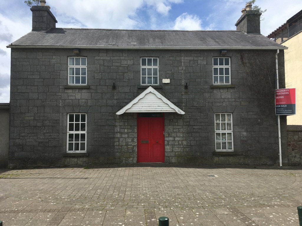
The former Harbour Master’s House now sits overlooking a car park where the harbour once was. According to the Guide to the Royal Canal if the harbour were to be re-excavated, all of the original stonework is in situ under the compacted infill.

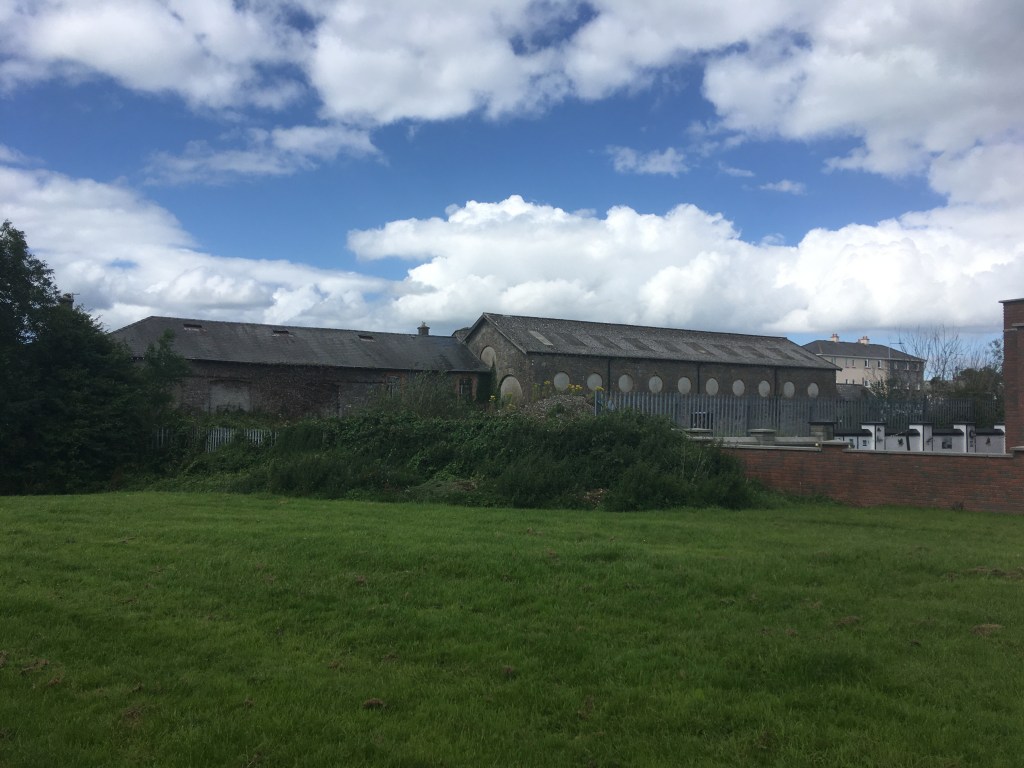
Another prominent building on the site of the infilled harbour is listed by the National Inventory of Architectural Heritage as being the former Royal Canal Ticket Office and may have been originally built as a warehouse or store for the canal. With the harbour now gone you can follow a path down underneath the railway to the other side where the new terminus of the canal is now.
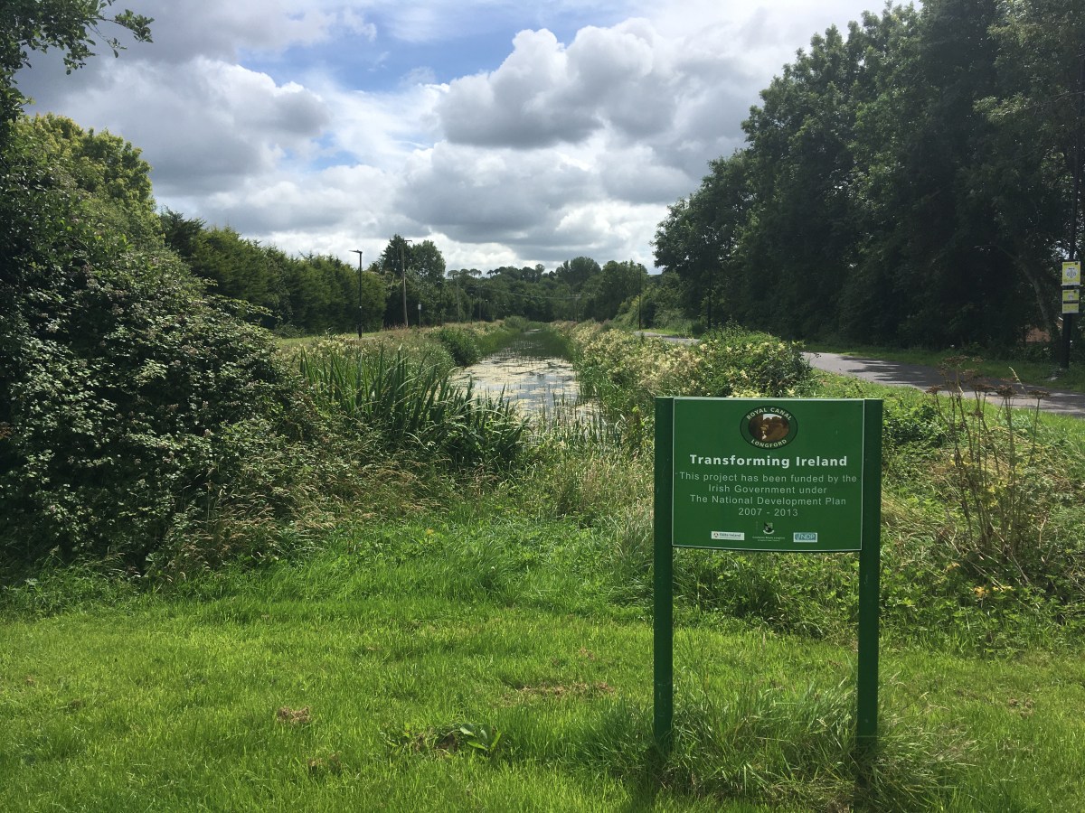
The first 1.5km of the canal from the new terminus to just beyond Farranyoogan Bridge holds water and is home to a considerable number of ducks, moorhens, butterflies and dragon flies. Longford County Council also recently finished upgrading the canal path on both sides with a smooth tarmac surface and lighting from the start as far as Churchlands Bridge, a distance of nearly 3km.

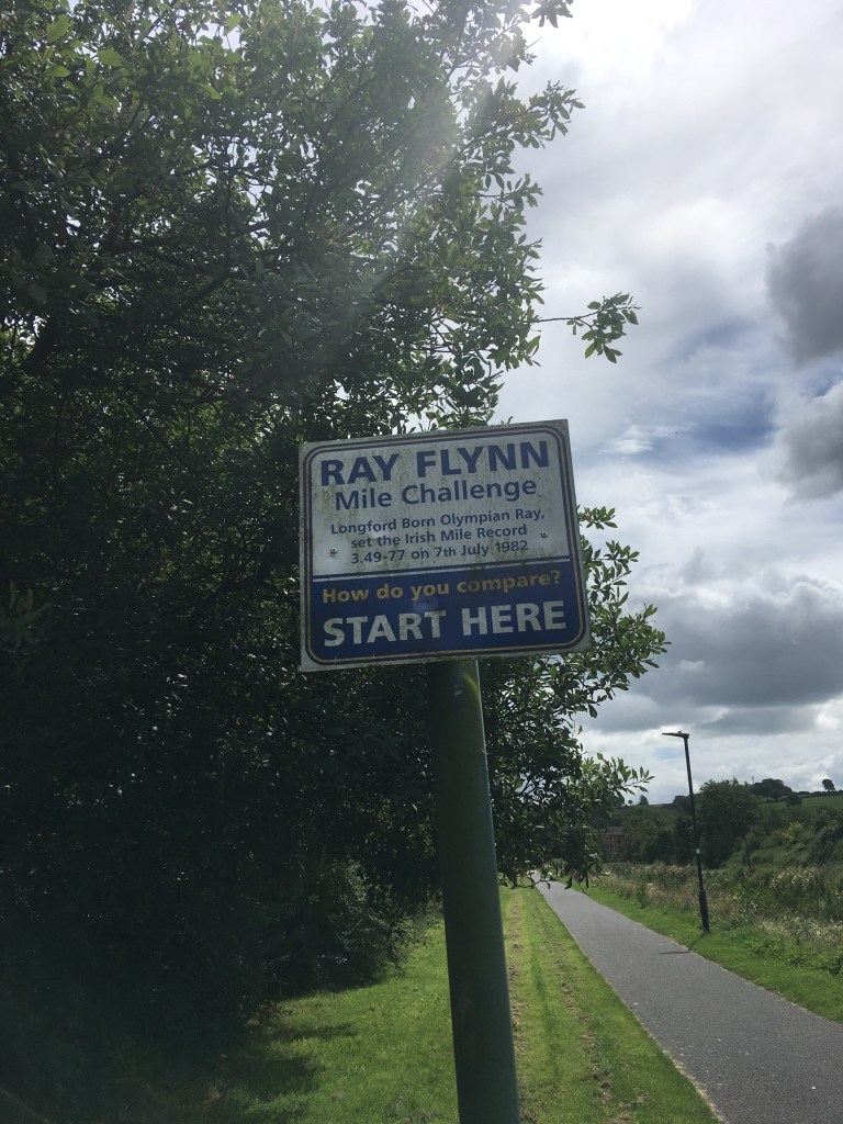
This section the of the canal is the venue of the popular Run Canal Run Longford which offers runners a choice of 10k, half marathon, full marathon and an ultra marathon running loops up one side and back the other between the terminus and Churchlands Bridge. This section also celebrates Irish athlete and Longford native Ray Flynn who ran an impressive 89 sub 4 minute miles over the course of his career and still holds the Irish 1 mile record with a time of 3:49.77 ran in Oslo in July 1982.
The first bridge we come to, a little less than 1.5km from the harbour is Farranyoogan Bridge and is the most prominent and visible bridges along the Longford Branch. It is possible to pass under the bridge on the eastern side of the canal.
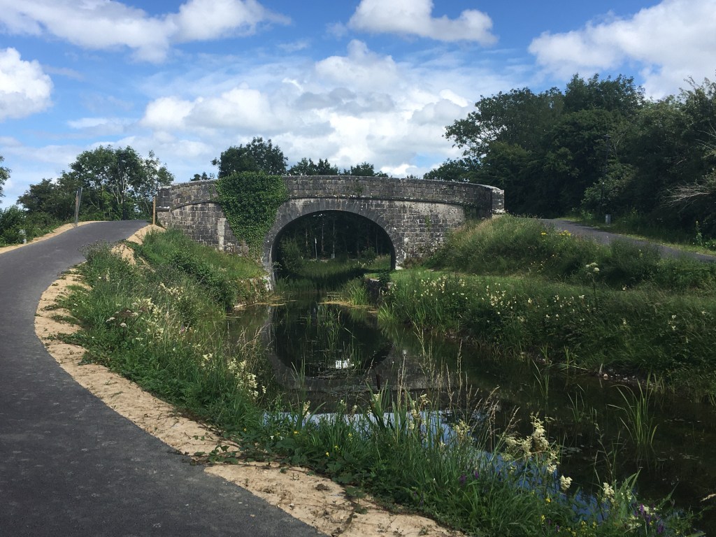
A very short distance after the bridge there is a dam which ensures the first section we have just completed remains watered from the local springs nearby. From here on to the junction with the Main Line is dry. It is a little over 1km from Farranyoogan Bridge to Churchlands Bridge and the canal bed is visible for almost all of this section, with much of the overgrowth that was in the canal removed when the paths were done.

Churchlands Bridge is a now out of use bridge built in the first half of the 20th century on the site of a former canal bridge dating back to the building of the Longford Branch.

Unfortunately after the closing of the canal in the early 1960’s several culverted road crossing at the canal level were built by Longford County Council to by-pass the narrow and often hump backed bridges of the canal that were not designed for the traffic of the 1960’s let alone today. All of these culverts on the Main Line have since been replaced by bridges allowing for full navigation of the Main Line, however two such culverts remain on the Longford Branch, both carrying the N63 and remain as probably the biggest cost and obstacle in reopening the Longford Branch to navigation.
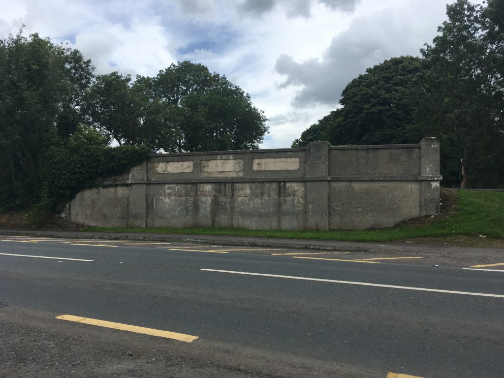
It is necessary to come off the canal path at Churchlands Bridge to cross the N63 over to the other side where the canal path now becomes single sided continuing on the east side only. The surface of the path here changes to a stone trail but apart from the occasional short patch is consistent with the stone dust trail we are used to on much of the Main Line Greenway. It is 1km from here to where we must pass over another culverted road crossing of the N63 near Knockanboy Bridge.
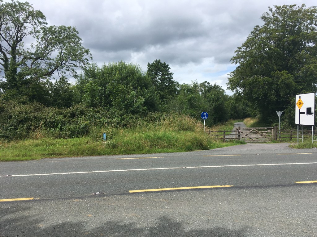
The old road Knockanboy Bridge carried and was by-passed by the culvert is still open and the main road can be seen swerving around it on either end from the top of the bridge.

It can be noted that as the Longford Branch was built after the Main Line and additionally after the original Royal Canal Company was wound up, the bridges are not named for company subscribes or owners of the land on which they were built but simply named now for the townlands they are in.
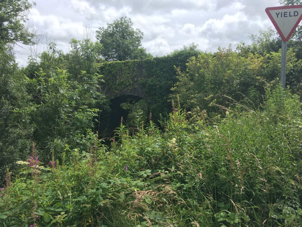
Shortly after Knockanboy Bridge the canal path lines up briefly with the R397. There is a small petrol station with a shop only a short distance down the road here and this is the only opportunity you will have to get any supplies should you want any one this section.
Turning the corner away from the road you pass over a small aqueduct before reaching Cloonturk Bridge. Cloonturk Bridge still provides an important function as you must cross it over to the west side of the canal to carry on the canal path.

Carrying on down the west side of the canal we pass an charming remote cottage which is still lived in.

It is just over 1km from Cloonturk Bridge to Newtown Bridge. Most of the Longford Branch between Churchlands Bridge and Cloonsheerin now has considerable tree growth or reeds along the channel and as such the bridges are fairly obscured from sight.

It is roughly 1.5km from Newtown Bridge to Aghantrah Bridge. Between the two bridges the canal path goes around a small clump of trees which may originally been part of the canal as place to allow other boats to pass. There is also a another small aqueduct that you would hardly notice. There is a 90 degree turn to the south just before Aghantrah Bridge itself.
There is a third aqueduct carrying the canal over a small stream below between Aghantrah and Cloonsheerin Bridge. The two bridges are 700m apart.

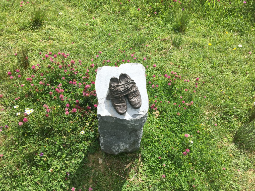
Around the next bend and 300m further down you will come to the dam and the junction with the Main Line of the Royal Canal. You will also see the familiar sight of the National Famine Way Shoes.
At the junction of the canal, Cloondara is only 8km to the right while Ballymahon is a little over 15km if you go to your left.

Waterways Ireland undertook a feasibility study into the restoration of the Longford Branch of the Royal Canal in 2014 but unfortunately the link to the study no longer works. Not factoring in the cost of the project the study was generally positive about the condition of the Longford Branch and also had so insights to the variety of wildlife that can be found on it.

While the section is not navigable the canal path is in good condition and the branch is well worth the detour for those who have the time or is a pleasant journey for those starting out in Longford Town. It also serves as a good reminder of all the amazing work done to restore the Main Line as it illustrates how quickly nature can take over when left to itself.
Part 1: North Wall to Cross Guns Bridge
Part 2: Cross Guns Bridge to Castleknock
Part 3: Castleknock to Leixlip Confey
Part 4: Leixlip Confey to Maynooth
Part 7: Thomastown to Mullingar Harbour
Part 8: Mullingar to Coolnahay
Part 9: Coolnahay to Ballynacargy Bridge
Part 10: Ballynacargy to Abbeyshrule
Part 11: Abbeyshrule to Ballybrannigan
Part 12: Ballybrannigan to the 41st Lock
Part 13: 41st Lock to Richmond Harbour
