Coolnahay and the 26th Lock mark the western end of the Summit Level of the Royal Canal and it is the perfect place to slow things down again and walk the to Ballynacargy. The advantage of leaving the Summit Level is this walk is all down hill from the 26th Lock to the 35th Lock and all of it is covered on the southern bank.
View from Coolnahay Bridge (Dolan Bridge) of Coolnahay Harbour, 26th Lock and Lock Keeper’s Cottage on the right.
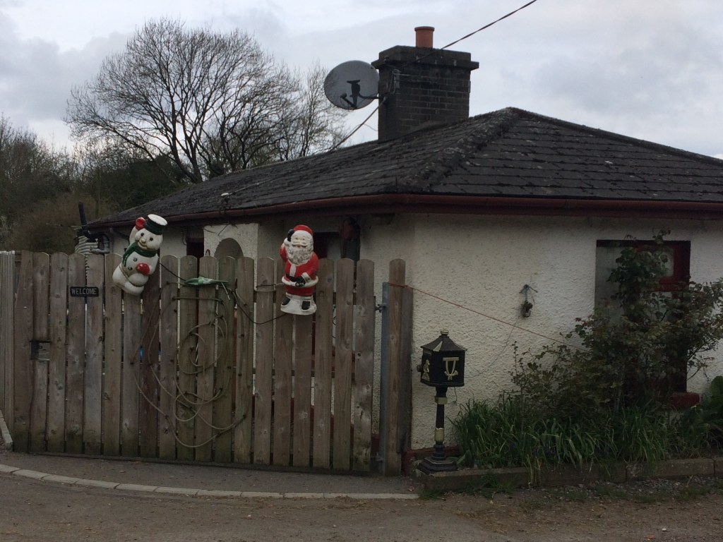
There is a small car park on the west side of Coolnahay Bridge (Dolan Bridge) across the road from the Lock Keeper’s Cottage that is fine to leave a car for several hours.
Looking west from Coolnahay Car Park
For those interested in the history of the building of the Royal Canal, Coolnahay also marks a very important point in the construction of the canal. The canal reached Coolnahay in 1809, some 19 years after construction first began in Dublin and by this stage the company was heavily in debt and unable to cover the construction costs to complete the canal. It was decided that the Royal Canal Company would be dissolved and the canal completed to the Shannon using public funds. In 1813 the Directors General of Inland Navigation took on to complete the canal under engineer John Killaly and contractors Henry, Mullins and McMahon. You may remember we previously came across the formation of this firm when they tendered for the restoration and extension of the Naas Branch of the Grand Canal as to Corbally Harbour.
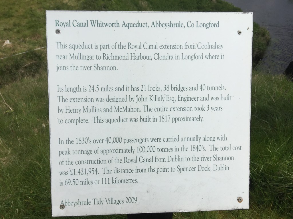
Information sign at Whitworth Aqueduct about the construction of the Royal Canal from Coolnahay to Clondra.
As previously mentioned, one of the advantages of this section is a continuous drop down through 10 locks to Ballynacargy. The other big advantage of this area is the pure scenic nature of the remainder of the canal. Mullingar is the last large urban centre we pass through on our way west and from Coolnahay we are truly out in the remote country side only passing through the odd small village or skirting around a small town. 400m from Dolan Bridge we come to the 27th Lock.
27th Lock Gates
Another 500m on from the 27th Lock we come to the 28th Lock which lies slightly around the next bend. Another feature of the Royal Canal as we move further west is that it begins to meander more through the landscape. For those of you who may have seen RTÉ’s Waterways: The Royal Canal series with Dick Warner, you may recall an interview with the daughter of the last lock keeper of the 26th Lock who discusses how her father, Michael Christie, would also look after the 27th and 28th Locks, cycling down to them from the cottage on the 26th Lock. As such it is no surprise that we do not find any cottages at these locks.
Looking up the 28th Lock Chamber
500m on from the 28th Lock we come to Walsh’s Bridge, an accommodation bridge over the canal. It is possible to walk under the bridge or to rise up over the road allowing for a good view down the canal.
Walsh’s Bridge on a soft day.
It is a 1.5km walk on from Walsh’s Bridge to Kildallan Bridge and the start of the quick descent down the 29th, 30th and 31st Locks.
29th Lock and Kildallan Bridge in the background
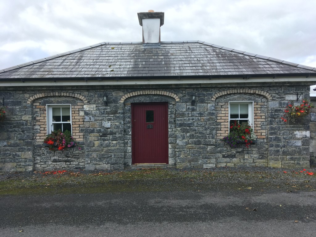
The three locks are in a linear stretch not long after the bridge. Each lock also has a restored Lock Keeper’s Cottage beside them.
Restored front of the 30th Lock Keepers Cottage
Each of these have been largely extended and modernised they make for appealing private residences on the bank of the canal.
31st Lock Keeper’s Cottage
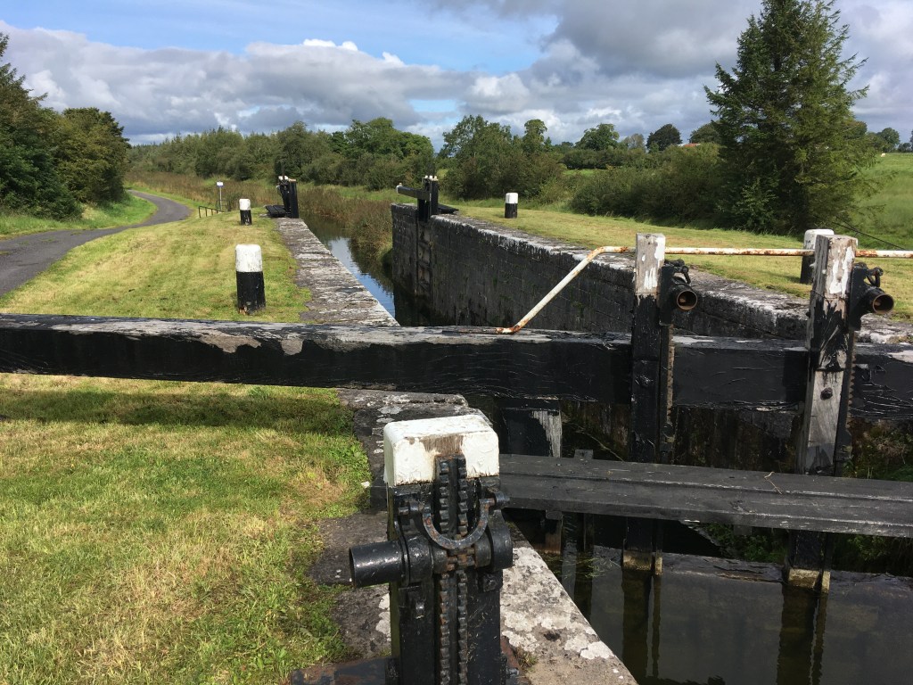
The canal path takes a sharp left after the 31st Lock before taking a sharp right to be greeted by Kill Bridge and the 32nd Lock.
32nd Lock and Kill Bridge
Kill Bridge is another accommodation bridge, something more common the further west you go as farmers needed access both sides of the canal as it cut through the land.
Looking down the 33rd Lock
It is a little over 500m down to the 33rd Lock before a 1.2km straight on to Balroe Bridge and the 34th Lock.
34th Lock and Balroe Bridge
With the passing of the 34th Lock we are now onto our final 2km stretch towards the 35th Lock and Ballynacargy.
Ballynacargy Harbour looking towards the 35th Lock
As we pass the 35th Lock and its Lock Keeper’s Cottage the large and magnificent Ballynacargy Harbour opens out into our view.
35th Lock Keepers Cottage
On the south bank we see the remains of the old Hotel and Store House while the majority of the small village sits on the opposite bank. There are also a few picnic benches out around the harbour which makes it a pleasant place to stop.
Remains of Ballynacargy Hotel and Store
At the end of the harbour is Ballynacargy Bridge which will give you access to the village itself. The village has a few small pubs, newsagents, garage and a chipper so its possible to grab a snack or a drink before making the trip back to Coolnahay or onwards to Abbeyshrule where I will pick up in part 10 below.
Keeping the sections short as I travel further west towards the Shannon, todays post covers the stretch from Ballynacargy to Abbeyshrule, an easy place to start, enjoy some time on the canal before having a good lunch and returning back the way you came.
Looking west from Ballynacargy Bridge
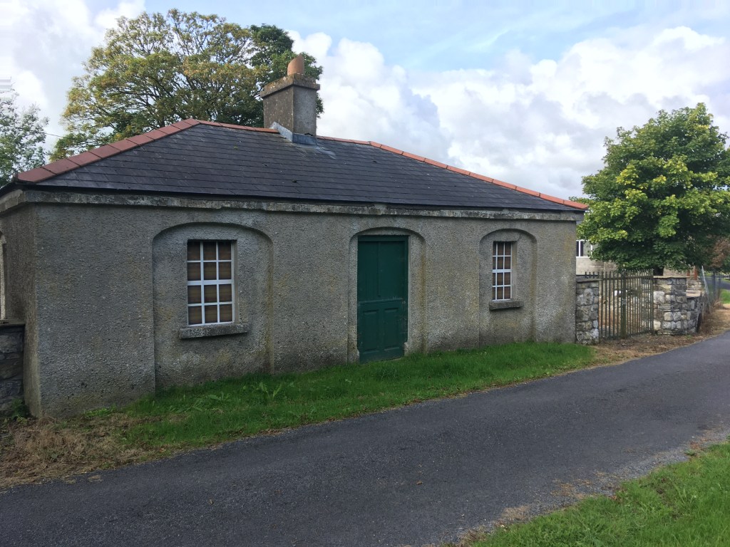
Leaving your vehicle in Ballynacargy village, much of which dates back to the time the canal was built, you will need to cross over Ballynacargy Bridge to join the greenway on the south bank of the canal. From here it is 1.5km to the 36th Lock and Bridge with adjacent former Lock Keeper’s Cottage which is now a private residence.
36th Lock, Bridge and Cottage
It is a little over 500m from the 36th Lock to Kiddy’s Bridge which you can pass under the arch if you want.
Kiddy’s Bridge
Staying on the south bank of the canal it is then 600m to the 37th Lock and Bridge.
37th Lock Gates seen from below the bridge
Once down onto the 37th Level you will see the 38th Lock with it’s Lock Keeper’s Cottage and Kelly’s Bridge only a short distance ahead. It is more common to find this matching set of lock, cottage and bridge on the western end of the canal, though the condition of the cottages can vary from ruins, to restored and also extended private residences.
38th Lock and Kelly’s Bridge
This whole section of the canal was dammed off west of Mullingar from the 1960’s until the 1990s’s with very little to water to speak of. As such some boats were abandoned where they lay. Once such boat is Heritage Boat4E which is well worth looking up on the link. The boat has had an interesting life with several designations but it was from here that the current owner salvaged her in 1980 by having her towed to the 38th Lock and craned out so it could be brought to the Grand Canal to be restored. 4E can often be sighted on both canals and wintered in Mullingar Harbour over 2019/2020.
4E Pictured at Chambers Bridge
We cross over the bridge at the 38th Lock to the north bank before proceeding on 500m to Ledwith’s Bridge. From here the countryside opens up as we pass through Ballymaglavy Bog. The wide expanse of the bog offers no protection so always be prepared for Irish weather, sunscreen and a rain jacket.
Ledwith Bridge
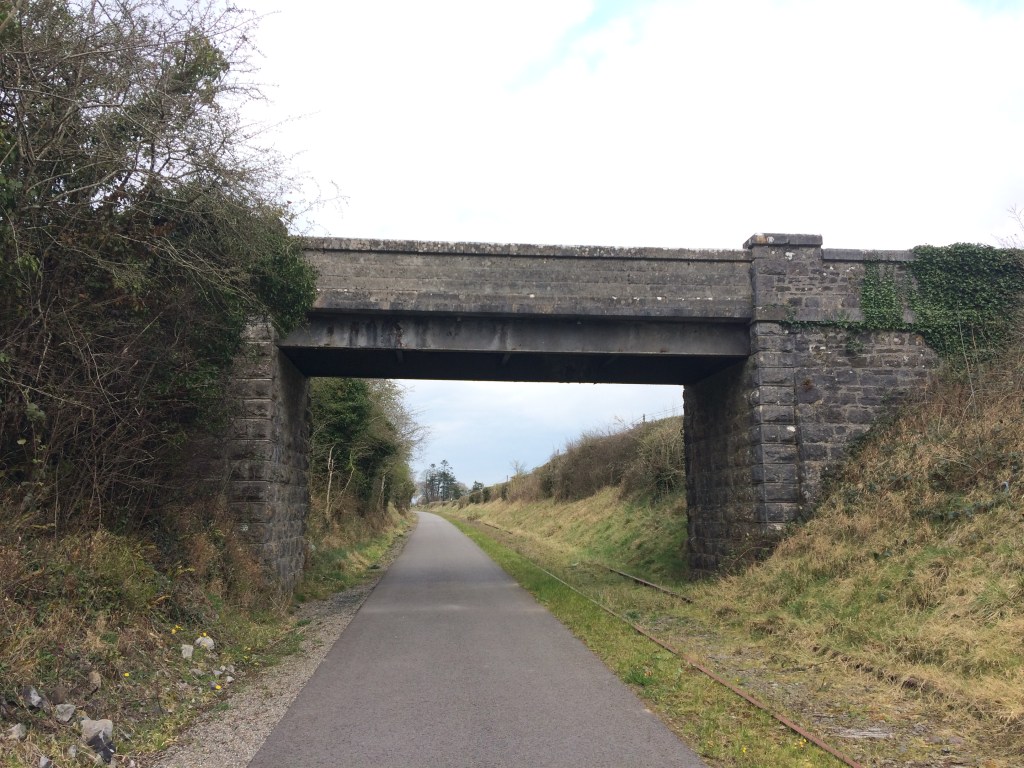
As we move through the last stretch out of Westmeath before we enter our final county of Longford we come to a landmark that catches the attention of all those who pass, that of Bog Bridge. This stunning bridge lies in the middle of nowhere, spanning the canal, linking one side of the bog to the other but in our modern times looks like it serves no purpose other than to provide us a view of the bog and act as a perfect example of the fine workmanship of the contractors that built this section of the canal.
Bog Bridge
With Bog Bridge behind us we now enter County Longford as we approach Quinn’s Bridge.
Quinn’s Bridge
To the right of Quinn’s Bridge we can also see Abbeyshrule Aerodrome which is mainly used for leisure flights and parachute clubs.
Plane and hanger of Abbeyshrule Aerodrome viewed from the Canal.
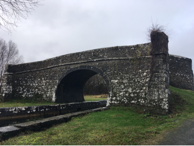
About 600m past Quinn’s Bridge we come to the Whitworth Aqueduct which carries the canal over the River Inny and is one of the most impressive structures on the canal.
Whitworth Aqueduct from below
The 5 arch aqueduct was most likely named for Lord Charles Whitworth, who was Lord Lieutenant of Ireland between 1813 and 1817 when this section of the canal was being built.
Approaching the Whitworth Aqueduct with water from the River Inny being pumped up to the canal from below.
The canal takes a sharp left once you cross the aqueduct as you line up to come into Abbeyshrule itself. If you keep and eye out just as you round the corner you can see an original overflow before you get to Scally’s Bridge.
Overflow before Scally’s Bridge. There are several of these overflows between Coolnahay and Cloondara. The arch on this one is obscured by a flat plinth added at a later date
The Greenway section on the north bank from Scally’s Bridge into Abbeyshrule recently opened and is safer than crossing the narrow bridge to bring you into the village. When you reach the village though you will need to cross Webb Bridge to either stop in the town or to carry on.
The approach to Abbeyshrule from Scally’s Bridge. The Greenway is now open on the right side as the main road goes in on the left.
Abbeyshrule is the site of of a Cistercian Abbey dating back to the 1200’s and poet Oliver Goldsmith is believed to have been born nearby.
Looking through the ruins of the abbey
The village also boasts a very active Tidy Towns group.
Abbeyshrule Sign with some of its Tidy Town accolades.
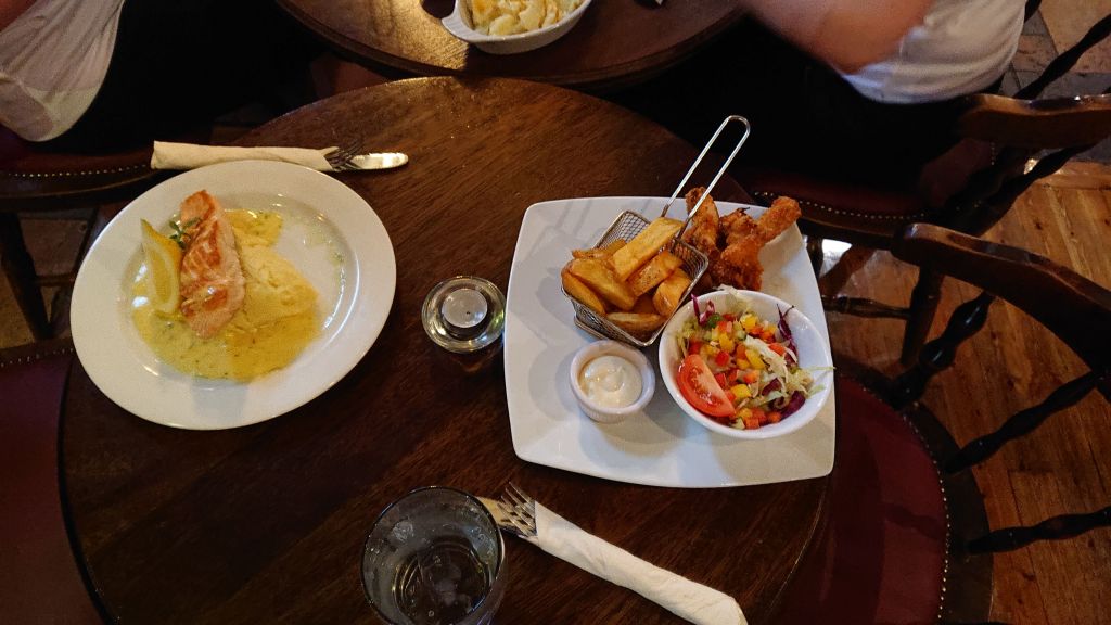
At the heart of the village you will find the Rustic Inn where I would highly recommend you stop in for a drink and a feed. The pub also has a guest house for those looking to rest their tired legs after a long walk, run or cycle.
A great feed is always to be had at the Rustic Inn
Once refueled you are all set to make the return journey to Ballynacargy to to push on further west to Ballybrannigan and Ballymahon where I will pick up in my next post.
Given how intertwined the history is between the Royal Canal and the Midlands Great Western Railway (MGWR) I think it would be remiss of me not to put up a post about the old MGWR Mullingar to Athlone railway line which has been converted into an amazing 40km greenway called the Old Rail Trail which is entirely in Westmeath.
Image of the Midland Great Western Railway Company Crest from the Model Railway Museum in Malahide
I previously discussed running the Old Rail Trail from Athlone to Mullingar here but in the context of my series of guide posts of the Royal Canal I will revisit the topic here starting in Mullingar. A quick history lesson will tell you that the MGWR was incorporated in 1845 and at its peak was the third largest railway company in Ireland after Great Southern & Western Railway (GS&WR) and Great Northern Railway of Ireland (GNR). The MGWR bought the Royal Canal with the aim to build a railway to Mullingar and onward to Longford. Construction of the railway began in January 1846 and reached Mullingar in 1848.
Plaque marking the 150th Anniversary of the opening of Mullingar Railway Station
There was a rivalry between the MGWR and the GS&WR to reach Galway first and so it was that the MGWR extended their line from Mullingar to Athlone and onward to Galway, capable of running trains from Dublin to Galway from August 1851. It would be another 8 years before GS&WR reached Athlone and from that point on used the already laid MGWR line west.
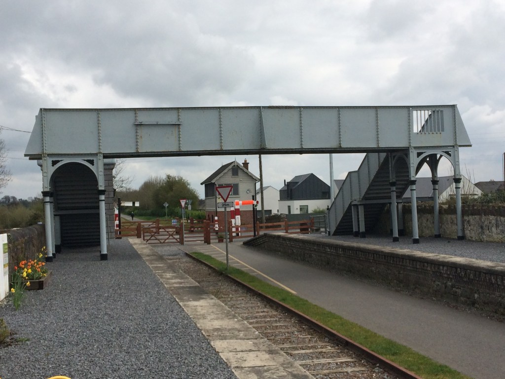
Starting at Mullingar Railway Station, the platforms and shelters of the old Athlone line are no longer in use or accessible. They sit around the far side of the station building and can only be viewed from inside. Also visible from the station building is the Signal Box on the Dublin side which commands view of both the Athlone and Sligo lines as they part either side of the station. The Athlone line through the station is still in place as far out as the railway sheds and workers terrace passing over a bridge immediately after the station. These sheds were used by the Railway Preservation Society of Ireland in the restoration of Great Southern & Western Railway Locomotive No. 184. This locomotive went on to be used in the filming of The First Great Train Robbery starring Sean Connery and Donald Sunderland where many moving scenes were shot on the Mulligar to Athlone railway line. No. 184 is on display at Whitehead Railway Museum in Co. Antrim. There is also the remains of a turntable out by the railway sheds. The workers terrace was also the location of a true crime in 1869 when it was reported that the then Station Master Thomas Anketell was shot and murdered and a newspaper article about the incident can be found here.
Old Rail Trail map near Grange Bridge
Unfortunately while we can view the sheds from a distance or on Google Maps we are unable to go directly by them so to access the start of the Old Rail Trail it is best to exit the station onto the Royal Canal Greenway and head west as far as Grange Bridge which was described by the late Dick Warner as like having the legs of a Mullingar heifer. Alternatively there is an Old Rail Trail car park adjacent to Grange Bridge on the south side of the canal.
Grange Bridge looking east.
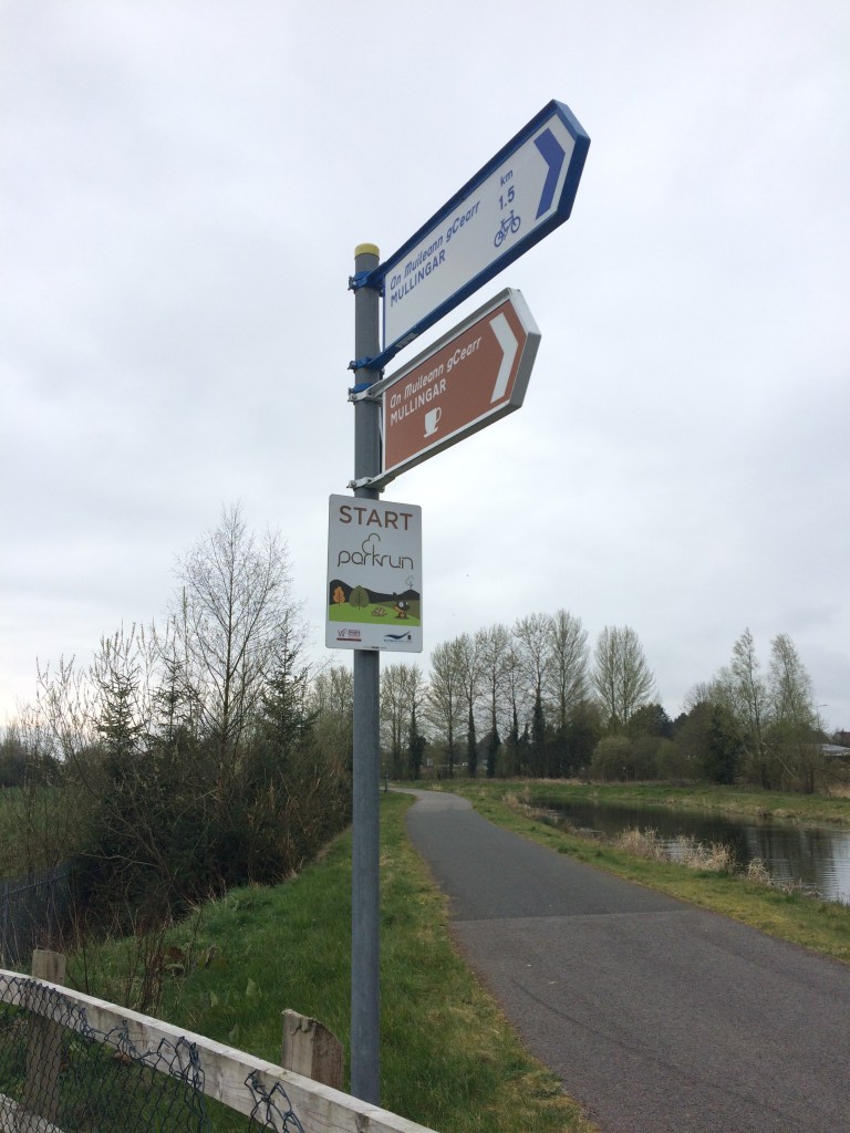
Just after passing Grange Bridge you will see that the Royal Canal Greenway splits in two. On the right you stay with the canal and the route as far as Coolnahay is described in my post here and on the left is the start of the Old Rail Trail. You will also see the start sign of Mullingar parkrun at the Y of the two greenways.
Mullingar parkun Start sign at the split between the Royal Canal Greenway and the Old Rail Trail
As you start moving west on the Old Rail Trail you will notice it is a smooth tarmac surface unlike the dust stone used on the Royal Canal Greenway. This tarmac surface is used the whole way to Athlone and as such makes it the perfect surface for a smooth cycle. Passing the industrial estate on the left you will notice the remains of a railway platform which was used to serve the Mullingar Racecourse at Newbrook. From what I can gather from Railscot’s record of Irish Stations the platforms operated from 1902 to 1962.
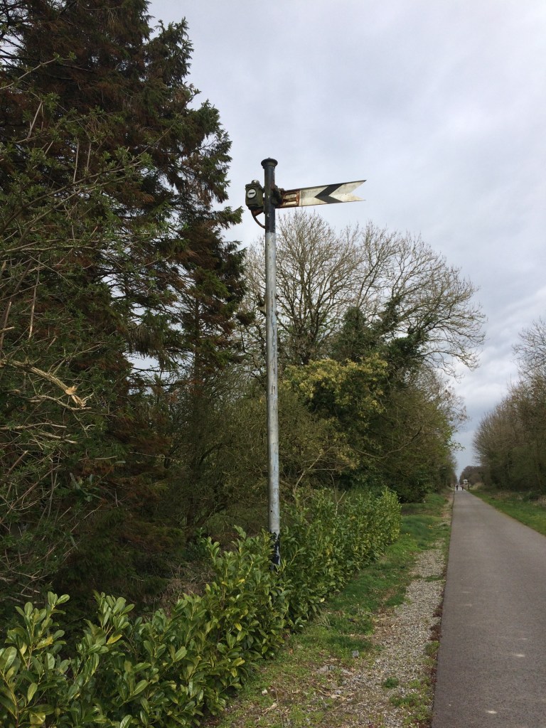
Signal Cable Pole along the trail
The Royal Canal Greenway and the Old Rail Trail run parallel to each other for roughly 3.5km from Grange Bridge out to Ballinea. The parkrun course is made up of an out on the canal and a return on the Old Rail Trail. Close to Kilpatrick Bridge over the canal there is also a squared off bridge over the trail.
The high wall at the road bridge over the trail at Kilpatrick
Not far beyond Kilpatrick Bridge we come to the last link to the Royal Canal Greenway where the parkrun turns to go back to its finish. Just beyond that is also the last MGWR bridge that is abutted to an older Royal Canal bridge at Belmont Bridge. There is a small shop in Ballinea which you can get to by taking the Royal Canal here. If you haven’t come with supplies I would suggest taking the time to stop here and get something as Moate is the next location where you really have an opportunity to get anything.
Looking towards Mullingar at Belmont Railway Bridge
As can be seen in the above photo, the Old Rail Trail only takes up about half the surface available to it as it was once a double line track and as a result there is the remains of one of the tracks for the majority of the distance to Athlone to remind us of the proud rail heritage that the trail is built on.
Old Railway Signal near Castletown
At Ballinea we pass a private residence that was most likely originally built as railway workers cottage. We have left the old world of the canal now, the familiar sights of Locks, Keeper’s Cottages and humpback bridges are replaced with the railways own take on engineering with workers cottages, stations, water towers and sheds all to come.
Short tunnel just west of Ballinea
Not far west of Ballinea we pass through the closest thing to a tunnel the Old Rail Trail has. As we move further west in what is nearly a straight line we both go over and under many bridges alternating between the roads going over and under the railway. Unless they have some key relevance though I will only mention the bridges we pass under as it is near impossible to take a worthwhile photo of a bridge when standing on top of it.
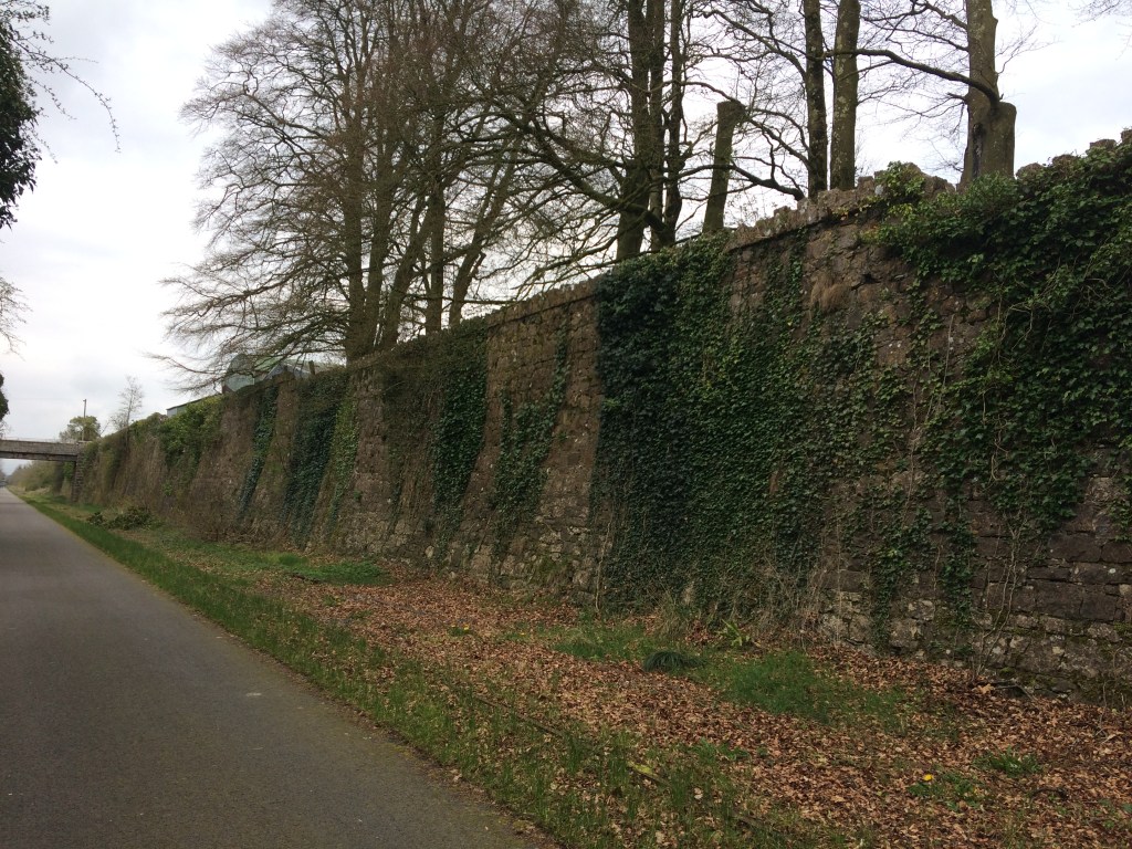
It is interesting as we move across the landscape how the railway would have cut through the land in places like at Barrettstown where high walls flank us on either side to soaring high above the farmland at other points affording us views as far as the eye can see, not to mention a wind that can cut you on a cold day so a reminder to always be prepared.
3.5km from Barrettstown we come to what was Castletown Station which was open from 1851 until 1987. The first thing to greet us is the magnificently restored signal box. Behind the signal box is Ard Na Greine, a Victorian house and former dispensary. Crossing over the road we come to the station and its platforms.
A dark eerie image of the remains of the Gate Keeper’s Cottage at Castletown.
The Castletown Station is now a private residence on the northern platform but the southern platform does offer picnic benches for those passing by. As mentioned previously it is important to bring your own supplies on this trip, however, Castletown Geoghegan has a shop in it 2km south along the road if you need it.
Castletown Station in the left with the Signal Box in the background.
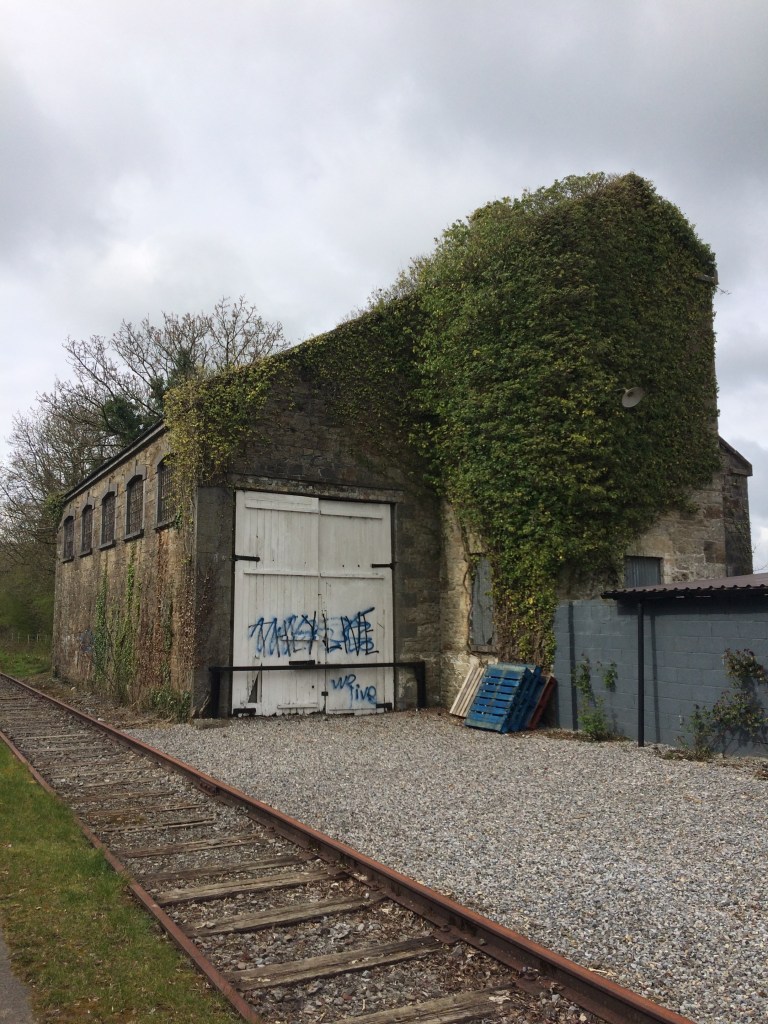
Though boarded up the remains of a platform waiting room faces the station on the southern platform and to complete the station set there is the remains of a goods shed just west of the platforms as you are leaving.
Castletoewn Goods Shed
Leaving Castletown behind us we head towards an area known as Killeen and the area around Jamestown Court, with its Gate Lodge adjacent to the bridge over the railway which acts an entrance into the estate and its folly. Unfortunately the splendour of Jamestown Court cannot be seen from the Old Rail Trail as it is cut into the land below it.
Bridge at Killeen near Jamestown Court
Just short of 4km from Jamestown Court we come to Streamstown Junction and its old station which opened in 1851 and closed in 1963. MGWR had a railway from Streamstown linking to the GS&WR at Clara via Horseleap. Horseleap was open from 1876 to 1947 with the line permanently closing in 1965. The MGWR station in Clara operated from 1866 to 1925 but what was the GS&WR station is still open on the line between Tullamore and Athlone.
Streamstown Station (under renovation?)
Streamstown is located nearly half way along the Old Rail Trail, 17km from Mullingar and 23km to Athlone. The last time I passed (April 2019) there was an open air museum dedicated to old farm machinery on the northern platform.
Some of the farm machinery on the northern platform
The station building itself was also covered in scaffolding. I have heard rumours that it was being done with the intention of opening a cafe in it. This would be a fantastic point along the route for one but I have no definite source for such a comment so only time will tell. The work may just be preservation work. The station also has the remains of a few other buildings including a small goods shed and a waiting room.
Waiting Room at Streamstown Station.
Apart from the obvious railway and buildings along the route, many other things associated with the railway also remain. These include mile markers, signals and cable polls.
Mile Marker 65 3/4. The shape of the marker indicates if it was a full, 1/4, 1/2 or 3/4 mile. A square being a full mile, a square turned 45 degrees a 1/4 mile, triangle being a half mile and the above ‘V’ being 3/4 mile.
At certain points along the trail you cross over older bridges that once carried the railway over the road below but have not endured the test of time as well as others. Not far past Streamstown is one such example where the trail narrows slightly where the old bridge that once carried two lines has been fixed up just to safely carry the trail.
View of an old bridge that has been repaired and modified to carry the trail
Not all the bridges we come to are built of the familiar limestone that we are used to along the canal. The next bridge up at Derryhall has a heavy metal work span over the trail, crossing at an angle rather than straight on.
It is an 11km stretch of open countryside between Streamstown and Moate and while it would be wrong to say it is flat, saying it is made up of rolling hills would not be fair either. Exposed at times, this rural area is quite a pleasant place to transit through dotted with little more than farmhouses, sheds and bridges.
Not too far after passing under the bridge at Grange we come to the largest urban settlement along the Old Rail Trail, the town of Moate.
Plaque marking the opening of the Athlone to Mullingar Cycleway at Moate Station in 2015
Moate railway station opened in 1851 and closed in 1987. Like Castletown there are a large number of railway associated buildings and structures remaining as we pass through the station between the old platforms.
Moate is a great little town to stop off in and get some lunch with plenty on offer to suit all tastes and budgets. Right beside the train station you will see signs pointing you to the Moate Golf Course Restaurant. If you rather venture into the town a little you will find the coffee shop at the Tuar Ard Arts Centre and of course you can never go wrong with at curry cheese chips at Supermacs. There is also a Centra and a SuperValu not far from the station for whatever supplies you may need.
Old Rail Trail Distance Signs at Moate
Leaving Moate behind us we only have another 12km to go to get us to Athlone. Not far from the station and still withing the town limits we come to Jones Crossing where the old Gate Keeper’s Cottage is now a private residence and the crossing gates are still in place.
Gates at Jone’s Crossing
Further west again we come to another level crossing at Magheramore where once again the Gate Keeper’s Cottage has been retained as a private residence.
Gate Keeper’s Cottage at Magheramore
The section between Moate and Athlone is very people with the residents of both towns to get out and get some exercise in both directions. There is a car park located for Greenway users at Tully Bridge about half way between the two towns.
Car park and access at Tully
You are met on the outskirts of Athlone by the bridge carrying the N6 over the Old Rail Trail on its way to Galway from Dublin, the modern passing over the old, the rushed passing over the leisurely.
N6 Bridge east of Athlone
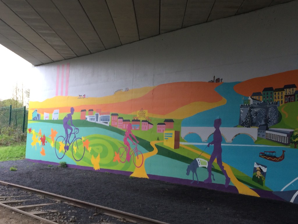
Much more welcoming than the N6 Bridge is the bridge a little further up at Garrycastle near Athlone I.T. with its colourful murals.
The murals at Garrycastle
There is a large Spar with a car park just off the Old Rail Trail at Garrycastle offering another good place to fuel up and it includes a reasonable deli and a place to sit down to eat. The trail is has lighting from here the whole way into Athlone town and will probably be the busiest section you will come to. It is only 2km from here to our end point at the White Gates.
Old Garrycastle Bridge with the new one behind it.
We pass Athlone GAA Club as we reach our destination at the White Gates after travelling the 40km from Grange Bridge at Mullingar. For the runners among you, add in the distance to Mullingar railway station and you will be looking a a nice marathon distance.
White Gates Athlone
When I did this journey last the White Gates marked the start/end of the Old Rail Trail but the plan is that this will continue on from here the whole way to Galway to make up the Dublin – Galway Cycleway. Westmeath County Council are certainly to be commended for having their part already done.
Given I started at the MGWR railway station in Mullingar I think it is only right that I should mention the old MGWR railway station in Athlone. Only 600metres from the White Gates the old MGWR railway was joined by it the GS&WR railway coming from Hueston where crossed the Shannon together on the Shannon Railway Bridge before the MGWR Railway Station on the west bank of the river. The old station now serves as Irish Rail offices and stores while the GS&WR Railway Station on the east bank is the passenger station for Athlone. From there locomotives from both companies steamed west to Galway.
My posts about the Royal Canal Greenway can be linked to below:
The Royal Canal Greenway has been officially launched today 24th March 2021, by Minister for Transport Eamon Ryan and Minister for State Malcolm Noonan.
Information, photos and guides for the entire length of the Royal Canal Greenway including the Longford Branch as well as information on the Lough Owel Feeder, the Old Rail Trail and the towpath from Spencer Dock to Maynooth can be found throughout this website. I hope you find it informative as you explore this amazing amenity. Take a look at the video here: