Categories
Royal Canal

Cycling on the Old Rail Trail: Mullingar to Athlone

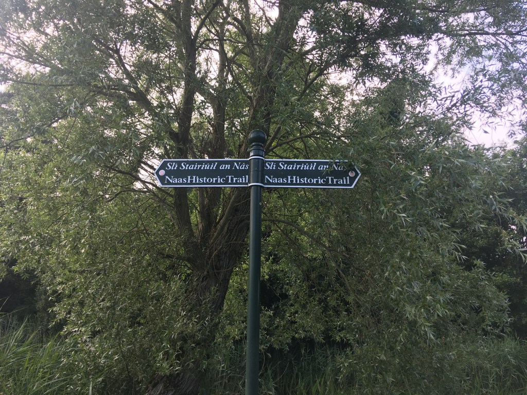
Given how intertwined the history is between the Royal Canal and the Midlands Great Western Railway (MGWR) I think it would be remiss of me not to put up a post about the old MGWR Mullingar to Athlone railway line which has been converted into an amazing 40km greenway called the Old Rail Trail which is entirely in Westmeath.

Image of the Midland Great Western Railway Company Crest from the Model Railway Museum in Malahide

I previously discussed running the Old Rail Trail from Athlone to Mullingar here but in the context of my series of guide posts of the Royal Canal I will revisit the topic here starting in Mullingar. A quick history lesson will tell you that the MGWR was incorporated in 1845 and at its peak was the third largest railway company in Ireland after Great Southern & Western Railway (GS&WR) and Great Northern Railway of Ireland (GNR). The MGWR bought the Royal Canal with the aim to build a railway to Mullingar and onward to Longford. Construction of the railway began in January 1846 and reached Mullingar in 1848.

Plaque marking the 150th Anniversary of the opening of Mullingar Railway Station

There was a rivalry between the MGWR and the GS&WR to reach Galway first and so it was that the MGWR extended their line from Mullingar to Athlone and onward to Galway, capable of running trains from Dublin to Galway from August 1851. It would be another 8 years before GS&WR reached Athlone and from that point on used the already laid MGWR line west.

Centre Platforms and shelters on the Sligo Line of Mullingar Train Station

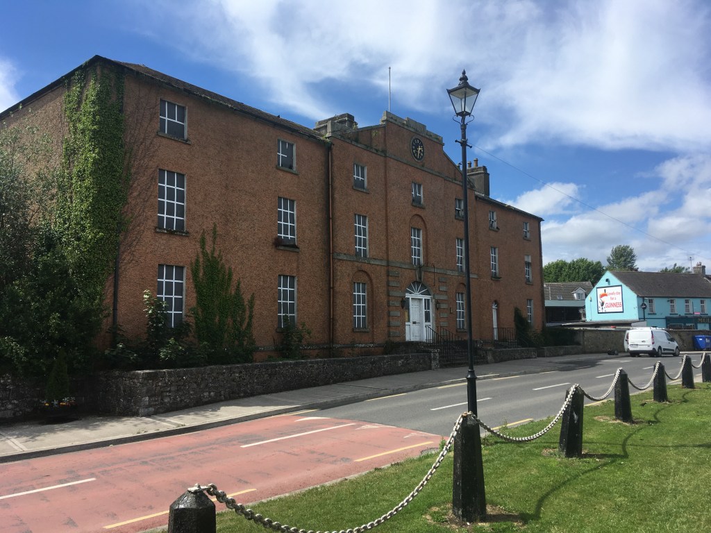
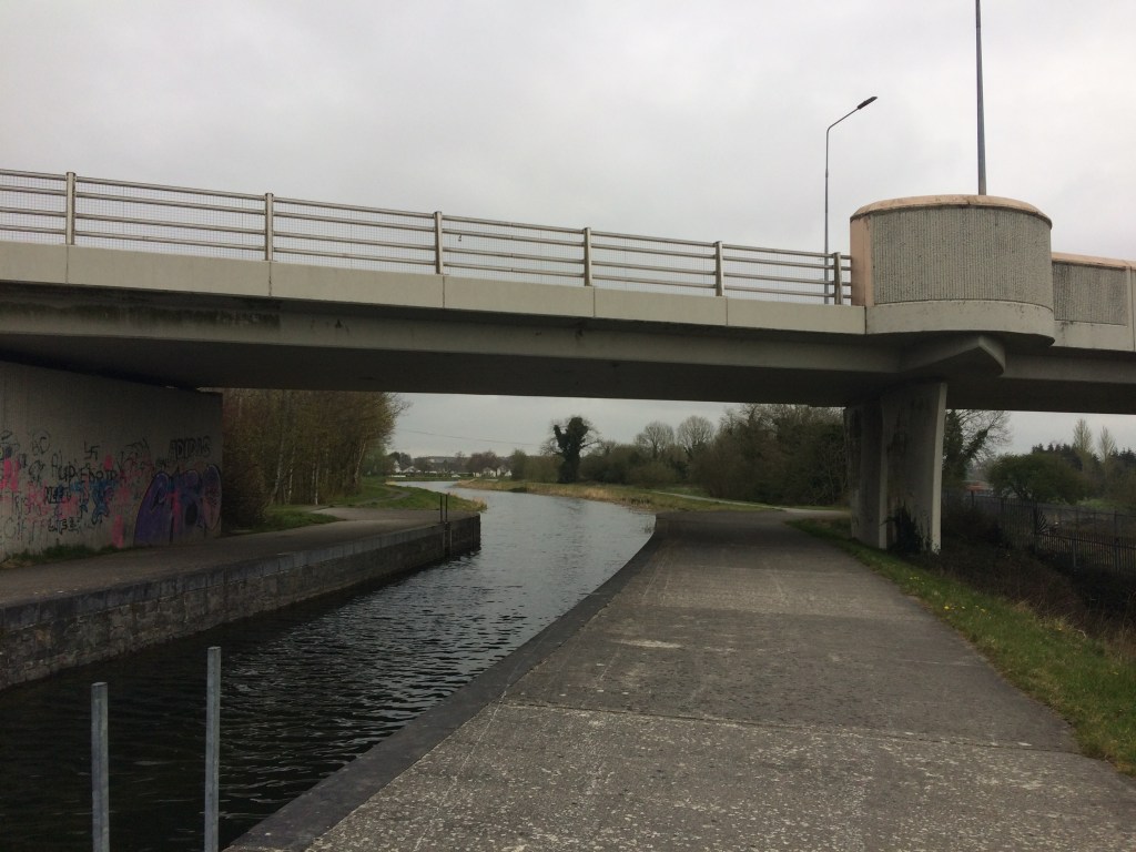
Starting at Mullingar Railway Station, the platforms and shelters of the old Athlone line are no longer in use or accessible. They sit around the far side of the station building and can only be viewed from inside. Also visible from the station building is the Signal Box on the Dublin side which commands view of both the Athlone and Sligo lines as they part either side of the station. The Athlone line through the station is still in place as far out as the railway sheds and workers terrace passing over a bridge immediately after the station. These sheds were used by the Railway Preservation Society of Ireland in the restoration of Great Southern & Western Railway Locomotive No. 184. This locomotive went on to be used in the filming of The First Great Train Robbery starring Sean Connery and Donald Sunderland where many moving scenes were shot on the Mulligar to Athlone railway line. No. 184 is on display at Whitehead Railway Museum in Co. Antrim. There is also the remains of a turntable out by the railway sheds. The workers terrace was also the location of a true crime in 1869 when it was reported that the then Station Master Thomas Anketell was shot and murdered and a newspaper article about the incident can be found here.

Old Rail Trail map near Grange Bridge

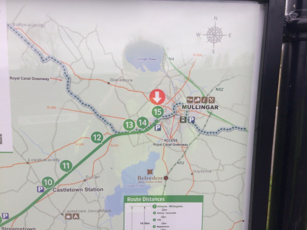
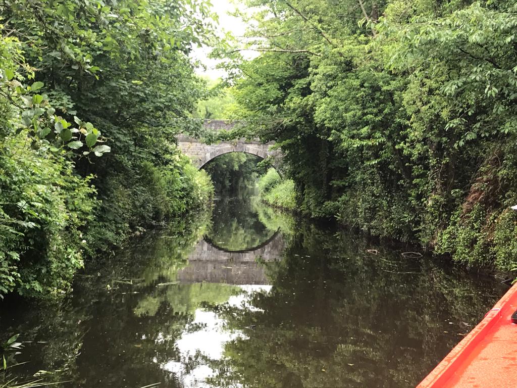
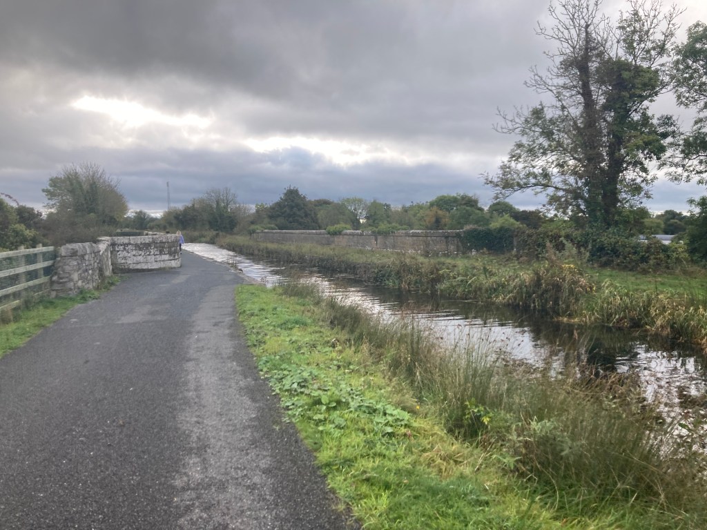
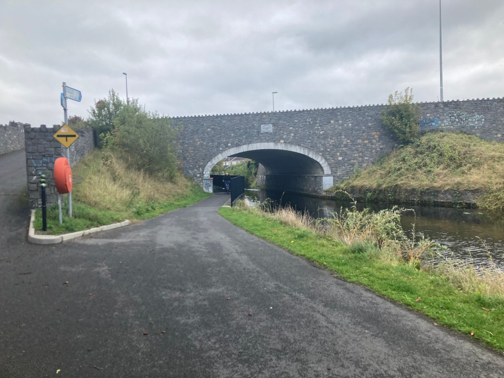
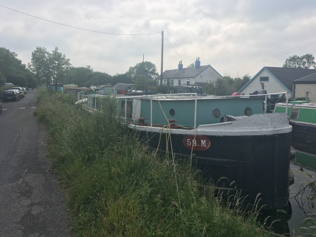
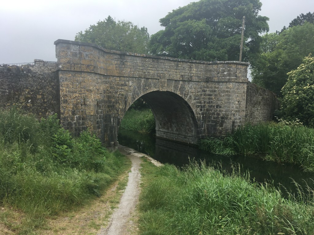
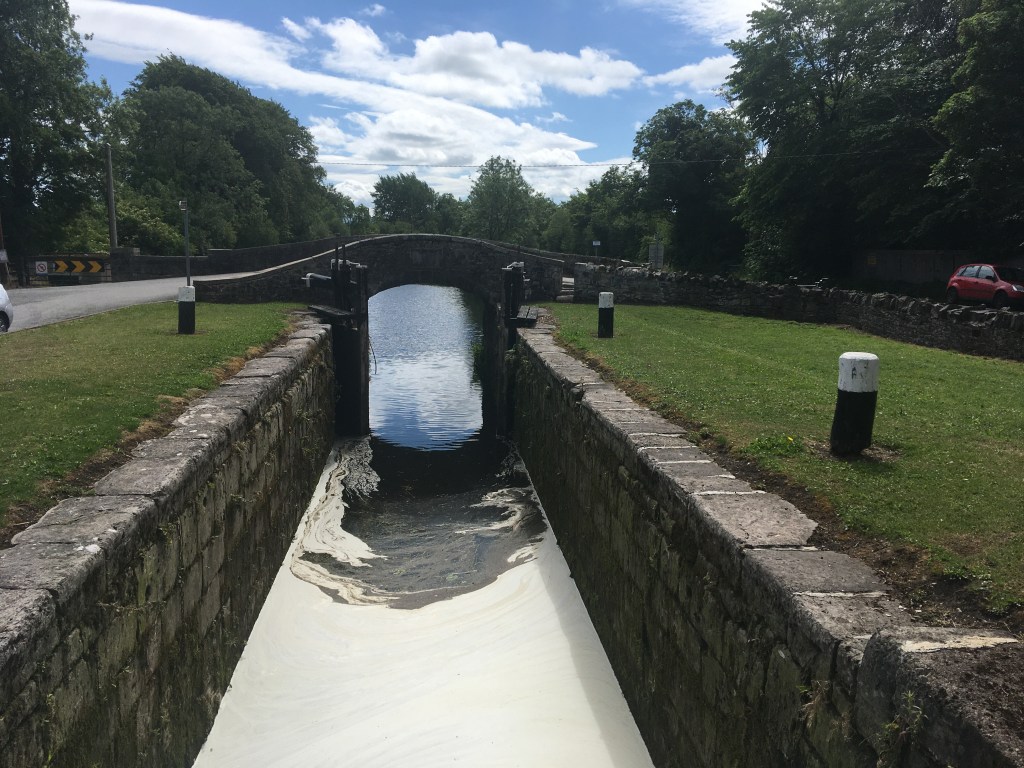
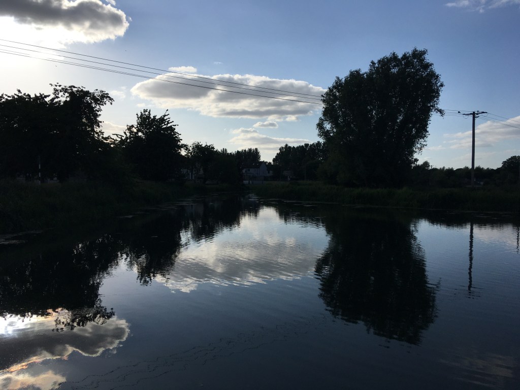
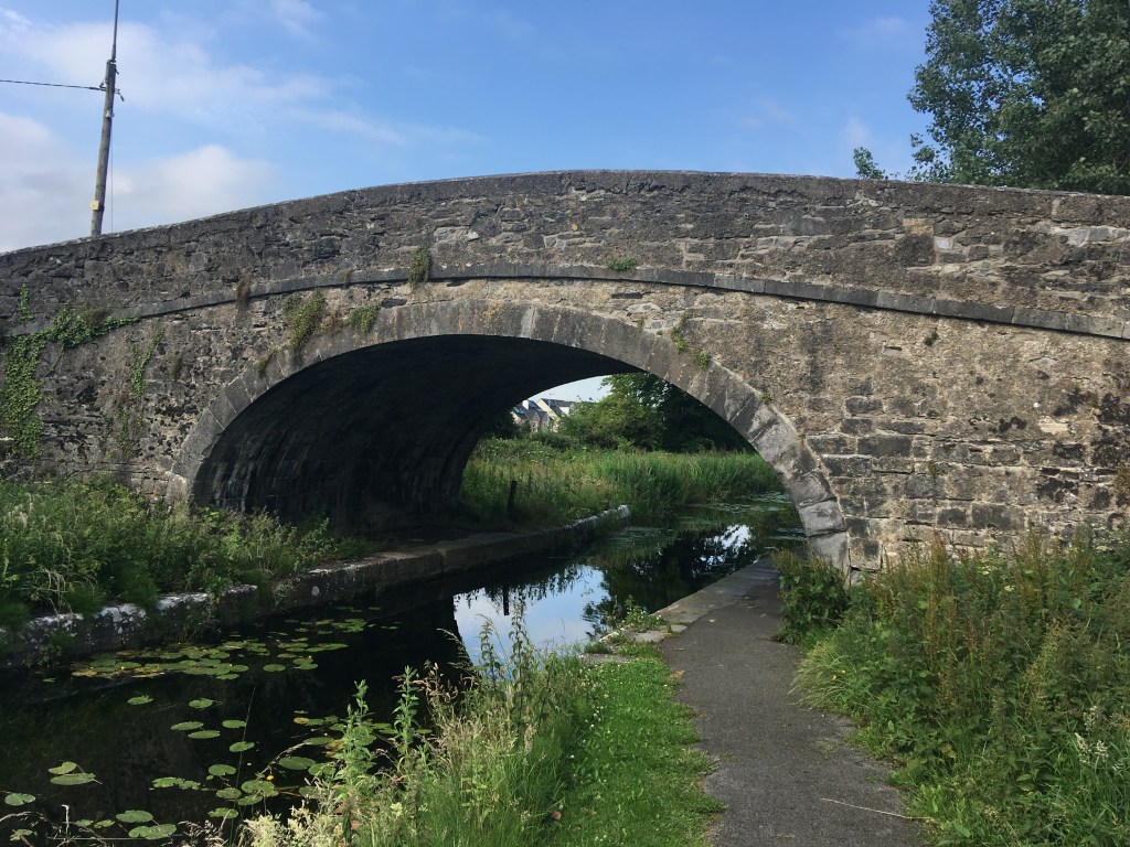
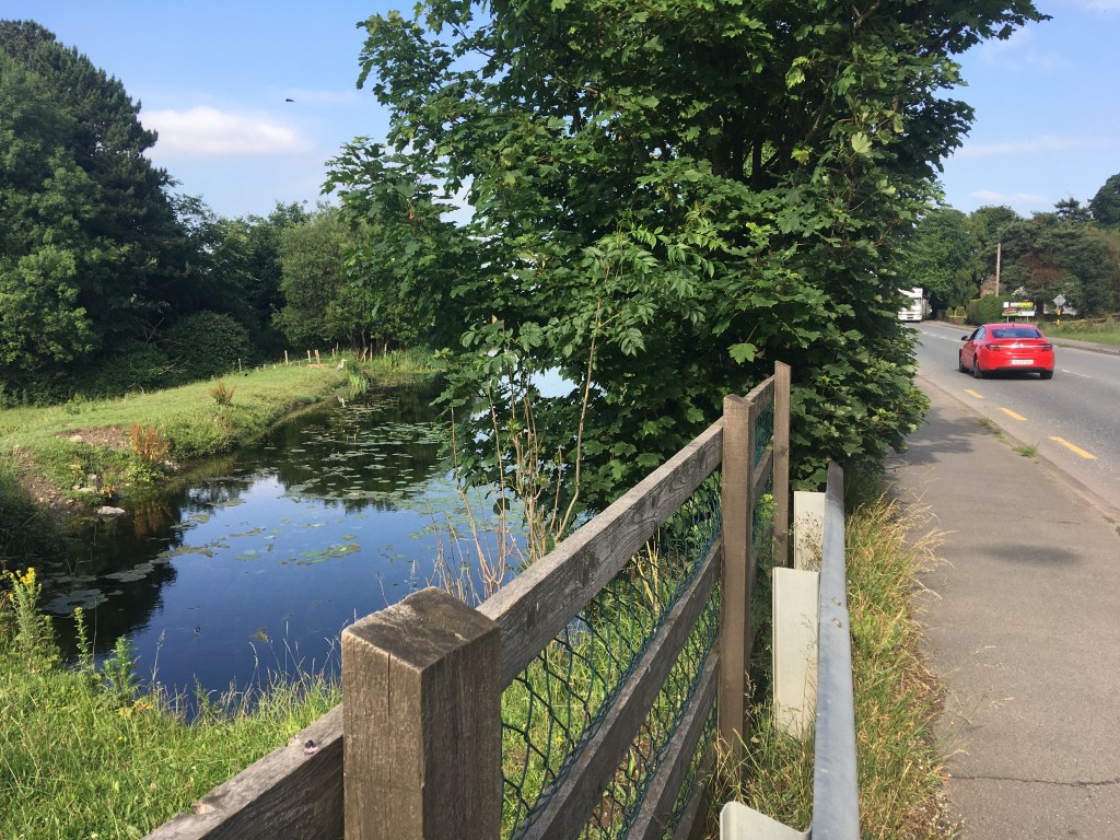
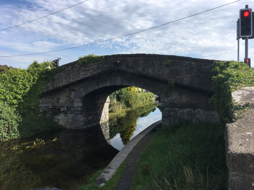
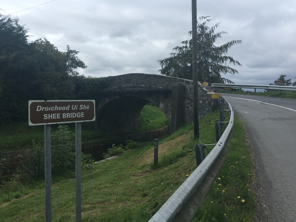
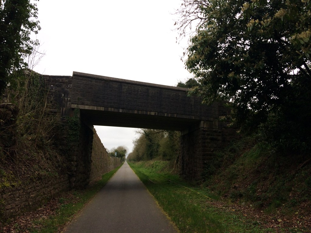
Unfortunately while we can view the sheds from a distance or on Google Maps we are unable to go directly by them so to access the start of the Old Rail Trail it is best to exit the station onto the Royal Canal Greenway and head west as far as Grange Bridge which was described by the late Dick Warner as like having the legs of a Mullingar heifer. Alternatively there is an Old Rail Trail car park adjacent to Grange Bridge on the south side of the canal.

Grange Bridge looking east.

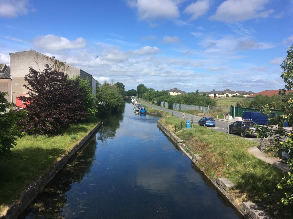
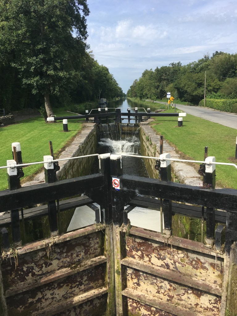
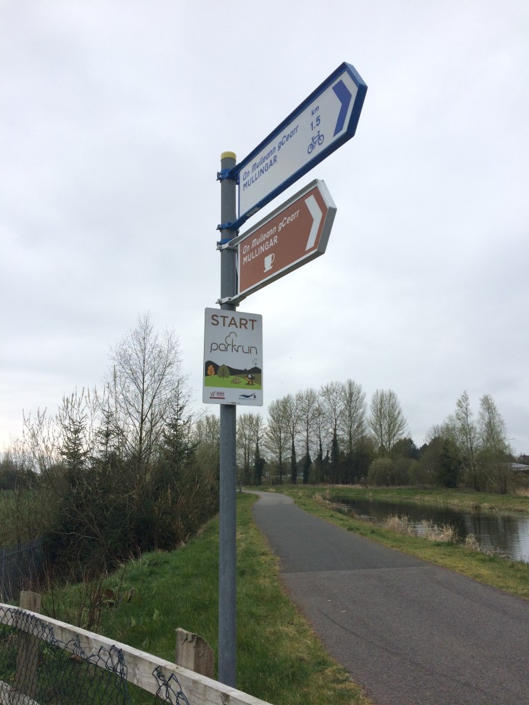
Just after passing Grange Bridge you will see that the Royal Canal Greenway splits in two. On the right you stay with the canal and the route as far as Coolnahay is described in my post here and on the left is the start of the Old Rail Trail. You will also see the start sign of Mullingar parkrun at the Y of the two greenways.

Mullingar parkun Start sign at the split between the Royal Canal Greenway and the Old Rail Trail

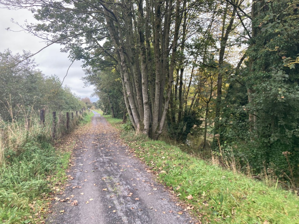
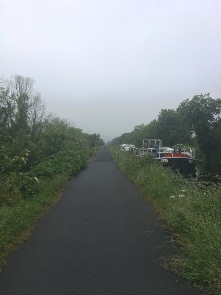
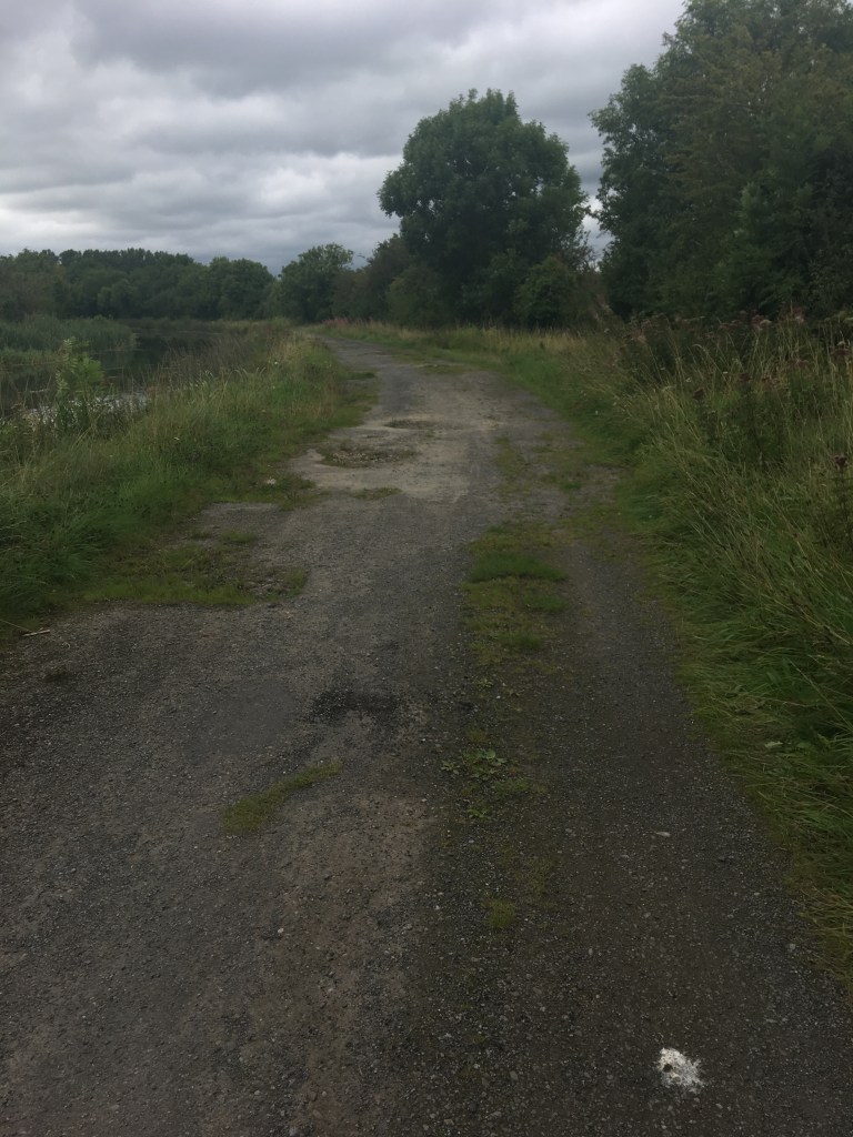
As you start moving west on the Old Rail Trail you will notice it is a smooth tarmac surface unlike the dust stone used on the Royal Canal Greenway. This tarmac surface is used the whole way to Athlone and as such makes it the perfect surface for a smooth cycle. Passing the industrial estate on the left you will notice the remains of a railway platform which was used to serve the Mullingar Racecourse at Newbrook. From what I can gather from Railscot’s record of Irish Stations the platforms operated from 1902 to 1962.

Signal Cable Pole along the trail

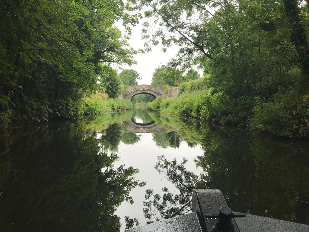
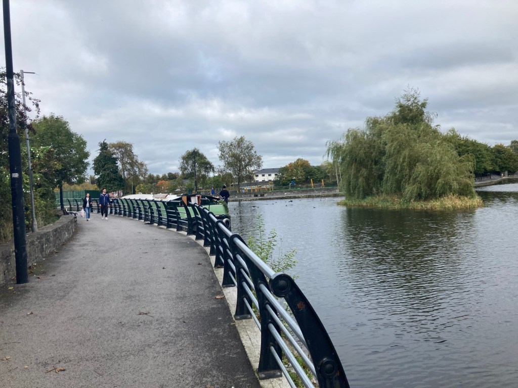
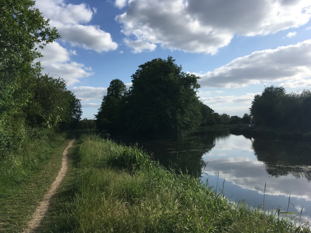
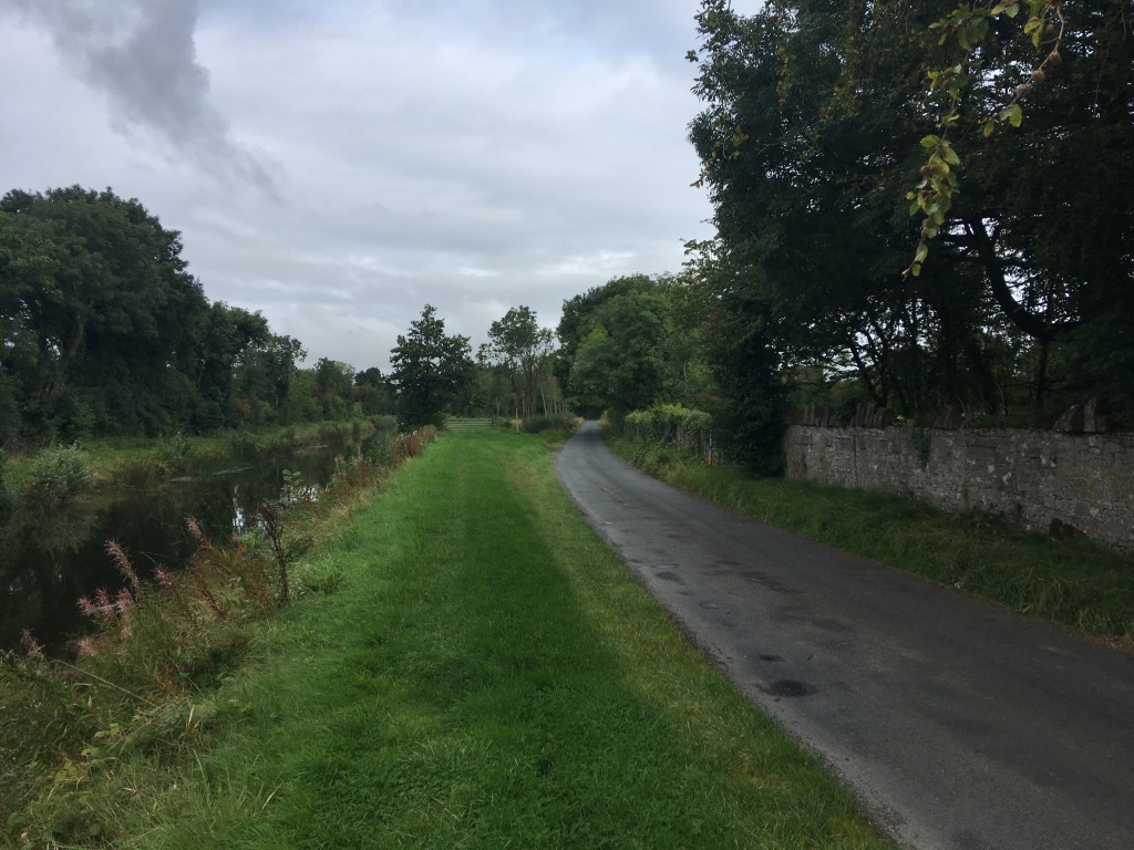
The Royal Canal Greenway and the Old Rail Trail run parallel to each other for roughly 3.5km from Grange Bridge out to Ballinea. The parkrun course is made up of an out on the canal and a return on the Old Rail Trail. Close to Kilpatrick Bridge over the canal there is also a squared off bridge over the trail.

The high wall at the road bridge over the trail at Kilpatrick

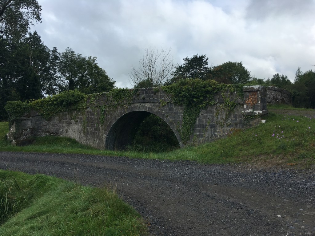
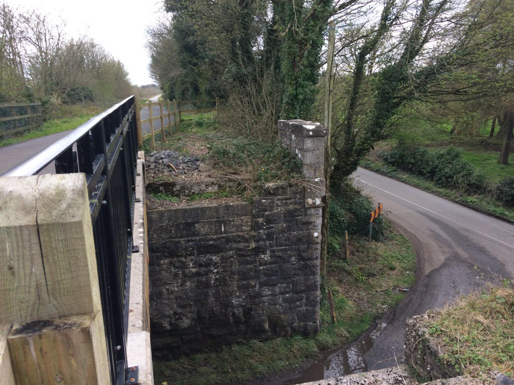
Not far beyond Kilpatrick Bridge we come to the last link to the Royal Canal Greenway where the parkrun turns to go back to its finish. Just beyond that is also the last MGWR bridge that is abutted to an older Royal Canal bridge at Belmont Bridge. There is a small shop in Ballinea which you can get to by taking the Royal Canal here. If you haven’t come with supplies I would suggest taking the time to stop here and get something as Moate is the next location where you really have an opportunity to get anything.

Looking towards Mullingar at Belmont Railway Bridge

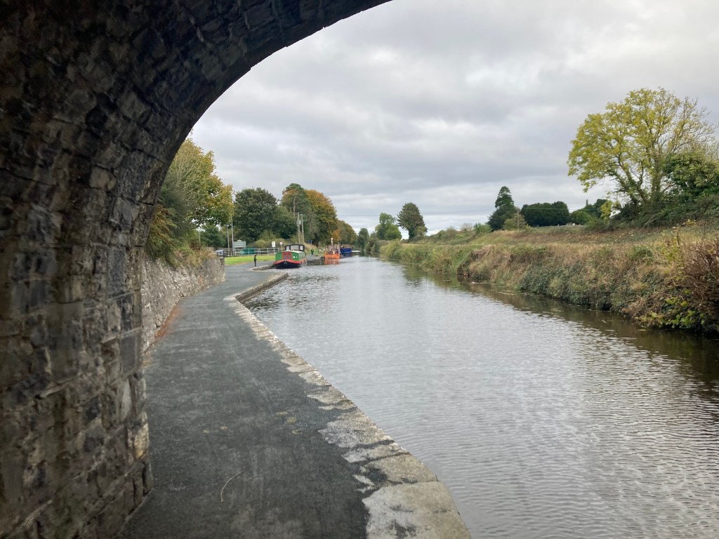
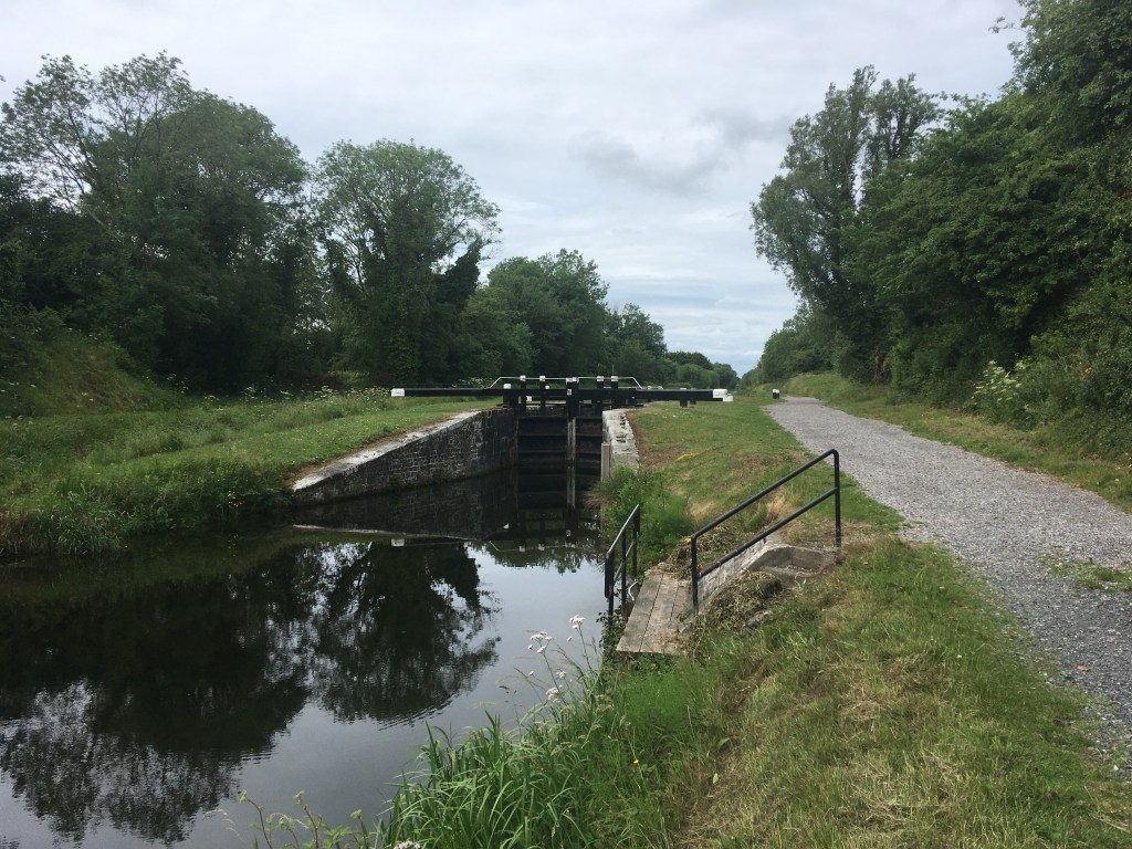
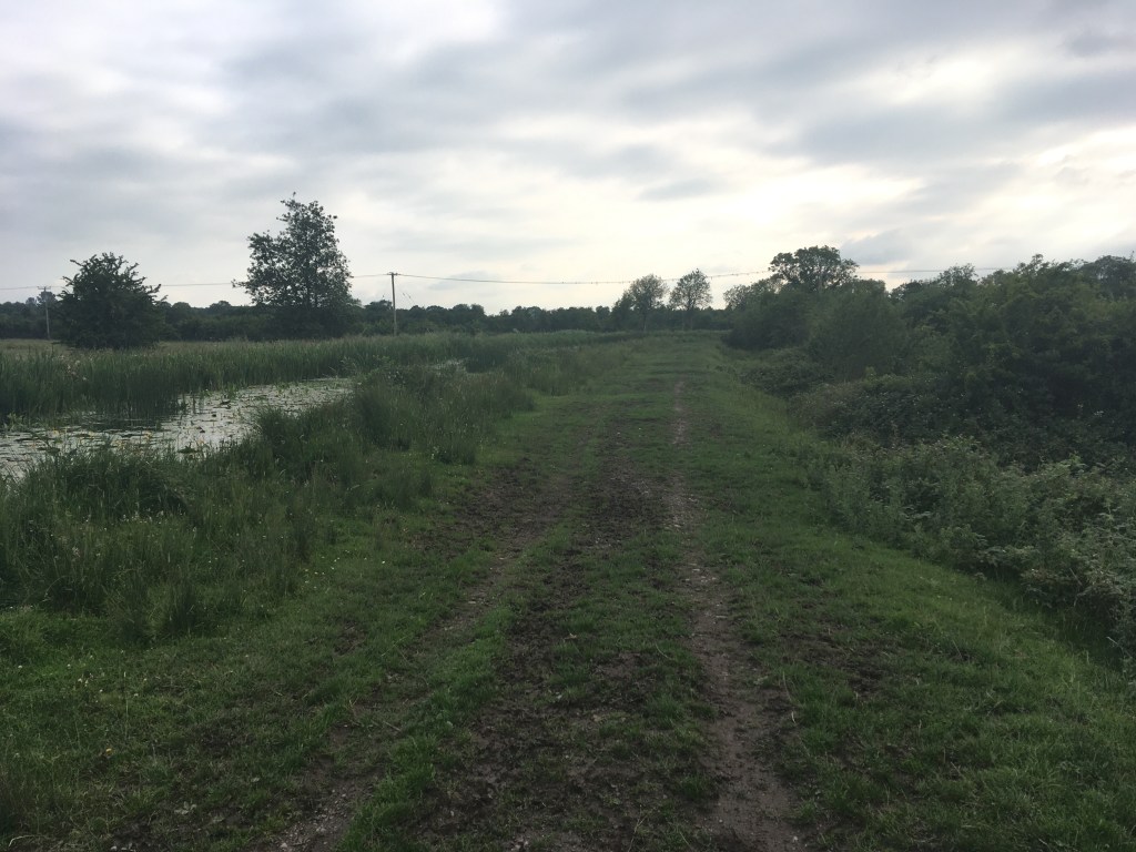
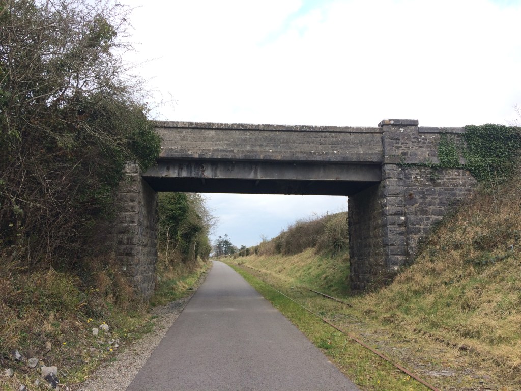
As can be seen in the above photo, the Old Rail Trail only takes up about half the surface available to it as it was once a double line track and as a result there is the remains of one of the tracks for the majority of the distance to Athlone to remind us of the proud rail heritage that the trail is built on.

Old Railway Signal near Castletown

At Ballinea we pass a private residence that was most likely originally built as railway workers cottage. We have left the old world of the canal now, the familiar sights of Locks, Keeper’s Cottages and humpback bridges are replaced with the railways own take on engineering with workers cottages, stations, water towers and sheds all to come.

Short tunnel just west of Ballinea

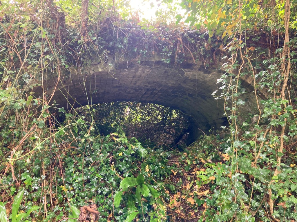
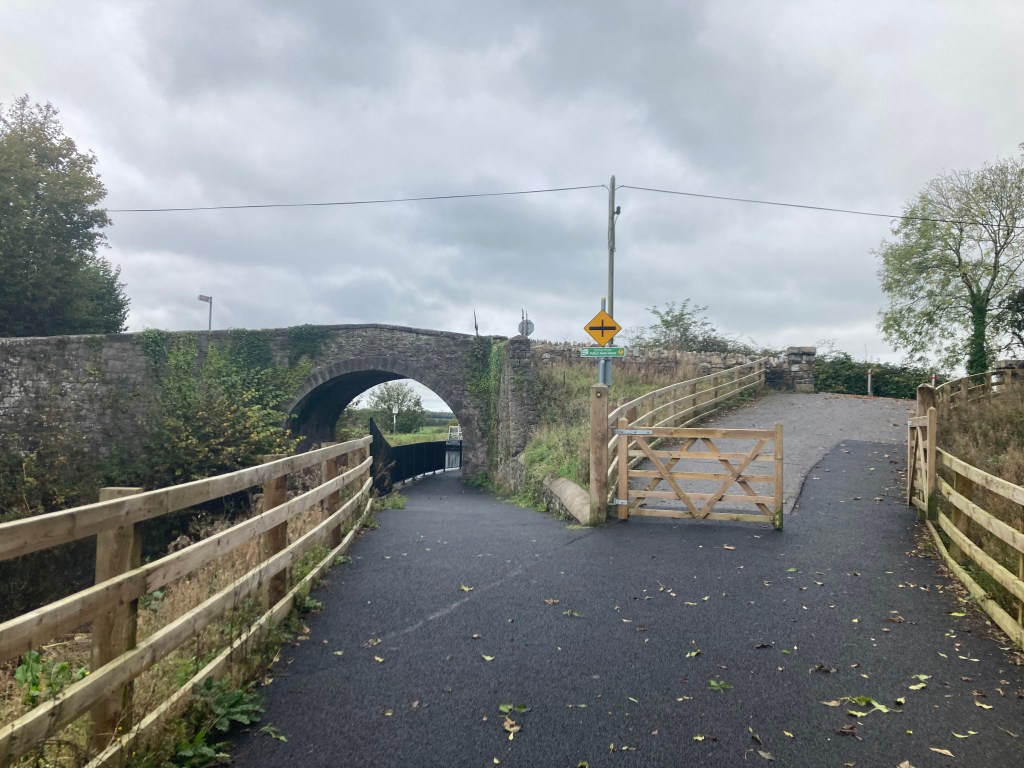
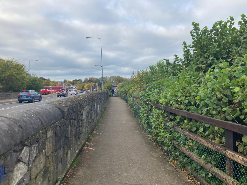
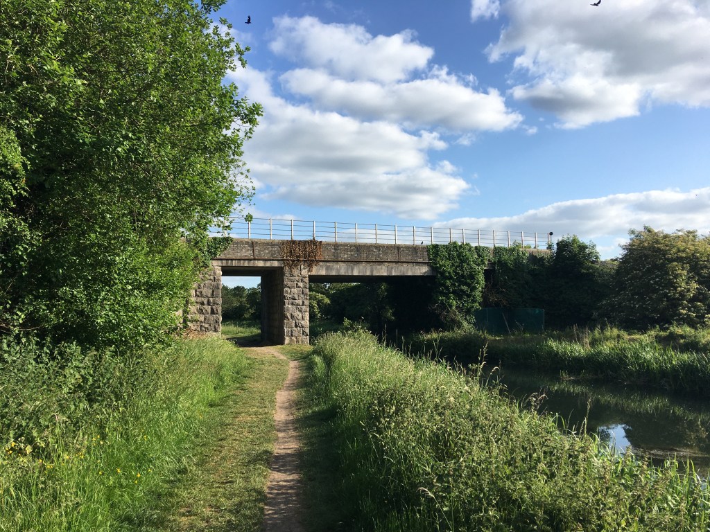
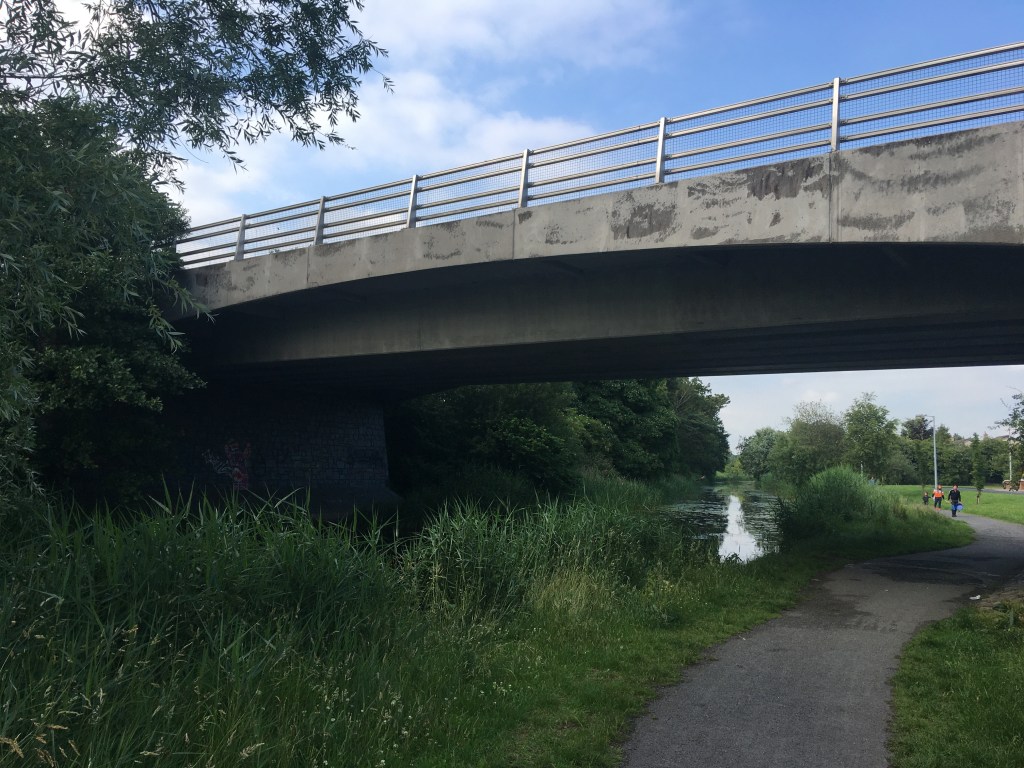
Not far west of Ballinea we pass through the closest thing to a tunnel the Old Rail Trail has. As we move further west in what is nearly a straight line we both go over and under many bridges alternating between the roads going over and under the railway. Unless they have some key relevance though I will only mention the bridges we pass under as it is near impossible to take a worthwhile photo of a bridge when standing on top of it.

Wall and bridge alongside Barrettstown House

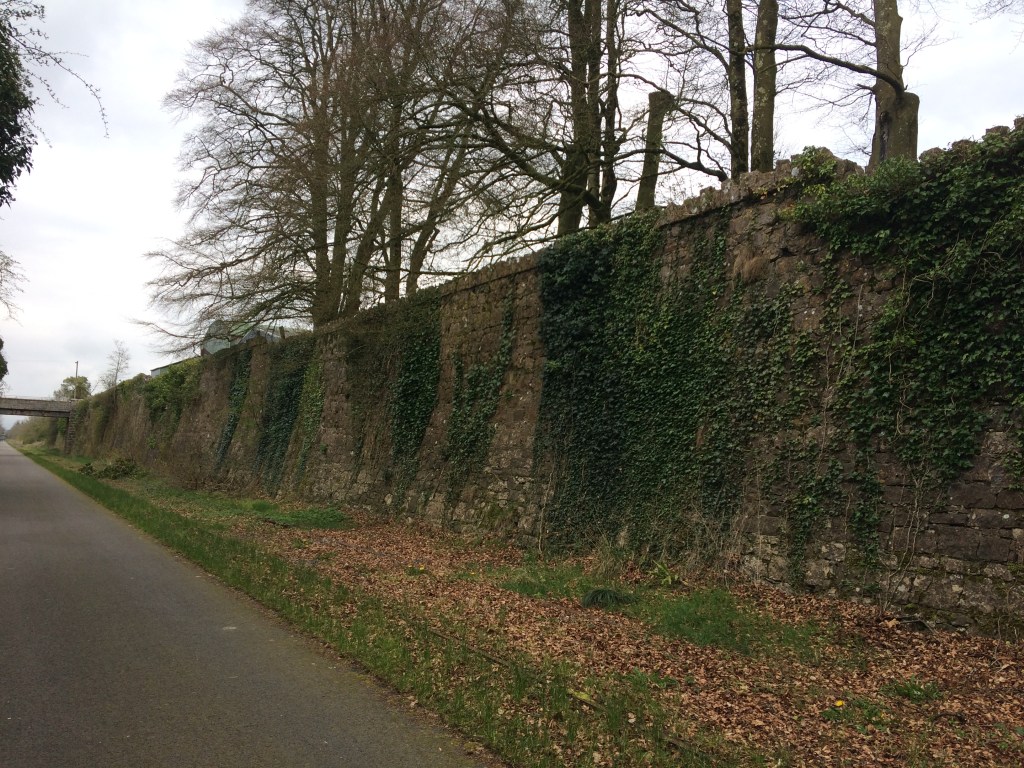
It is interesting as we move across the landscape how the railway would have cut through the land in places like at Barrettstown where high walls flank us on either side to soaring high above the farmland at other points affording us views as far as the eye can see, not to mention a wind that can cut you on a cold day so a reminder to always be prepared.

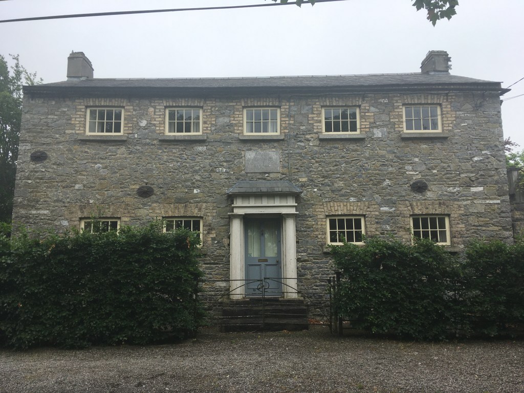
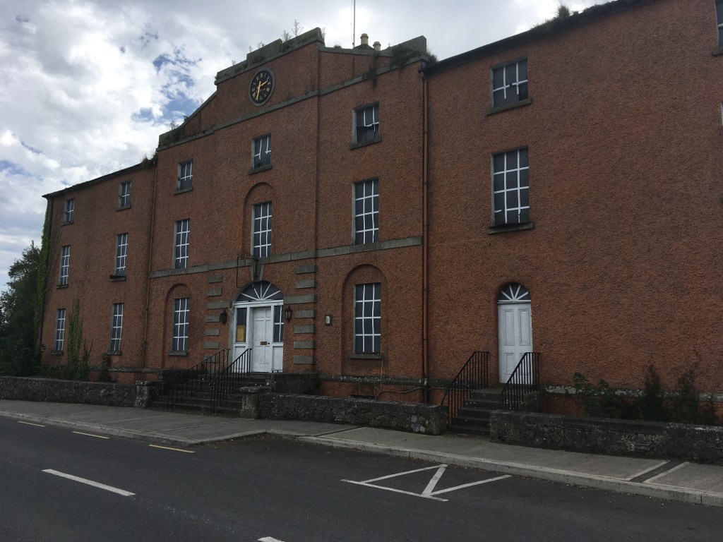
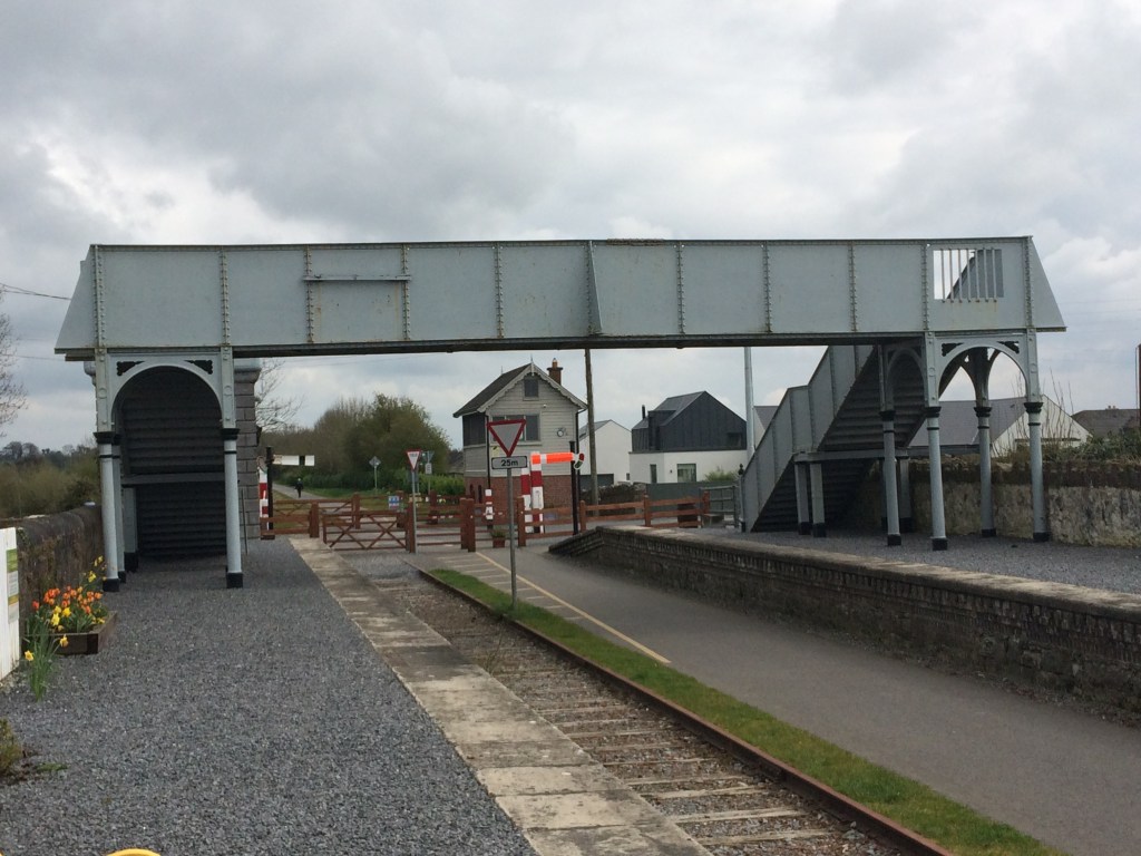
3.5km from Barrettstown we come to what was Castletown Station which was open from 1851 until 1987. The first thing to greet us is the magnificently restored signal box. Behind the signal box is Ard Na Greine, a Victorian house and former dispensary. Crossing over the road we come to the station and its platforms.

A dark eerie image of the remains of the Gate Keeper’s Cottage at Castletown.

The Castletown Station is now a private residence on the northern platform but the southern platform does offer picnic benches for those passing by. As mentioned previously it is important to bring your own supplies on this trip, however, Castletown Geoghegan has a shop in it 2km south along the road if you need it.

Castletown Station in the left with the Signal Box in the background.

Though boarded up the remains of a platform waiting room faces the station on the southern platform and to complete the station set there is the remains of a goods shed just west of the platforms as you are leaving.

Castletoewn Goods Shed

Leaving Castletown behind us we head towards an area known as Killeen and the area around Jamestown Court, with its Gate Lodge adjacent to the bridge over the railway which acts an entrance into the estate and its folly. Unfortunately the splendour of Jamestown Court cannot be seen from the Old Rail Trail as it is cut into the land below it.

Bridge at Killeen near Jamestown Court

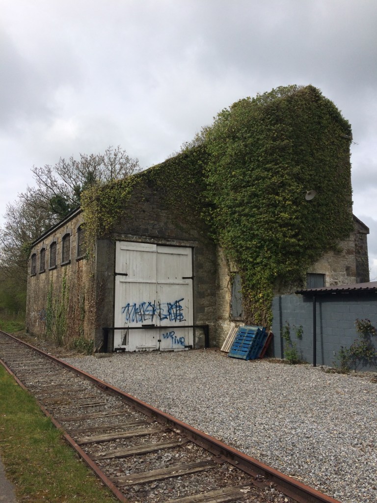
Just short of 4km from Jamestown Court we come to Streamstown Junction and its old station which opened in 1851 and closed in 1963. MGWR had a railway from Streamstown linking to the GS&WR at Clara via Horseleap. Horseleap was open from 1876 to 1947 with the line permanently closing in 1965. The MGWR station in Clara operated from 1866 to 1925 but what was the GS&WR station is still open on the line between Tullamore and Athlone.

Streamstown Station (under renovation?)

Streamstown is located nearly half way along the Old Rail Trail, 17km from Mullingar and 23km to Athlone. The last time I passed (April 2019) there was an open air museum dedicated to old farm machinery on the northern platform.

Some of the farm machinery on the northern platform

The station building itself was also covered in scaffolding. I have heard rumours that it was being done with the intention of opening a cafe in it. This would be a fantastic point along the route for one but I have no definite source for such a comment so only time will tell. The work may just be preservation work. The station also has the remains of a few other buildings including a small goods shed and a waiting room.

Waiting Room at Streamstown Station.

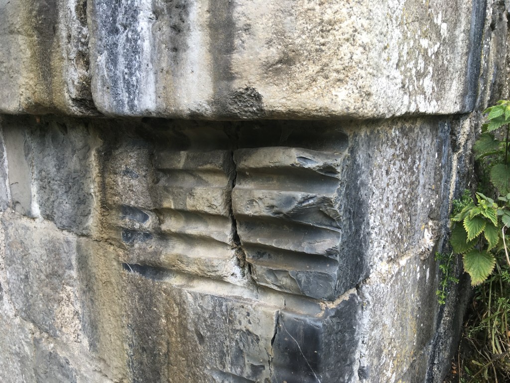
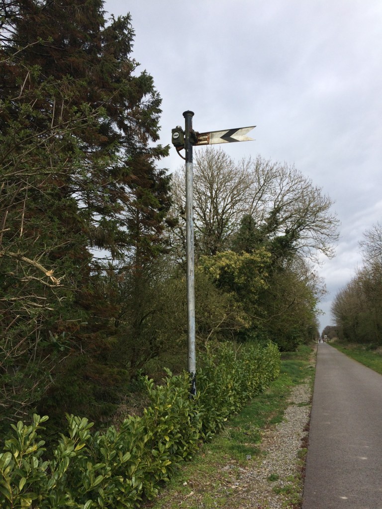
Apart from the obvious railway and buildings along the route, many other things associated with the railway also remain. These include mile markers, signals and cable polls.

Mile Marker 65 3/4. The shape of the marker indicates if it was a full, 1/4, 1/2 or 3/4 mile. A square being a full mile, a square turned 45 degrees a 1/4 mile, triangle being a half mile and the above ‘V’ being 3/4 mile.

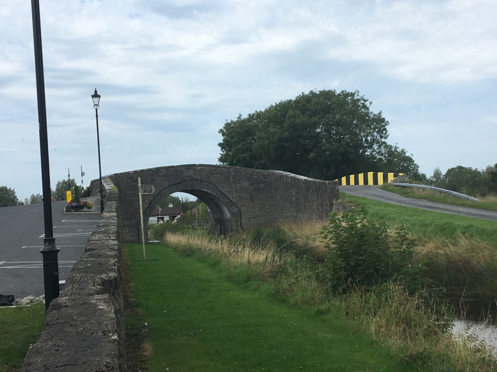
At certain points along the trail you cross over older bridges that once carried the railway over the road below but have not endured the test of time as well as others. Not far past Streamstown is one such example where the trail narrows slightly where the old bridge that once carried two lines has been fixed up just to safely carry the trail.

View of an old bridge that has been repaired and modified to carry the trail

Not all the bridges we come to are built of the familiar limestone that we are used to along the canal. The next bridge up at Derryhall has a heavy metal work span over the trail, crossing at an angle rather than straight on.

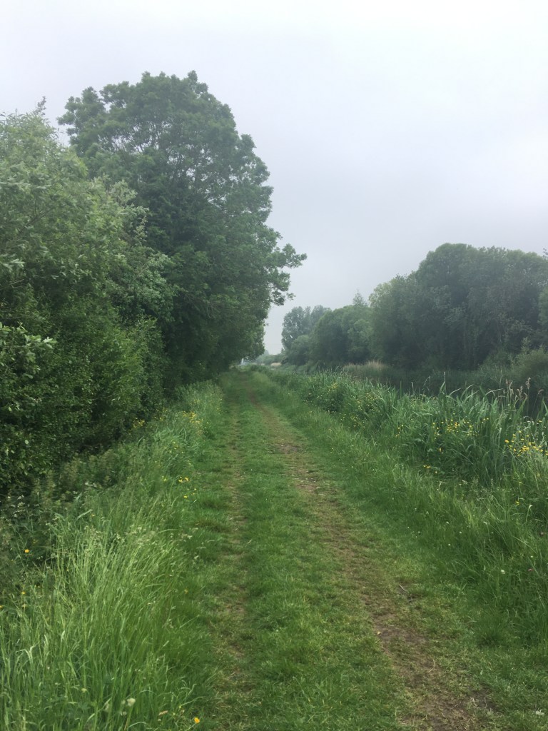
It is an 11km stretch of open countryside between Streamstown and Moate and while it would be wrong to say it is flat, saying it is made up of rolling hills would not be fair either. Exposed at times, this rural area is quite a pleasant place to transit through dotted with little more than farmhouses, sheds and bridges.

Not too far after passing under the bridge at Grange we come to the largest urban settlement along the Old Rail Trail, the town of Moate.

Plaque marking the opening of the Athlone to Mullingar Cycleway at Moate Station in 2015

Moate railway station opened in 1851 and closed in 1987. Like Castletown there are a large number of railway associated buildings and structures remaining as we pass through the station between the old platforms.

Moate Station with Shelter on the right

Moate is a great little town to stop off in and get some lunch with plenty on offer to suit all tastes and budgets. Right beside the train station you will see signs pointing you to the Moate Golf Course Restaurant. If you rather venture into the town a little you will find the coffee shop at the Tuar Ard Arts Centre and of course you can never go wrong with at curry cheese chips at Supermacs. There is also a Centra and a SuperValu not far from the station for whatever supplies you may need.

Old Rail Trail Distance Signs at Moate

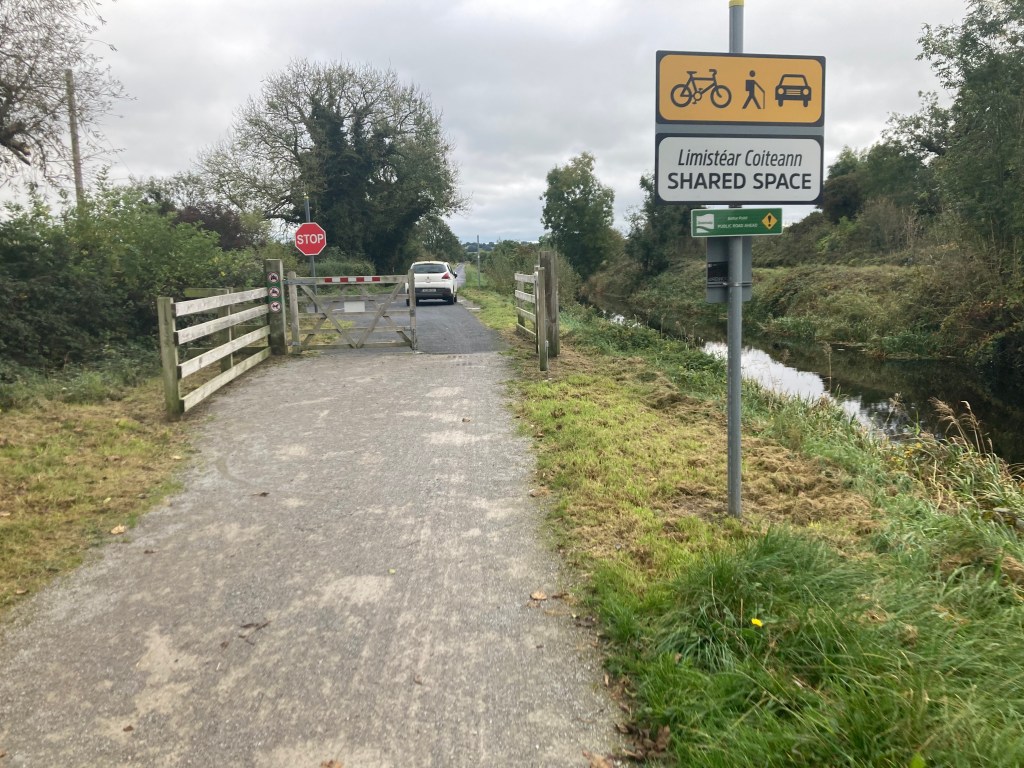
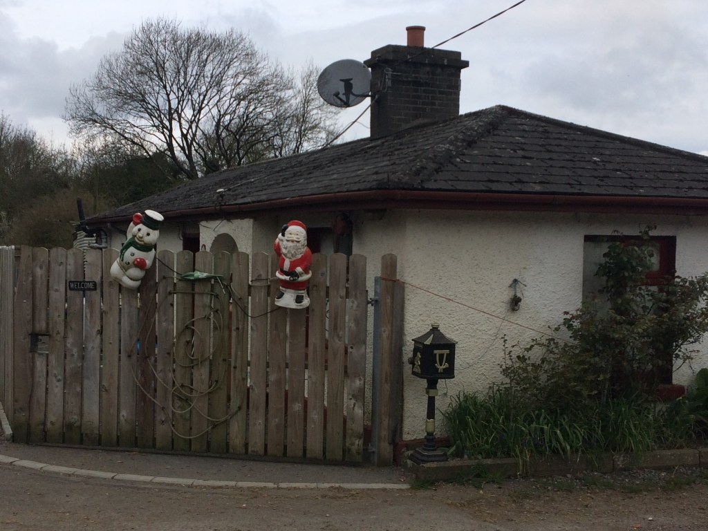
Leaving Moate behind us we only have another 12km to go to get us to Athlone. Not far from the station and still withing the town limits we come to Jones Crossing where the old Gate Keeper’s Cottage is now a private residence and the crossing gates are still in place.

Gates at Jone’s Crossing

Further west again we come to another level crossing at Magheramore where once again the Gate Keeper’s Cottage has been retained as a private residence.

Gate Keeper’s Cottage at Magheramore

The section between Moate and Athlone is very people with the residents of both towns to get out and get some exercise in both directions. There is a car park located for Greenway users at Tully Bridge about half way between the two towns.

Car park and access at Tully

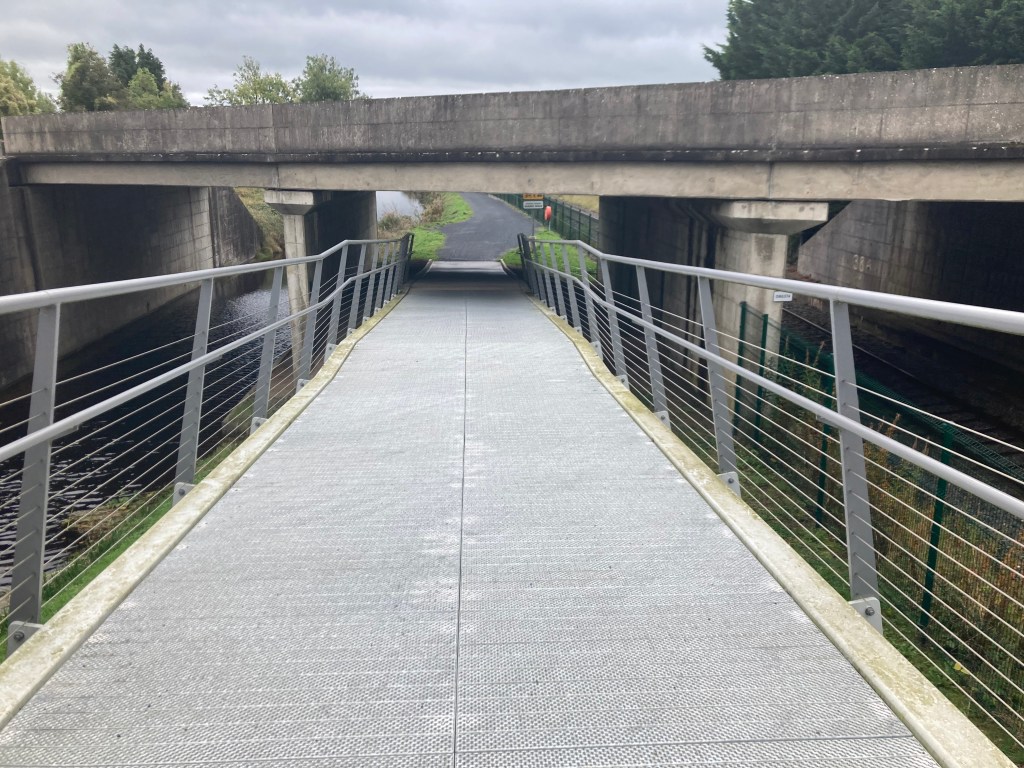
You are met on the outskirts of Athlone by the bridge carrying the N6 over the Old Rail Trail on its way to Galway from Dublin, the modern passing over the old, the rushed passing over the leisurely.

N6 Bridge east of Athlone

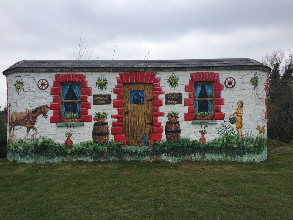
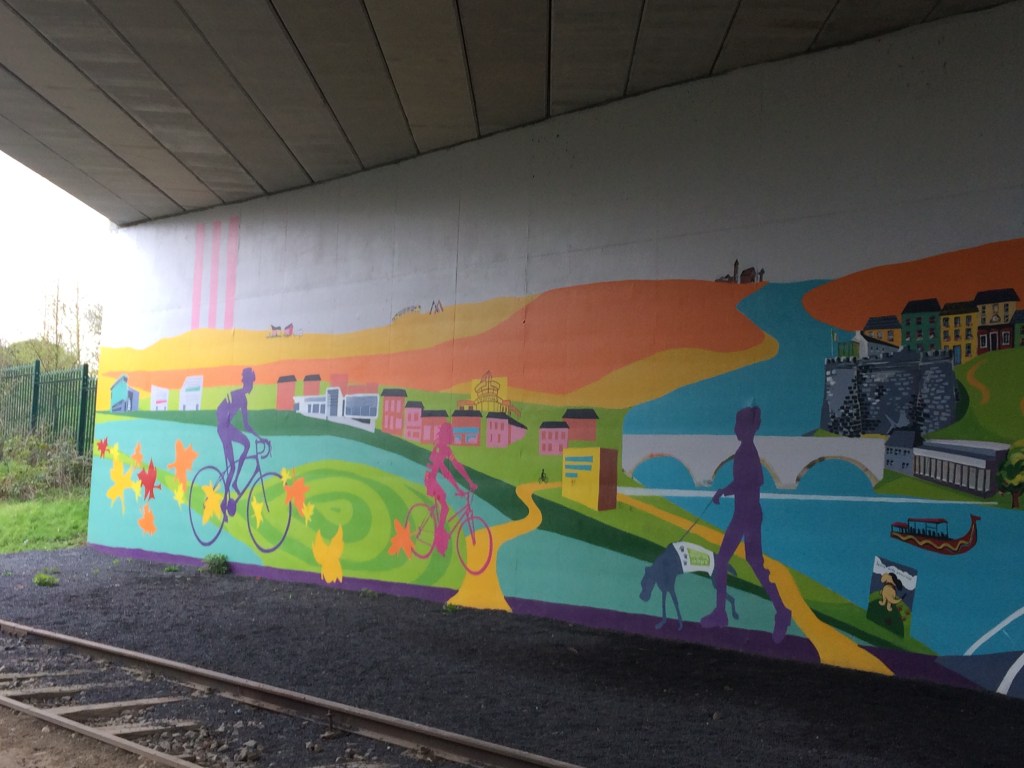
Much more welcoming than the N6 Bridge is the bridge a little further up at Garrycastle near Athlone I.T. with its colourful murals.

The murals at Garrycastle

There is a large Spar with a car park just off the Old Rail Trail at Garrycastle offering another good place to fuel up and it includes a reasonable deli and a place to sit down to eat. The trail is has lighting from here the whole way into Athlone town and will probably be the busiest section you will come to. It is only 2km from here to our end point at the White Gates.

Old Garrycastle Bridge with the new one behind it.

We pass Athlone GAA Club as we reach our destination at the White Gates after travelling the 40km from Grange Bridge at Mullingar. For the runners among you, add in the distance to Mullingar railway station and you will be looking a a nice marathon distance.

White Gates Athlone

When I did this journey last the White Gates marked the start/end of the Old Rail Trail but the plan is that this will continue on from here the whole way to Galway to make up the Dublin – Galway Cycleway. Westmeath County Council are certainly to be commended for having their part already done.

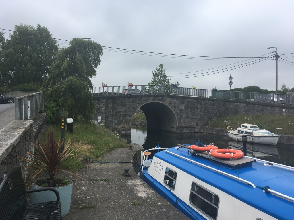
Given I started at the MGWR railway station in Mullingar I think it is only right that I should mention the old MGWR railway station in Athlone. Only 600metres from the White Gates the old MGWR railway was joined by it the GS&WR railway coming from Hueston where crossed the Shannon together on the Shannon Railway Bridge before the MGWR Railway Station on the west bank of the river. The old station now serves as Irish Rail offices and stores while the GS&WR Railway Station on the east bank is the passenger station for Athlone. From there locomotives from both companies steamed west to Galway.

My posts about the Royal Canal Greenway can be linked to below:

Part 1: North Wall to Cross Guns Bridge

Part 2: Cross Guns Bridge to Castleknock

Part 3: Castleknock to Leixlip Confey

Part 4: Leixlip Confey to Maynooth

Part 5: Maynooth to Enfield

Part 6: Enfield to Thomastown

Part 7: Thomastown to Mullingar Harbour

Part 8: Mullingar to Coolnahay

Part 9: Coolnahay to Ballynacargy Bridge

Part 10: Ballynacargy to Abbeyshrule

Part 11: Abbeyshrule to Ballybrannigan

Part 12: Ballybrannigan to the 41st Lock

Part 13: 41st Lock to Richmond Harbour

Part 14: The Lough Owel Feeder

Part 15: The Longford Branch

Categories
Royal Canal

Cruising on the Royal Canal: Travelling through the Deep Sinking by Barge

Running the length of the Royal Canal in a single day is a fairly unique way to experience the joys of travelling along its banks. However, a promise I made to myself that mid-summers day in 2019 was that one day I would return to see the canal the way it is truly meant to be seen, to be experienced, from the water. It took me over two years to finally book a trip with Royal Canal Boat Trips and the charismatic skipper Jenny.

Jenny and her barge passing the Maynooth Swans and cygnets

2021 has certainly been the year of the Royal Canal. While the navigation itself fully reopened in 2010, 2021 has seen the launch of the Royal Canal Greenway, Ireland’s longest greenway, linking Maynooth to the Shannon at Cloondara with options to also travel the Old Rail Trail to Athlone or take the Longford Branch off the main line to Longford town. Following on from the launch of the greenway, RTÉ’s Nationwide also dedicated a weeks worth of their programming to exploring the canal with hosts Anne Cassin and Bláthnaid Ní Chofaigh starting at opposite ends and meeting each other in Mullingar.

While the Greenway has been getting the majority of the focus of late, the setting for my short cruise is the marvelous Deep Sinking, casting off from the 12th Lock in Castleknock and heading west through a true man made wonderland, largely untouched by development since its difficult and costly construction in the 1790’s.

Heading towards Granard Bridge and the Deep Sinking

I have already covered the Deep Sinking from the towpath on my page here but I think it is fair to say it is an area like no other on the Royal Canal for intrigue, controversy, expense and tragedy, all of which take on a much greater meaning when seen from the water rather than from the heights above.

Magical Reflections from the water of the Deep Sinking

Let me first start with the intrigue. Why was it that over 200 years ago the board of the original Royal Canal Company decided to deviate away from the surveys that told them that it would be more practical and cost effective to build the canal on a more northerly route rather than to dig and blast their way through a limestone quarry? As knowledge of history of the Royal Canal grows, many would now tell you that this was done at the behest of the William Fitzgerald, 2nd Duke of Leinster, a subscriber to the Royal Canal Company, so that the canal would pass alongside his country seat of Carton House, now a luxury hotel and golf course.

Tool marks at Kirkpatrick Bridge

Unfortunately with all the records of the original Royal Canal Company lost, it is not something I think we can ever be 100% sure of. That said the Deep Sinking was a mammoth undertaking in terms of cost and labour, taking several years to dig out of the hard rock. Fast forward to today and considerable attention has been drawn to the existence of 4 arches built into the south bank of the Deep Sinking between Kirkpatrick and Keenan Bridges. Awareness of these arches has gained traction through the Friends of the Deep Sinking Facebook group while their true function remains a mystery. My own personal thinking is that they were build to provide stability to weak parts of the towpath where the horses would have once pulled the barges through the Deep Sinking from a considerable height above the canal.

Arch hidden by overgrowth as seen from the barge

As Jenny navigates her daily charter back and forth along the Deep Sinking she has well established the location of the 4 arches. While I know exactly where 2 are from the towpath and have been down in both, one of them is definitely inaccessible from land and I think it was with sense of glee and adventure that she waited patiently to unveil another arch to the world from its mask and curtain of thorny overgrowth. As she stopped the barge alongside the arch pointing out its keystone and light coming through from the other side, it didn’t take any encouragement for me to clamber up the bank and see it from the inside.

Looking back at skipper Jenny and my wife from the arch

Of course now that I made my way up here, it was time to document what I found. The most startling object that caught my attention first was an old motorcycle helmet, lord knows how long that has been down there.

A motorcycle helmet found in the arch

So while I had a sense of adventure, it would seem I am not the only one to have been down here in recent years despite how inaccessible I think the place is. The arch itself is built of brick and is the width of the towpath it carries above.

Several bricks are missing and it can be seen how the arch is built into the bedrock below it.

Vegetation from above has caused some damage as roots have spread over years and a large root now sprouts out of canal facing side of the arch having forced some bricks free and splitting others around it.

Roots protruding out through the brickwork near the centre of the arch

Of course a structure like this is not something that should be kept secret or hidden, especially if we are to have any hope of it being preserved given its delicate condition. Jenny came prepared and passed me up a set of pincer shears which I was able to use to remove some of the curtain, allowing light flow in from the canal side so that passers-by on the canal can marvel at another wonder of the Deep Sinking.

The arch after its haircut, opened up for all to see

After getting my feet firmly back on the barge, we proceeded gently west again, stopping a short distance further at the site of an old well just before Keenan Bridge. While the well was dry you could see how steps had been fashioned down to it from the towpath and how a pipe had been installed so water could be taken from the well. It gave me an amazing sense of joy to be shown these things that I knew nothing of before, highlighting that no matter how often you pass through a place, there are always little treasures and secrets to find.

Well on the south back with small pipe at its base

It is at Keenan Bridge that we come to the tragedy I mentioned earlier. Sensitive souls can feel an eerie feeling of loss passing through the bridge, not far from where the sinking of the Longford passenger boat, with the loss of 16 lives happened in 1845. A better account than I can offer can be read on the Irish Waterways History website. A memorial plaque was erected by the Royal Canal Amenity Group on the bridge on the 150th anniversary in 1995.

Keenan Bridge as viewed from the Clonsilla side near the location of the sinking of the Longford passenger boat

From Keenan Bridge we headed for our turn around point just short of Callaghan Bridge at Clonsilla Train Station, a distance of 2.5 miles in about 90 minutes. This is the true pleasure of travelling by barge. When running I would expect to cover 9 miles in 90 minutes and would still think that I have taken in my surroundings but in reality I have missed so much and have a whole new appreciation for the Deep Sinking by taking the time to travel its waterway and conversing with those who have a shared love of the canal, its history and its heritage, each of us filling in a little bit of the rich tapestry that makes up the fascinating tale of its past and those who have gone before us, be they navvies, engineers, merchants or travellers.

Approaching the turn around point near Callaghan Bridge

I mentioned earlier that the Deep Sinking was also the site of controversy and expense. This started indeed with its construction in the 1790s and between making the Deep Sinking navigable and building the Rye Water Aqueduct in Leixlip, the Royal Canal Company had drained its financial resources barely getting out of Dublin, let alone making it to the Shannon. What followed was protracted funding requests to government allowing the canal be finished first to Kilcock in 1796, eventually on to Mullingar in 1806 before the company fell bankrupt after reaching Coolnahay around 1813. From there the canal was finished to the Shannon under the control of the Directors for Inland Navigation, finally being completed to Richmond Harbour in 1817.

The canopy above the Deep Sinking on a soft day

It seems this controversy continues on into the 21st century with the planning for the completion of the Greenway into Dublin from Maynooth and the intention of developers to build apartments very close to the canal bank. I cannot deny that I am an advocate for the completion of the Greenway and I hope that a solution that allows that completion can be found, however I am very mindful that the Deep Sinking is a place steeped in wildlife, built heritage and also a spiritual resting place. All these factors must be considered in advance of any work undertaken. The canal is man-made, built over 200 years ago and while it needed substantial work to restore it for navigation, the craftsmanship on display shows it was built not only to outlast those who started it, but the many generations that would follow in its wake from a commercial route to a leisure amenity.

Kirkpatrick Bridge built into the bedrock of the Deep Sinking with tool marks visible

The short trip only heightened my desire to one day travel the full length of the canal once again, only this time at an easy pace, by barge, all the best explorers went by boat right? I will take it one step at a time though, the next step is to see if I can book another trip with Royal Canal Boat Trips as far as Maynooth and get to experience transiting through a lock. After our return to Castleknock my wife and I were a little early for lunch in the 12th Lock so we walked on along the canal to The Lock Keeper at the 10th Lock in Ashtown.

Finished the day with lunch at the Lock Keeper in Ashtown

PS – Many thanks to my wife Niamh for many of the photos used here, recording what I was only taking in in my own minds eye as the skipper and I shared stories of travelling the canal.

Categories
Royal Canal

Official Launch of The Royal Canal Greenway

The Royal Canal Greenway has been officially launched today 24th March 2021, by Minister for Transport Eamon Ryan and Minister for State Malcolm Noonan.

Information, photos and guides for the entire length of the Royal Canal Greenway including the Longford Branch as well as information on the Lough Owel Feeder, the Old Rail Trail and the towpath from Spencer Dock to Maynooth can be found throughout this website. I hope you find it informative as you explore this amazing amenity. Take a look at the video here:

Categories
Royal Canal

Down to Town Marathon Route Description

With the Dublin Marathon being held virtually for another year, Leixlip man Declan Kenny has organised a self supported marathon along the banks of the Royal Canal from the Hill of Down to Leixlip Confey which people can use to record a virtual Dublin City Marathon time on the DCM app or for people who just want to do a distance event in great surroundings. Details about signing up for the Down to Town Marathon can be found here. For those of you signed up, I hope you will find this post a useful guide to the route on the day along with the photos I have taken to help give you visual reference points along the way.

Race Organiser Declan Kenny wearing the event Buff

As Down to Town is a point-to-point marathon, the meet up point is at the finish area at the Confey GAA Club at the top of Captains Hill in Leixlip. Please note this is not the same as Leixlip GAA club which is on Green Lane. From there participants will take a bus departing at 9am to Hill of Down for a start time of 10am. In order to make up the correct distance, the start line is roughly 450 meters west of drop off point at Killyon Bridge which the participants will have to walk to. This will give you a good opportunity to warm up.

The tree on the south bank that marks the start line.
View looking east towards Hill of Down from the start line.

The marathon starts on the north bank of the Royal Canal Greenway (canal is on your right hand side) and it is a short distance of 450m to the first landmark we will come to, Killyon Bridge in the village of Hill of Down. Approaching the bridge, the path splits in two, one leading under the bridge and the other leading over it. The path under the bridge is narrow and caution is required but is still the better option as going over the bridge to the other side requires crossing a main road.

Approach to Killyon Bridge, Hill of Down. Runners can use the narrow path on the right to pass under the bridge.

Leaving Hill of Down, it is 2.5km to the next major landmark, Blackshade Bridge. It is not possible to pass under the bridge so it is necessary for runners to run up a slope to the bridge and cross a main road before carrying on down on the other side, all the while remaining on the north bank of the canal.

Rising up to the main road crossing at Blackshade Bridge

After dropping down the other side of Blackshade Bridge it is a little over 2km before we come to the River Boyne Aqueduct which lies just to the west of Longwood Harbour.

Approaching River Boyne Aqueduct

After passing over the River Boyne and the Longwood Road Aqueduct you will come into Longwood Harbour. As this is a self-sufficient marathon it is useful to know that there is a tap on the edge of the old cottage building in the harbour. There is also usually a horse-box coffee shop at the harbour should anyone want to get supplies early on. I will point out several places where supplies can be purchased close to the route as I go along. Unfortunately I cannot be certain that all of these will be open/working on the day.

Longwood Harbour with Horsebox Coffee Shop. Note small black box to the right of the Red Cottage door which has a water tap.

Next up, leaving Longwood Harbour behind us, we come to the Ribbontail Footbridge and stop gates. These are just short of 2km beyond Longwood Harbour.

Ribbontail Footbridge and Stop Gates

A further 2km east we come to Furey’s pub in Moyvalley and the first place we must cross over the canal to the south bank where the canal will now be on the runners left. Ascending up towards Furey’s Pub and Moyvalley Bridge, you will be on the old Galway road as you cross the canal bridge before descending down the ramp under the new Galway Road and continuing on the south bank.

Ascending up to road level between Furey’s Pub and the old Moyvalley Bridge
Runners must cross the bridge carrying the old road to the south bank of the canal.
Once over the bridge you descend down the new ramp on the other side of the canal.

Not long after coming down the ramp you will pass the 10k marker for the marathon as you run along a green fence that separates the Greenway from the Railway.

Approaching the 10K marker for the marathon just after Moyvalley

Just under 2km from Furey’s you will come to Kilmore Bridge. Like Killyon Bridge in Hill of Down, runners have the option to take the narrow path under the bridge or to rise up over it having to cross the road while doing so. There is a guard rail under this bridge so it is best to carry on under.

Approach to Kilmore Bridge where runners can pass under the bridge rather than having to cross the road over it.

Less than 1km after Kilmore Bridge, runners will pass over the Blackwater Aqueduct.

Crossing over the Blackwater Aqueduct

Runners have a good straight run of 3.7km after the Blackwater Aqueduct to the next landmark of Enfield Bridge and the next crossing point of the canal. This is one of two major road crossing on the route that have pedestrian traffic lights. When you come up to the bridge it is worth knowing there is an Applegreen Service station about 100 meters to the right before crossing the road if you need any water or supplies. The pedestrian lights are very responsive to those using the canal so I recommend using the lights to cross the road which will also bring you back down on the north bank of the canal (canal is on your right hand side) which is the side you will stay on for the rest of the marathon.

Approach to Enfield Bridge
Applegreen Garage with Shop 100m from Enfield Bridge on the right.
Pedestrian Lights and Crossing on Enfield Bridge. Runners must cross over the road and the canal to the north bank to continue.
Dropping down the other side of Enfield Bridge with the canal now back on the right hand side of the Greenway path.

Leaving Enfield behind we run for just over 2km before we reached a shared road space where cars may be driving along the same section of canal as we are running.

Approaching the gate to the shared space road to Cloncurry Bridge
Shared space road heading towards Cloncurry Bridge

The road lasts for just less than 1km before we reach Cloncurry Bridge. Unfortunately we cannot pass under Cloncurry Bridge so please exercise caution as you rise up over it, across the road and down the other side. Any of you who are familiar with Lock Up the Year marathon may remember having to cross over the bridge here. This is no longer necessary, the Greenway continues on the north bank so please stick to the good surface and avoid the muddy trails of the south bank (unless that’s really your thing).

Approach up to Cloncurry Bridge
Be careful crossing the road and carry on down the otherside.

There are a few houses down the road on the other side of Cloncurry Bridge so be mindful you may have a car or two pass you along this section but it is unlikely. 2km on from Cloncurry Bridge you will reach a farm house with a pair of gates to the right. These gates are closer together than any of the gates we have gone through so far, reduce your speed as you pass through them.

Tight squeeze of gates beside farmhouse

Not long after passing through the gates you will reach the half way mark for the marathon before reaching the forest section.

Tree marking the halfway point of the marathon.

It is roughly 3.5km to the next landmark of the 17th Lock, known locally as Ferrans Lock. You have spent nearly 24km on the Long Level before reaching the 17th Lock which marks the start of the descent down into Leixlip. As we approach the 17th Lock you will see a gate off the road and the Greenway rises to the lock on the right before dropping down again, crossing the road at the railway crossing to carry on towards Kilcock.

Keep right when you meet the road as you approach the 17th Lock.
The drop down to the road at the 17th lock, caution when crossing the road.
Pass through the metal gate to carry on towards Kilcock

After crossing the road at the 17th Lock it is just short of 3km to the next landmark of Allen Bridge, also known locally as Spins Bridge. This part of the route may be familiar to those of you who have done Royal Canal parkrun Kilcock. The path under Allen Bridge is fairly tight and this can be a busy section of Greenway so it may be useful to shout ahead as you approach encase you bump into somebody coming in the other direction.

Approach to Allen Bridge.
Coming out the other side of Allen Bridge, be aware that a path joins from the left as you emerge.

It is 1km from Allen Bridge to the 16th Lock and Shaw’s Bridge and the upper end of Kilcock Harbour. Dropping down by the 16th Lock you come to the second major road crossing of the route which have pedestrian lights. Unfortunately these lights are less responsive than those in Enfield so be prepared for a wait to get a green man to cross. There is a Supervalu in Kilcock to the left off the bridge if you really need any supplies at this point however it does require a diversion of 250 meters to get to the shop and another 250 meters to get back to the canal. Alternatively there is a Lidl just across the road on the edge of the town as you pass. The harbour in Kilcock also has several bins so is the first real opportunity to dispose of any rubbish you may have.

Dropping down to the pedestrian crossing at the 16th Lock in Kilcock.
Pedestrian Lights at Shaw’s Bridge, Kilcock Harbour.
If you take the road here between Kilcock Dental and the Black Forest Cafe, Supervalu is 250 meters straigh ahead.

Less than 2km east of Kilcock you will come to Chambers Bridge at the 15th Lock. There is a double set of gates here and while it is unlikely that any cars will be moving around the bridge, the local residents can be coming or going so just keep an eye out.

Approaching the first gates at Chambers Bridge and the 15th Lock.
Approach to Chambers Bridge and the local access road on the left.

Once past Chambers Bridge you are running alongside the grounds of North Kildare Club. As you are passing you are likely to see an open gate to a small shipping container that is usually open selling snacks, coffees and soft drinks and may be a useful place to have a quick pit stop if you need an energy boost. As mentioned before I cannot be 100% certain it will be open on the day but at time of writing it usually is on a Sunday morning.

Gate into North Kildare Club with small coffee stand beside the canal.

You will notice that from the 17th Lock on, there tends to be more traffic along the Greenway from walkers to runners and cyclists so please be mindful and respectful of other users of the Greenway. A short distance after North Kildare Club you will pass under Bailey Bridge which now has a large concrete extension to cater for Greenway users but can have a bit of a blind spot for those coming in the other direction.

Approach to Bailey Bridge which as you can see is difficult to see people coming towards you from the other side.

It is slightly less than 1.5km from Bailey Bridge to Jackson Bridge and the 14th Lock which marks the 32km of the marathon or more importantly, only 10km left to go. There is a low narrow pedestrian arch in Jacksons Bridge which can also be blind to people coming from below the lock so be cautious on approach.

Approaching the 14th Lock at Jacksons Bridge, 10km to go.
Narrow, low pedestrian arch at Jackson Bridge

After passing under Jackson Bridge you are running alongside the edge of Maynooth College and after nearly 2km you will come to Bond Bridge as you come into Maynooth. Like Allen Bridge, Bond Bridge is narrow and can be blind passing under it.

Approach to Bond Bridge

Out the other side of Bond Bridge you are on the last of the official Greenway section of the Royal Canal as you approach Maynooth Harbour 500 meters further on from the Bridge.

Approaching Maynooth Harbour

Maynooth Harbour is triangular in shape and requires you to run slightly towards the town and the harbour slipway before carrying on past the the playground towards Mullen Bridge. As you reach the slipway you will see the Harbour Field. If you look across the field you will see a set of traffic lights on the far corner, beyond which lies a newsagents and Supervalu in the Glenroyal complex should you want any supplies. If you do leave the course here it is possible to rejoin the canal by running up the ramp beside the hotel which will then drop you down the other side of Mullen Bridge. Like almost all the bridges we have encountered, when coming from the harbour, exercise caution as you pass under the bridge as the path us narrow. You will also pass under the ‘new’ road bridge.

Approach to Mullen Bridge
Passing under Mullen Bridge and the Straffan Road Bridge
Ramp up from Supervalu Maynooth to Mullen Bridge

As I mentioned earlier, the Royal Canal Greenway ends at Maynooth Harbour so the towpath isn’t as good from here on to the finish. That said it still have a stone surface from Maynooth Harbour to Pike Bridge and a little beyond which is over 2.5km before you reach a grass section. Some of the section can have large puddles though if it is wet.

Approach to Pike Bridge outside Carton House.
Passing under Pike Bridge to Carton Wharf

A little after Carton Wharf at Pike Bridge we come onto the softest section of the course which lasts for about 1km to Deey Bridge.

Trail section of Towpath approaching Deey Bridge and the 13th Lock

As we get to the 13th Lock, we cross over a quiet road, however we must make our way through a set of kissing gates before crossing the road. The good news however is that we are back on solid ground for a bit on the other side.

Approaching the Kissing Gates and road at Deey Bridge and the 13th Lock
Crossing the road and the narrow gate the other side of Deey Bridge.

You are now running past Intel and Le Chéile Running Club as you approach Louisa Bridge, 1.5km beyond Deey Bridge. Again Louisa Bridge has a narrow approach and is blind to the other side.

Approaching Louisa Bridge.
Emerging out the other side of Louisa Bridge.

You are now on the final stretch of the Down to Town Marathon as you make your way across the Ryewater Aqueduct and past the Old Toll House.

The Old Toll House.

You round one last corner before having less than 1km straight to the finish line.

The finish line awaits you just short of Cope Bridge at Confey

When you finally reach the finish line, it is just a short hop across the road to Confey GAA where we all gathered at the start to grab the bus.

Confey GAA Club from the Canal.

One final thing I have to add, you will see several portaloos along the route behind fencing. Unfortunately these are not for public use and are locked so they may as well be a mirage or an hallucination for all they are worth. Sadly, a few that had been put in recently for public use have already been burnt out.

One of several inaccessible portaloos along the route.

I hope you have found this guide useful and I look forward to running with you on the day. – Gary aka the Royal Canal Runner.

Categories
Grand Canal

Walking on the Grand Canal: Hazelhatch to Sallins

The 13km section of the Royal Canal between Hazelhatch and Sallins is a very accessible and enjoyable stretch for walkers, runners and cyclists alike. It can easily reached by taking the short train journey to Hazelhatch Railway Station from Heuston Station in Dublin and then it is possible to get the train back to either Hazelhatch or Heuston from Sallins, both stations only a few minutes walk off the canal. Both Hazelhatch and Sallins also have car parks at the stations if you are travelling by car.

Old Station House at Hazelhatch Train Station

Hazelhatch is located just a little bit outside Celbridge on the Dublin and Kildare border and the canal can be accessed at the narrow Hazelhatch Bridge.

Hazelhatch Bridge looking west

McEvoys pub is also located beside the bridge and is a good place to have a pint to close out an evening or as a place to stop as you pass by on a longer trek.

Hazelhatch is home to a good number of boats, many of them live-aboard’s and includes some Heritage Boats like the former Grand Canal Company boats 36M, 42M, 56M and 58M as well as the older Horse Boat No. 1 now known as Misneach.

36M
42M
56M
58M
Misneach

The canal path from Hazelhatch to Sallins is entirely traveled on the south bank of the canal and is of good surface quality for the majority of the route but it is necessary to be mindful of cars for a good part of it also.

Canal Path west of Hazelhatch

About 1.5km west of Hazelhatch you come to Aylmer Bridge named for the Aylmer family of Donadea Demense. The bridge also marks the start of the boundary wall of the Lyons Estate in the area of Lyons Hill which runs alongside the canal for several kilometres.

Aylmer Bridge looking west

1km on from Aylmer Bridge is the double chambered 13th Lock. The 13th Lock lies close to a cemetery just below it on the south leading to the suggestion that the 13th Lock is haunted. There are also stories that the 13th Lock on the Royal is haunted. I have never found out for certain to which one Arthur Griffith’s poem refers.

Lower Chamber of the 13th Lock

Above the 13th Lock lies the Lock Yard including the Pantry. Part of the Cliff at Lyons, it is an ideal place to stop for a snack or take away cake and coffee. The Lock Yard was originally the site of a mill which was built by Valentine Lawless, 2nd Baron Cloncurry who was noted as a canal enthusiast and also served as the Chairman of the Grand Canal Company. The mill was later run by the Shackleton family, related to Antarctic explorer Ernest Shackleton until it burned down in 1903. Botanical artist Lydia Shackleton, the Royal Botanical Garden Dublin’s first artist in residence lived here for several years. After the Cloncurry title became extinct in 1929 the Lyons Estate fell into disrepair and was bought and restored by Ryanair founder Tony Ryan from the mid 1990’s on.

Henry Bridge

Just a little over a kilometre on from the 14th Lock we come to Henry Bridge named for a family from nearby Straffan. Henry Bridge is located in the village of Ardclough, resting place of Arthur Guinness. A small shop is located just north of the bridge past Ardclough GAA club for anyone looking for supplies and the burial place of Arthur Guinness can be visited by travelling south of the bridge for a few minutes. A little further west of the bridge we pass the original Ardclough National School that was build in 1839.

Ardclough National School of 1839

We continue along the narrow road on the south bank for another 2.5km when we reach Ponsonby Bridge. When passing under the bridge you can see that it has been widened on both sides for the road traffic it carries and as a result the original faces of the bridge have been lost.

Ponsonby Bridge

When we emerge on the other side of the bridge we have lost the smooth path and road we have enjoyed from Hazelhatch to this point and enter a more grassy section. Most of the remainder of the distance to Sallins is soft ground. The majority of it is fine for walking and cycling with a hybrid or a mountain bike but a few small sections tend to remain muddy throughout the year.

Canal path west of Ponsonby Bridge

It is a further 2.5km to Devonshire Bridge. This stretch tends to be a lot quieter than the section around Hazelhatch and the Lyons Estate and offers a real rural feel even though we are still well within the commuter belt of Dublin. The railway is not far to the north of the canal and trains can often be heard but unlike the Royal Canal, they are rarely seen.

Devonshire Bridge

The 14th Lock follows shortly after passing under Devonshire Bridge. The original Lock Keeper’s Cottage has been restored and extended as a private residence.

Looking down into the 14th Lock Chamber

It is just over half a kilometre then to the 15th Lock and the remains of it’s Lock Keeper’s Cottage.

15th Lock with remains of the Lock Keeper’s Cottage in the background.

Leaving Dublin, it is noticeable that the Grand Canal follows very long straight lines south west. Not long after passing the 15th Lock the canal takes an obvious turn to the west as it leads towards Sallins. 2km from the lock we are greeted by the Railway Bridge that passes over the canal bringing trains into Sallins from Dublin.

Railway Bridge Crossing the canal before Sallins

It is just over 1km from the railway bridge into Sallins. The canal path narrows here and as it is sheltered it can get quiet mucky for a few hundred metres along this stretch.

Narrow path coming into Sallins

Like Hazelhatch, Sallins is the home to a good many boats and you can even see plenty of post boxes for each of the live aboard’s along the jetty on the east side of Sallins Bridge.

Sallins Bridge

Sallins is where we finish today. The small town just outside Naas has a good selection of take-away’s just off the canal, a Supervalu and even though we are on the 15th level the 13th Lock Gastro and Brew Pub is a great spot to stop for a bite and a few drinks. For those who would like to see the canal as it should be seen it is possible to book a cruise on a barge in Sallins on the blue and white barge in the picture above.

For those who don’t fancy the walk back to Hazelhatch, Sallins Railway Station is only a 3 minute walk off the canal.

Sallins Railway Station

Walking on the Grand Canal: Sallins to Robertstown

Walking on the Grand Canal: Naas Branch

Walking on the Grand Canal: Naas Harbour to Corbally Harbour

A Guide to Staying on the Right Side of the Grand Canal: Grand Canal Dock to Edenderry

A Guide to Staying on the Right Side of the Grand Canal: Edenderry Branch to Tullamore

Categories
Grand Canal

Walking on the Grand Canal: Sallins to Robertstown

Leaving Sallins on the north bank of the Grand Canal we pass a Waterways Ireland service block and like the eastern side of Sallins Bridge there is always a good number of boats found tied up across from the old Odlums mill. It is a 12km journey to Robertstown.

Looking west from Sallins Branch

Not long after we leave Sallins we pass by the remains of an old dry dock on the opposite bank. If you look closely you can see the wall at the entrance of the now filled in dock which is also beside the access point to the tow path for the Naas Branch of the canal.

Wall of the filled in Dry Dock before the Naas Branch

Beyond the dry dock we come to the triangular Soldier’s Island and the junction with the Naas Branch. Past the island we pass under the new bridge that carries the Sallin’s Ring Road over the canal before we reach the Leinster Aqueduct which carries the canal over the River Liffey.

Leinster Aqueduct from the bank of the Liffey

Not far beyond the Leinster Aqueduct we find a rather unique circular stone overflow. The Guide to the Grand Canal refers to it as “the big pot, the little pot, the boolawn and the skillet”. The workings of the overflow are explained by The Helpful Engineer. It is an interesting albeit overgrown feature of the Grand Canal. It would be great to see the overgrowth cut back to see the actual workings of this unusual piece of engineering. The overflow itself would have spilled into a stream behind it that then flows down into the Liffey

The inner basin of the overflow west of the Leinster Aqueduct.

As we round the next corner we come to Digby Bridge and the 16th Lock. This bridge is one of two to bear the name Digby along the Grand Canal. Another can be found just east of Tullamore at the 25th Lock.

Digby Bridge with the 16th Lock behind it.

The canal path turns to grass again when we cross over the road but staying on the north bank of the canal. It is little over 1km to Landenstown Bridge and the 17th Lock. On the opposite side of the canal is the gate into Landenstown Estate which is boasts a Palladian country house and large farm in much need of renovation. Landenstown House was built for the Digby family around 1740. The Digby family who apart from being land owners in Kildare, at one stage also owned the Aran Islands. The house and grounds were owned and farmed by a German man from the 1940’s until the early 2000’s. Yeomanstown Stud purchased the vast property in 2017.

17th Lock Chamber and Landenstown Bridge

After Landenstown Bridge we have just over 1km of road to travel along before we join up again with a grass path as the canal takes a turn away from the road towards the 18th Lock.

Approaching the 18th Lock

It is 1.5km from the 18th Lock to the Burgh Bridge. It is usually around this stretch that you will hear hear the engines of the cars racing around nearby Mondello Park which lies just 1km south of the Bridge. Burgh Bridge boasts several rope grooves that would have been carved into the stone over the years by horses pulling barges past the bridge, a great reminder of the working past of the canal. It is worth looking out for rope grooves on many canal bridges.

Rope Grooves on the east corner of Burgh Bridge

It is nearly two 2km on the grass bank to Bonynge or Healy’s Bridge. At Healy’s Bridge it is best to come up and cross over to the other side to finish out the last stretch to Robertstown. Standing on top of the bridge you can see where the Blackwater Feeder once entered the canal to the right of the main line towards Robertstown. It once connected an artificial reservoir, Ballinafagh Lake to the canal but was closed in 1952 and is now partly filled in. The lake is now protected as a Special Area of Conservation.

Looking west from Healy’s Bridge

We are now on the final 2km approach to our destination at Robertstown. On reaching Robertstown you are greeted by what was the Grand Canal Hotel. A splendid hotel in the early life of the canal the hotel later became an RIC Barracks and also served as a community centre. Currently unused one can only hope it will find new life and not fall into dereliction much like the similar looking Grand Canal Hotel in Shannon Harbour.

Former Grand Canal Hotel

You will generally find several boats in Robertstown Harbour and there are several pubs, shops and a cafe in the village to stock up or get a feed. Robertstown Community Amenities Association are currently in the process of trying to restore Heritage Boat 52M. An outboard engine was fitted during the summer of 2019 and the barge made its own way down the canal to Shannon Harbour for an inspection to take place. I finish this section at Binn’s Bridge.

Binn’s Bridge, Robertstown.

Walking on the Grand Canal: Hazelhatch to Sallins

Walking on the Grand Canal: Naas Branch

Walking on the Grand Canal: Naas Harbour to Corbally Harbour

A Guide to Staying on the Right Side of the Grand Canal: Grand Canal Dock to Edenderry

A Guide to Staying on the Right Side of the Grand Canal: Edenderry Branch to Tullamore

Categories
Grand Canal

Walking on the Grand Canal: Naas Branch

I am taking a break today from the Royal Canal to instead look at the short branch off the Grand Canal to Naas town. Since the start of the Covid-19 Pandemic I have been confined to Maynooth and areas on the Royal Canal which I have already covered but when restrictions eased briefly I saw it as the perfect time to take a look at a branch of the Royal’s southerly competitor.

Soldier’s Island at the split between the Main Line (R) and Naas Branch (L)

From where the canal branches off the Main Line of the Grand Canal at Soldier’s Island it is less than 3.5km to the Harbour in Naas itself. However for the assistance of those who wish to follow this route it is best that we start a little further back at Sallins Bridge where it is necessary to come off the Grand Canal and through a warren of estates to join the Naas Branch on the south bank of the Grand Canal rather than follow the Main Line out on the north bank.

View from Sallins Bridge looking west. As you cannot follow the bank on the left to the Naas Branch it is necessary to divert through the Oberstown Housing Estates.

If you come to Sallins along the Grand Canal towpath from Dublin you come into the village on the south bank along Church Avenue. To get to the Naas Branch you must come up to the bridge level and take a left down to the entrance of Oberstown Court on your right (before the road rises over the railway). Follow the road the whole way down Oberstown Court to Sallins Wharf following it around until you come to a large green space. Cross over the green space in front of the Sallins Pier houses to the line of trees by the canal. If you follow these line of trees down you will find a break through which you can access the towpath that will lead you to the Naas Branch.

Entrance of filled in Dry Dock

As you pass through the trees you are passing over the remains of a filled in Dry Dock of the Grand Canal Company. Little seems to be known about this dry dock and what little information I can find is best described on the Irish Waterways History website here.

Stonework on the corner of the Dry Dock

Following the canal around to the left you will see the split with the main line and the triangular shaped Soldier’s Island. The Naas Branch was originally independently built by The County of Kildare Canal Company and was overseen by engineer William Chapman who was renowned for his use of Skew Bridges. The Naas Branch had three but these were later modified to give more headroom. Started in 1786/7 it was originally envisioned that the branch would go down to Kilcullen and possibly even as far as Baltinglass however the company did not survive long and was acquired by the Grand Canal Company by 1807/8. The Grand Canal Company extended the line as far as Corbally by 1810 and that is as far as it ever got.

Railway Bridge at the start of the branch.

At the start of the branch we immediately pass under the Great Southern and Western Railway Bridge as we head south towards Oberstown Bridge and the first lock N1. There are a total of 5 Locks on the Naas Branch rising all the way up from the main line to Naas Harbour. Leaving the towpath, we cross over Oberstown Bridge and join the road that will bring us almost the whole way into Naas.

Osberstown (Oberstown) Bridge

The Naas Branch was one of the first sections of the Irish Canal systems to see a completed restoration. New lock gates were made for the Naas Branch in Watling Street in the mid 1980’s where the Royal Canal Amenity Group had already been making new gates for many of the locks on the Royal Canal. This restoration work was undertaken by volunteer work parties of the Inland Waterways Association of Ireland, the Office of Public Works along with FÁS trainees and was completed in May 1987.

N1 Lock at Osberstown Bridge

A little further down the canal we first pass under the M7 Motorway before passing under the Millennium Park Link Road. We then come to the second lock N2 at the Old Odlum’s Mill which closed in 1989 after nearly 200 years in operation. The Mill structures span both sides of the canal. The mill opened as the Leinster Mills in 1790 only a year after the branch itself opened. An article from the Leinster Leader about the closure of the Mill can be found here. Both the Mill and the Mill House were listed for sale in 2019.

N2 Lock at Leinster (Odlums) Mill

It is 800 m from the Mill to the third lock, Burgh’s Lock N3 and a short distance further we come to Tandy’s Bridge.

Tandy’s Bridge (Note support wall under arch)

Staying on the western bank we come up to the fourth lock N4 and across on the east bank we can see the remains of the old Naas Gas Works. It is clear that the canal had a profound effect on the industrial development of Naas with such sites as this and the Mill built along its banks not to mention the market trade the canal would have brought to the town.

Old Naas Gas Works

We then come to the fifth and last lock N5 on the branch about 600m short of the harbour itself.

N5 Lock

Between Lock N5 and the harbour is Abbey Bridge also known as Finlay Bridge which we rise up and cross over to the east bank to bring us into the Naas Harbour.

Abbey Bridge

The old store building can still be found at the harbour while the Naas Market House, built by John Bourke, 4th Earl of Mayo is only a stone’s throw from the harbour.

Old Harbour Store (Now a youth centre) Note CIE marked crane in the centre.
Naas Market House

Just off the harbour you can also see the start of the Corbally Branch that while disused is still in water as it provides the feeder for the Naas Branch. See below link to carry on your journey to Corbally Harbour.

Corbally Branch on the left at Naas Harbour

Walking on the Grand Canal: Naas Harbour to Corbally Harbour

Walking on the Grand Canal: Hazelhatch to Sallins

Walking on the Grand Canal: Sallins to Robertstown

A Guide to Staying on the Right Side of the Grand Canal: Grand Canal Dock to Edenderry

A Guide to Staying on the Right Side of the Grand Canal: Edenderry Branch to Tullamore

Categories
Grand Canal

Walking on the Grand Canal: Naas Harbour to Corbally Harbour

Although long closed to navigation by boats the stretch of the Grand Canal from Naas Harbour to Corbally Harbour offers the walker and runner a fine route of just over 8km on which to travel, almost all of which is expansive countryside, ideal for those looking to escape the urban landscape of Naas.

Looking towards the Corbally Extension from Naas Harbour

The Corbally extension has been closed to navigation since the building of the Newbridge Road at canal level in 1954, the line remains in water as a the water source for the Naas Branch comes into the system at Corbally Harbour and flows the whole way down the the main line at Soldier’s Island.

Water Source for the Naas Branch at Corbally Harbour

Built between 1808 and 1810, the Grand Canal Company contracted the Civil Engineering firm of Henry, Mullins & McMahon to construct the extension as well as restoring and adapting some of the Naas Branch after the collapse of the County of Kildare Canal Company. This would be the first job for the firm that also went on to finish the Royal Canal from Coolnahay to Richmond Harbour as well as building the Ballinasloe and Mountmellick Branches of the Grand Canal. While John Killaly did survey a route through Kilcullen and Baltinglas, plans to extend the line beyond Corbally were abandoned.

Signs for the Naas Historic Trail. You can follow these for the first part of the extension from Naas Harbour to Jigginstown Bridge

Passing the Naas Community Library as you leave the Naas Harbour on the south bank you follow the path through Sarto Park to a tree lined trail on the bank and on to Ploopluck Bridge.

Ploopluck Bridge

Continuing west and skirting behind several housing estates you then pass under the more modern Caragh Road Bridge which carries traffic high over the canal.

Canal and Naas Historic Trail passing under the Caragh Road Bridge

It is only a short distance from the Caragh Road Bridge to Jigginstown Bridge (may also be known as Terry Bridge) which now acts as pedestrian access to Naas Sports Centre on the opposite side of the canal.

Sun setting on Jigginstown Bridge

It is necessary to leave the canal at the bridge and move up to the main Newbridge Road and the ruins of Jigginstown House. When this road was built over the canal in the 1950’s it was decided to use a culvert instead of a bridge, therefore sealing the fate of the line as closed to navigation.

Corbally extension meeting the Newbridge Road

We leave the canal as we cross the road and travel on down Jigginstown Green. The canal passes behind several house before we rejoin it about 500m later at Limerick Bridge.

Limerick Bridge

Staying on the south bank of the canal we proceed on west as the canal takes a turn south, now walking on a grassy trail and leaving behind the urban neighbourhoods of Naas. I did this section in mid-summer after a prolonged dry spell so the surface was ideal for me but many have warned me that this area can be overgrown and wet in winter so a good pair of trail runners or boots is advised. It is nearly a 2km stretch before we reach the next landmark of Connaught Bridge.

Connaught Bridge

When you get to Connaught Bridge you must first pass under it before coming up to cross over it and descend down on the other side to what has now become the west bank of the canal. From here on in, we will meet several gates along the path. It is important to be mindful to close the gates behind us as we pass through them as there are free roaming cattle in the fields along the canal. That being the case it is also important to be mindful of where you step!

Canal path after Connaught Bridge

It is 2km from Connaught Bridge along the trail before your come to a canal spillway just before the The Cowhouse at Williow Cottage. From here you are briefly back on a hard surface to Hoare Bridge.

Looking back at Hoare Bridge from Corbally side. The bridge has lost its original features after being widened for traffic on both sides.

It is easier to come up to the road level and back down on the other side at Hoare’s Bridge rather than squeeze through the overgrowth under the bridge. We have a good surface for a short while as we pass along some houses and driveways but before long we are back on the grassy and on a wet day, muddy trail towards Corbally Harbour.

Canal Path between Hoare’s Bridge and Mooney’s Bridge

1km further on from Hoare’s bridge you come to the remains of Mooney’s Bridge. A low level flat accommodation bridge has been built alongside the humpback Mooney’s bridge to allow farmers access to both sides of the canal. Sadly a good part of the wall of Mooney’s Bridge has fallen away on one side.

Looking across Mooney’s Bridge with the flat bridge visible on the left.

From Mooney’s Bridge it is less than 1km to the end of the line at Corbally Harbour and the water source for the Naas Branch. The harbour itself is slightly overgrown but the harbour walls are still visible as are the remains of the harbour stores on the opposite bank.

Looking across Corbally Harbour at the old Harbour Building.

The Corbally Extension is a hidden gem of a route well worth exploring when out by Naas on the Grand Canal. Unfortunately it must be said that it does finish in an area with little around it so it advisable to bring a picnic with you on your walk as you will need to make the return trip to Naas back the way you came.

Walking on the Grand Canal: Naas Branch

Walking on the Grand Canal: Hazelhatch to Sallins

Walking on the Grand Canal: Sallins to Robertstown

A Guide to Staying on the Right Side of the Grand Canal: Grand Canal Dock to Edenderry

A Guide to Staying on the Right Side of the Grand Canal: Edenderry Branch to Tullamore

Categories
Grand Canal

A Guide to Staying on the Right Side of the Grand Canal: Grand Canal Dock to Edenderry

Like the Royal Canal, following the Grand Canal is a pleasurable experience be it walking, running or cycling but knowing which side of the canal you should be on at any given time can be a tricky one. The last thing you need when you have some distance in your legs is to find out you’ve hit a dead end or worse still on the Grand Canal taken the wrong branch and ending up in Naas when you thought you were on your way to Robertstown.

This post is a quick reference guide for those who want to follow the Main Line Branch from the Sea Locks at the Liffey to Shannon Harbour.

Note: This post only goes as far as Downshire Bridge where the Edenderry Branch splits from the Main Line. There is a link at the bottom of the page which links to a post covering Edenderry to Tullamore and another that looks at the Naas Branch.. I will add additional posts as I complete the rest of the route and hopefully I will add in the Barrow Way as separate posts in the future.

This post will also give an indication of the surface types you can expect as you travel. I ran the first 65km of this route over two dry August days so the trail parts were for the most part dry and the grass well maintained however I can imagine that a lot of the route could be a quagmire in winter months and would recommend you keep this in mind. A runner or walker who doesn’t mind getting muddy should have no concerns covering the route and a cyclist on a mountain bike would have no issues, personally I wouldn’t recommend taking a road bike on the route.

The Grand Canal has a few twists and turns but for the most part it runs East to West so regardless of its turns I will indicate if you should be on the North or South Banks based on the overall direction of the canal.

So let us begin at Grand Canal Dock:

Grand Canal Docks sign facing the Liffey between the Dodder and the Sea Locks

Leaving the Sea Lock we follow the Canal around Grand Canal Dock on the North Bank. A few buildings will separate you from the canal briefly as you cross Pearse Street, go under the railway line and come back out at Grand Canal Street at the C1 Lock. From there you follow the Circular Line up past Locks C1 to C7 as far as Robert Emmet Bridge at Clanbrassil Street. This is a distance of approximately 4.2km.

Statue of Patrick Kavanagh on the Circular Line

Crossing Robert Emmet Bridge to the South bank we now have a long stretch of paths from here up to the Main Line Junction just after Griffith Bridge at Suir Road (where the LUAS now goes along the original path of the Main Line).

Works to fix a breach after the 1st Lock in Inchicore

The path then continues all the way out to the 12th Lock at Lucan. This is a total distance of 13.8km including the Grand Canal Way Green route from the 3rd Lock to the 12th Lock. A bit of caution is needed at the start of this section as you will have to cross over several busy roads.

The 12th Lock at Lucan Road Bridge

At the 12th Lock we must cross Lucan Road Bridge back onto the North Bank and we encounter our first bit of trail. This section of trail can be mucky in winter but was totally fine for me on a dry August day. This section of grassy trail extends for 4.6km out to Hazelhatch where you might get to see some of the original Grand Canal Company M boats tied up.

Hazelhatch Bridge

Information about many of these boats can be found on the Heritage Boat Association website which I link to were I mention any of the Heritage Boats I come across. For those with a real interest in the history of these boats I highly recommend the Associations Clear Water books series which can be bought from their website here.

The path heading west from Hazelhatch Bridge

At Hazelhatch you cross over the bridge (mind the traffic lights) and are back on the South Bank where you are welcomed by a a solid path for 6.4km taking you by Lyons Estate as far as Ponsonby Bridge.

The trail heading west from Ponsonby Bridge

It is possible to go under Ponsonby Bridge but as you emerge on the other side you are back onto a trail path, still on the South Bank of the canal. This continues for 6.2km the whole way to Sallins however you should note the roughest section of the trail is between the Railway Bridge and Sallins town and I would imagine this sheltered section becomes a tough, muddier trail after a few days of rain regardless of the time of year.

View from Sallins Bridge looking west.

When you reach Sallins Bridge you must cross again over to the North Bank. It’s a busy bridge so it’s worth using the pedestrian lights on your left as you approach the bridge. (Staying on the South Bank will lead you via a warren of housing estates to the Naas Branch which I will cover another day).

River Liffey from the Leinster Aqueduct

The North Bank has a road to take you out west of Sallins to the Leinster Aqueduct and the road lasts for some 800m past the Aqueduct giving a distance of 2.6km of solid ground.

Path over the Leinster Aqueduct before it turns into trail.

You stay on the North Bank when you meet the trail and it takes you along for 2.4km as far as the 17th Lock at Landenstown Bridge.

17th Lock from Landenstown Bridge

Staying on the North Bank at the 17th Lock you join a busy road for 1.2km. After this distance the road and the canal part ways and you are back on a grassy trail.

This grassy trail continues on the North Bank for 3.2km as far as Bonygne or Healy’s Bridge.

Bonynge or Healy’s Bridge looking west.

You must come up onto the road and cross the bridge back over to the South Bank and the grassy trail continues for 2.2km as far as Binn’s Bridge in Robertstown.

Old Grand Canal Hotel as you enter Robertstown

Finally, crossing over Binn’s Bridge back onto the North Bank you follow the road for 1.4 km and the 19th Lock at Lowtown.

Binn’s Bridge, Robertstown

When you reach the 19th Lock at Lowtown you are at the end of the Summit Level. Just after the Lock is Fenton Bridge which if you cross will bring you onto the Barrow Way but for our purposes we stay on the solid path on the North Side of the Canal and continue on towards Allenwood.

19th Lock with Fenton Bridge in the background.

As we continue west we pass the Barrow Way navigation as it splits with the Main Line and heads south towards Athy. The path on the North Bank remains good all the way up to Bond Bridge in Allenwood, a distance of 1.8km.

Bond Bridge Looking East

After passing under Bond Bridge and remaining on the North Bank we come to a grassy trail for the short distance up the Shee Bridge. It is only 1.4km between the bridges. At Shee Bridge we must cross over to the South Bank. The main road to Rathagan goes over this narrow bridge and we must go along the road for 200m before we enter a grassy stretch of 650m along the canal bank.

Shee Bridge west of Allenwood which we must cross to the South Bank.

Emerging from the grassy section which some know as Allenwoods Millennium Park we rejoin a country road which takes us all the way up to Hamilton Bridge on the South Bank, a distance of 2.4km. At Hamilton Bridge we cross back over to the North Bank again where we will remain for the considerable future distance.

Hamilton Bridge Looking West.

After Hamilton Bridge we are on a mix of road and rough path all the way to the the 20th Lock. There is no risk of mud here but with many potholes it would be easy to see puddles building up and trip hazards for walkers and runners as well as a chance of getting a puncture for cyclists. It is a total distance of 4.2km from Hamilton Bridge to the 20th Lock.

Picture of the surface between Hamilton Bridge and the 20th Lock.

After passing the 20th Lock we are back on a grassy trail for the remainder of the distance to the Edenderry Branch but at least we don’t have to worry about crossing sides again. It is a distance of 6.4km to Downshire Bridge which is a narrow bridge that crosses over the Edenderry Branch adjacent to the main line.

The grassy trail from the 20th Lock to Downshire Bridge

Downshire Bridge is 63.8km from where we started at the Sea Lock. From here it is possible to take a path for 1.6km into Edenderry Harbour if you wanted to stop for a snack. This is where I stopped for now.

Downshire Bridge looking out towards the Main Line from the Edenderry Branch.

A Guide to Staying on the Right Side of the Grand Canal: Edenderry Branch to Tullamore

Walking on the Grand Canal: Hazelhatch to Sallins

Walking on the Grand Canal: Sallins to Robertstown

Walking on the Grand Canal: Naas Branch

Walking on the Grand Canal: Naas Harbour to Corbally Harbour

Categories
Grand Canal

A Guide to Staying on the Right Side of the Grand Canal: Edenderry Branch to Tullamore

If it’s one thing I’ve come to accept is that my mind is never satisfied with something to focus or even fixate on, if I truly want to be at peace I need something to obsess about.

When I was prepping for my run along the Royal Canal and even for several weeks after I completed it I kept telling myself I had no desire or need to do the same on the Grand Canal. I’ll say it now though so it’s out in the open, I will always have a bias for the Royal Canal and all the troubled history that goes with it. That said, sitting in work for several weeks my subconscious chipped away at me, ‘you’ve done one, it only makes sense to do the other’ and ‘sure why wouldn’t you do it, it’s shorter’ so a few weeks ago I set myself a target of running the main line from the Liffey to the Shannon over several runs just to map it out.

My approach on the Royal Canal was planned out meticulously, like eating an elephant, I took my time, one bite at a time, one section at a time but since completing it to quote Top Gun my “ego is writing cheques my body can’t cash”.

I was a little over zealous on my first day out on the Grand Canal. I had planned on running from Grand Canal Dock to Allenwood. A nice round 48km, bearing in mind the furthest I had run in one go since June was 16k. The first 20k went fantastic, a warm autumn morning making my way up the locks out of Dublin and into Kildare. Ah but then the reality kicked in, as I transitioned into the softer grasslands of Kildare the body highlighted that I was undertrained, under fueled and under hydrated. My highly inflated ego got a much needed reality check.

After leaving Sallins I bargained with myself that I would make it as far as Robertstown, still a respectable distance, still further than a marathon and I would stop there. I was rather happy when I saw my lift waiting for me there, a cold bottle of Diet Coke easily acquired in the local shop. 1/3 of the Grand Canal covered in 1 day. Happy out. Time to rest.

And yet the mind and body want to wander. I happened to be off work the following Tuesday (3 days later) so with the relative arse kicking I got 3 days earlier I decided on a slightly easier run. Pick up where I left off in Robertstown and run the 20km to Edenderry where I had access to public transport which could get me back to near where I left the car. A splendid run on an overcast day, a manageable distance. Half the Grand Canal covered in 2 days.

The following Saturday I decided it was time I jump back into running marathons, it had been 3 months and with proper fueling and hydration I managed a sub 4 despite not having the adequate training. Certainly a good result, the body deserves a rest. But of course I’ve got half the Grand done now, my mind is obsessing on the rest… how can I not continue.

Starting at Edenderry Harbour

So events conspired that my wife wanted to do a new parkrun this weekend while another friend was planning on visiting a parkrun near Edenderry… near Edenderry, interesting, so with a lift arranged to where I stopped 11 days previously the plan was in action, run from Edenderry to Tullamore and get the train home. Sorted! 32k more I can tick off as done, mapped and documented and only leaving 35km more to do.

67M heading for Edenderry Harbour

So at half 8 this morning I was dropped at Edenderry Harbour and made the mile walk down the Edenderry Branch to where it meets the Main Line at Downshire Bridge. I set off over the bridge where I previously stopped at 8:50.

A swan with 2 of her cygnets at Downshire Bridge, her mate and 4 more cygnets were waiting on the other side.

Leaving Downshire Bridge the towpath is still firm as it heads west past Colgan, George and Rathmore Bridges. Rathmore Bridge has a set of stop gates just west of it, similar to the stop gates near the Ribbontail Bridge on the Royal Canal. I can only assume these are there to assist stopping the water flowing should there ever be a breech on the longest level of the Grand Canal.

Open stop gates as seen from Rathmore Bridge

Unfortunately as you can see from the above image, once you are past Rathmore Bridge you are onto a grass trail. This short section to Cartland Bridge isn’t too bad, the grass was short and when I passed to the other side of Cartland Bridge I was back onto a solid surface.

Approaching Cartland Bridge

There was a road down to a house after Cartland Bridge but once you pass the house it was back onto the grassy trail once again.

Trimblestown Bridge

Next up is Trimblestown Bridge, there are quite a few bridges as you head west out of Edenderry. What was to be found the other side of Trimblestown Bridge was certainly the most difficult surface of the day. High and wet grass followed and while the ground wasn’t muddy the soft grass was energy sapping and the my feet got wet which raises the possibility of blisters, something you certainly don’t want to encounter on a long run.

The long and wet grass west of Trimblestown Bridge

In the midst of all the high grass I found another old mile marker, this time either 32 or 37, weathering has made it difficult to decipher, either number still makes no sense for James’s Street Basin or Grand Canal Docks so I’d love to know where these Mile markers are laid out from.

Mile Marker between Edenderry and Daingean

After 4.5km of the high grass where the focus is so much on avoiding trip hazards below you that you hardly notice the canal beside you, you come the Rhode Bridge and thankfully some better maintained short grass the far side of it.

Rhode Bridge with Grand Canal Way signpost. Thankfully the entire section today is run on the north bank of the Canal so now worries about having to think where you need to cross.

Leaving Rhode Bridge behind it is just another kilometer to Toberdaly Bridge with its wide grassy on approach and a short section of roadway as you leave. Sadly the dry road surface only lasts for a few hundred meters before you are back on the grassy trail but still loyal to the canal bank.

Where road and trail part after Toberdaly Bridge.

By now you can see the new Mount Lucas Wind Farm off to the south as you approach a Bord Na Móna Lifting Bridge that runs through the bog and carries on south through the wind farm. The bridge seems to be left in the upright position which may mean the canal has more traffic now than the railway but that might just be wishful thinking.

Bord Na Móna Light Railway Lifting Bridge north of Mount Lucas

After another 2km from the Lifting Bridge you get a short reprieve of 1km on the road before you take on the last section of grass trail that brings you from Killeen Bridge into Daingean.

Farmers gate after Killeen Bridge. The trail takes you past Daingean golf club and into the village itself.

Daingean is a neat little village on the Grand Canal with a few pubs and mooring spots. As you get to the centre of the village the remains of a 3 bay, 3 storey old Grand Canal Storehouse towers over the bank beside Molesworth Bridge, staring across at the high walls of Daingean’s joinery and what was Saint Conleth’s Reformatory School.

Remains of the abandoned storehouse in Daingean.

Once the far side of Molesworth Bridge we can rejoice as we have now ran our last grass section this side of Tullamore and have solid ground for the the next 15km.

Back on solid ground.

3kms west of Daingean we come to a triple arch fixed span Bord Na Móna Bridge built in 2000. I think it looks in character with the canal unlike many of the modern bridges I deliberately neglect to mention but I think the greatest thing you notice as you approach this bridge is the width of the canal at this point.

Bord Na Móna Bridge

It’s important to be mindful around here that you actually are on a road a several vehicles including farmers, fishermen and Waterways Ireland staff passed me along this section with only room for one vehicle always keep an ear out and don’t have the headphones up too loud. Just before we come to the abandoned Kilbeggan Branch we pass under Chenevix Bridge.

Chenevix Bridge from the east before the Kilbeggan Branch

After passing under Chenevix my eyes immediately fall upon Bye-Trader Boat 107B looking a little forlorn. I know this boat was regularly moving up and down the canal after being restored in the early 2000s. Sadly it looks like it hasn’t seen much love lately and goes to show the mammoth task it is to take on to be a custodian of one of these amazing heritage boats and the never ending dedication and work it takes to keep them alive.

While 107B might need a little love, it would take a lot more to bring the abandoned Kilbeggan Branch back to life. Kilbeggan used to be a vibrant branch of the Grand Canal with much of the towns whiskey shipped out on the boats of the Grand Canal, unfortunately like the Longford Branch of the Royal Canal it has long since been dammed and gone dry. Campbell’s Bridge still spans the branch behind the dam and like Downshire Bridge at Edenderry is a narrow bridge designed for horses and pedestrians to cross over the branch to continue on the main line.

Campbell’s Bridge behind the dam for the abandoned Kilbeggan Branch.

After 30km on the 20th Level we finally reach the 21st Lock at Ballycommon just after passing the Kilbeggan Branch. While not exactly a flight of locks, we fairly quickly descend down from the 21st Lock to the 26th Lock before we enter Tullamore.

Looking down the 21st Lock

The 21st Lock also has the remains of an original Grand Canal Lock Keepers Cottage adjacent to a much newer one which I’m guessing serves the same purpose given it had a Waterways Ireland keep outside it.

Remains of the 21st Lock Keepers Cottage.

The road between the 21st and 22nd Lock is made up of a harsh stone, ok to run on but I would be cautious of it on a road bike, that said if you made it past some of the previous grass sections on a road bike you are hardier and braver than I. The 22nd Lock has the adjacent Cappyroe Bridge to the west of it.

22nd Lock and Cappyroe Bridge

The 23rd Lock follows on shortly after the 22nd Lock. The 23rd Level is the home of the Offaly Rowing Club who have a good 3km stretch to the 24th Lock to train on.

Members of the Offaly Rowing Club training on the 23rd Level

There is only 600m between the 24th and the 25th Locks. The 25th Lock has a Bridge with the plague ‘Digby Bridge 1797’ on it. According to Waterways Ireland Guidebook for the Grand Canal the bridge at the 16th Lock is also Digby Bridge and the bridge at the 25th Lock is called Cappincur Bridge (after the local townland) but who am I to argue with either WI or a plaque that most likely existed long before me and most likely will still be weathering storms long after I have turned to dust.

Digby Bridge plaque at the 25th Lock.

After the 25th Lock there is a lovely smooth tarmac surface that leads most the way into Tullamore town and is obviously a popular exercising route.

Tarmac surface from the 25th Locker

The 26th Lock has an interesting Lock Keepers “Cottage”, two Storey and oval in shape, built around 1800. It is open as a visitor centre in the summer months.

Just beyond the house and lock Bye-Trader Boat 112B – Terrapin is on display. Terrapin also served time on the Royal Canal as Horse Boat 21. Click on the link below the image for more info on her.

We are now on our final approach to Tullamore, coming off the tarmac path to join a ordinary footpath between the canal and the road. Across the canal we see Bury Bridge and the entrance to Tullamore Harbour off the Main Line.

Bury Bridge with Tullamore Harbour behind it.

At last I reach Kilbeggan Road Bridge where I stop my watch for today. This will be where I start for the last run to Shannon Harbour which I’ll hopefully do in the near future, I just need to find someone willing to pick me up from the Shannon.

Looking back east on Kilbeggan Road Bridge, my finish line today.

After I finished I had two options before me, run for a soon departing train back to Dublin… or get a curry chips and wait for a later train. I went for the chips!

A Guide to Staying on the Right Side of the Grand Canal: Grand Canal Dock to Edenderry

Walking on the Grand Canal: Hazelhatch to Sallins

Walking on the Grand Canal: Sallins to Robertstown

Walking on the Grand Canal: Naas Branch

Walking on the Grand Canal: Naas Harbour to Corbally Harbour